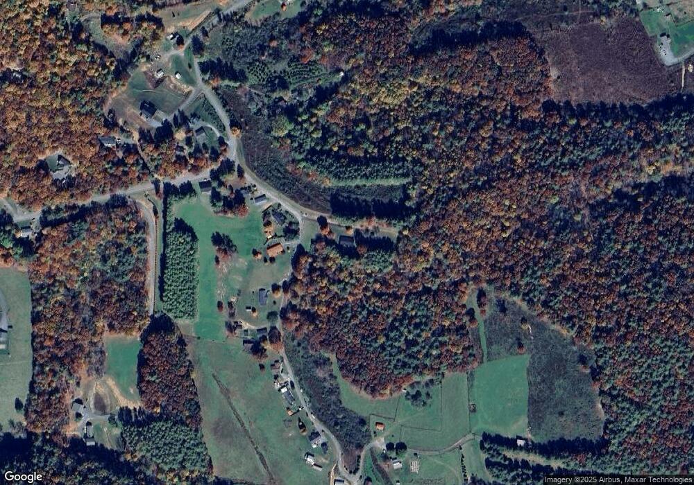
169 Carrie Dillard Rd West Jefferson, NC 28694
Estimated Value: $262,000 - $364,000
--
Bed
--
Bath
1,736
Sq Ft
$182/Sq Ft
Est. Value
About This Home
This home is located at 169 Carrie Dillard Rd, West Jefferson, NC 28694 and is currently estimated at $315,261, approximately $181 per square foot. 169 Carrie Dillard Rd is a home with nearby schools including Ashe County High School.
Ownership History
Date
Name
Owned For
Owner Type
Purchase Details
Closed on
Aug 6, 2025
Sold by
Johnson Glenn Allen and Johnson Jill B
Bought by
Johnson Nathaniel Allen and Johnson Olivia Patton
Current Estimated Value
Home Financials for this Owner
Home Financials are based on the most recent Mortgage that was taken out on this home.
Original Mortgage
$182,160
Outstanding Balance
$182,004
Interest Rate
6.77%
Mortgage Type
New Conventional
Estimated Equity
$133,257
Purchase Details
Closed on
Jun 5, 2025
Sold by
Johnson Glenn Allen and Johnson Jill B
Bought by
Cox Martha J and Cox Donny R
Purchase Details
Closed on
Jun 1, 2007
Sold by
Johnson Agnes D
Bought by
Johnson Glenn Allen and Cox Martha J
Create a Home Valuation Report for This Property
The Home Valuation Report is an in-depth analysis detailing your home's value as well as a comparison with similar homes in the area
Home Values in the Area
Average Home Value in this Area
Purchase History
| Date | Buyer | Sale Price | Title Company |
|---|---|---|---|
| Johnson Nathaniel Allen | $262,500 | None Listed On Document | |
| Johnson Nathaniel Allen | $262,500 | None Listed On Document | |
| Cox Martha J | -- | None Listed On Document | |
| Cox Martha J | -- | None Listed On Document | |
| Johnson Glenn Allen | -- | -- |
Source: Public Records
Mortgage History
| Date | Status | Borrower | Loan Amount |
|---|---|---|---|
| Open | Johnson Nathaniel Allen | $182,160 | |
| Closed | Johnson Nathaniel Allen | $182,160 |
Source: Public Records
Tax History Compared to Growth
Tax History
| Year | Tax Paid | Tax Assessment Tax Assessment Total Assessment is a certain percentage of the fair market value that is determined by local assessors to be the total taxable value of land and additions on the property. | Land | Improvement |
|---|---|---|---|---|
| 2025 | $1,468 | $291,300 | $87,000 | $204,300 |
| 2024 | $1,410 | $291,300 | $87,000 | $204,300 |
| 2023 | $1,410 | $291,300 | $87,000 | $204,300 |
| 2022 | $1,138 | $179,700 | $57,000 | $122,700 |
| 2021 | $1,138 | $179,700 | $57,000 | $122,700 |
| 2020 | $1,018 | $179,700 | $57,000 | $122,700 |
| 2019 | $998 | $179,700 | $57,000 | $122,700 |
| 2018 | $993 | $182,800 | $57,000 | $125,800 |
| 2016 | $995 | $182,800 | $57,000 | $125,800 |
| 2015 | $971 | $182,800 | $57,000 | $125,800 |
| 2014 | $971 | $191,200 | $57,000 | $134,200 |
Source: Public Records
Map
Nearby Homes
- 162 Carrie Dillard Rd
- 3247 Water Tank Rd
- TBD Sharpes Mountain Ln
- 321 Shady Oak Ln
- 300 Shady Oak Ln
- TBD Long View Dr
- TBD Lake Circle St
- Lot #67 Autumn Fern Trail
- Tbd Beaver Creek Dr
- 126 Lower Nettle Knob Rd
- 867 New River Bend Rd S
- 255 Lakeside Dr
- Lot 35 Smoke Rise Path
- Lot 37 Smoke Rise Path
- Lot 42 Smoke Rise Path
- TBD New River Overlook (Lot 7)
- TBD Apple Canyon Dr
- TBD New River Overlook (Lot 11)
- 901 Mile High Lake Rd
- 637 Monticello Dr
- 240 Carrie Dillard Rd
- 266 Carrie Dillard Rd
- 545 Will Vannoy Rd
- 417 Will Vannoy (Upper Level) Rd
- 310 Carrie Dillard Rd
- 588 Will Vannoy Rd
- 668 Will Vannoy Rd
- 352 Carrie Dillard Rd
- 550 Will Vannoy Rd
- 456 Carrie Dillard Rd
- 417 Will Vannoy Rd
- 686 Will Vannoy Rd
- 524 Will Vannoy Rd
- 333 Will Vannoy Rd
- 367 Will Vannoy Rd
- 418 Will Vannoy Rd
- 458 Will Vannoy Rd
- 814 Will Vannoy Rd
- 368 Will Vannoy Rd
- 807 Will Vannoy Rd
