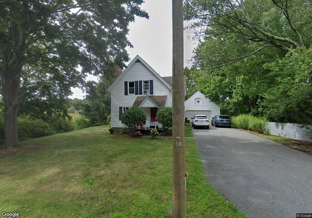
169 Charles St Abington, MA 02351
Estimated Value: $548,000 - $641,000
4
Beds
2
Baths
1,700
Sq Ft
$350/Sq Ft
Est. Value
About This Home
This home is located at 169 Charles St, Abington, MA 02351 and is currently estimated at $594,581, approximately $349 per square foot. 169 Charles St is a home located in Plymouth County with nearby schools including Beaver Brook Elementary School, Abington Middle School, and Woodsdale School.
Ownership History
Date
Name
Owned For
Owner Type
Purchase Details
Closed on
May 14, 2018
Sold by
Taylor Anne-Marie and Taylor Robert M
Bought by
Taylor Anne-Marie
Current Estimated Value
Purchase Details
Closed on
Nov 18, 2005
Sold by
169 Charles St Rt
Bought by
Taylor Robert M and Taylor Anne Marie
Home Financials for this Owner
Home Financials are based on the most recent Mortgage that was taken out on this home.
Original Mortgage
$240,000
Interest Rate
6.07%
Mortgage Type
Purchase Money Mortgage
Create a Home Valuation Report for This Property
The Home Valuation Report is an in-depth analysis detailing your home's value as well as a comparison with similar homes in the area
Home Values in the Area
Average Home Value in this Area
Purchase History
| Date | Buyer | Sale Price | Title Company |
|---|---|---|---|
| Taylor Anne-Marie | -- | -- | |
| Taylor Robert M | $410,100 | -- |
Source: Public Records
Mortgage History
| Date | Status | Borrower | Loan Amount |
|---|---|---|---|
| Previous Owner | Taylor Robert M | $238,000 | |
| Previous Owner | Taylor Robert M | $240,000 |
Source: Public Records
Tax History Compared to Growth
Tax History
| Year | Tax Paid | Tax Assessment Tax Assessment Total Assessment is a certain percentage of the fair market value that is determined by local assessors to be the total taxable value of land and additions on the property. | Land | Improvement |
|---|---|---|---|---|
| 2025 | $6,189 | $473,900 | $242,300 | $231,600 |
| 2024 | $6,088 | $455,000 | $220,600 | $234,400 |
| 2023 | $6,022 | $423,800 | $192,200 | $231,600 |
| 2022 | $5,819 | $382,300 | $168,600 | $213,700 |
| 2021 | $5,432 | $329,600 | $153,200 | $176,400 |
| 2020 | $5,525 | $325,000 | $148,600 | $176,400 |
| 2019 | $5,187 | $298,300 | $141,700 | $156,600 |
| 2018 | $5,121 | $287,400 | $141,700 | $145,700 |
| 2017 | $4,872 | $265,500 | $141,700 | $123,800 |
| 2016 | $4,642 | $258,900 | $135,100 | $123,800 |
| 2015 | $4,386 | $258,000 | $135,100 | $122,900 |
Source: Public Records
Map
Nearby Homes
- 96 Plymouth St
- 5 Clark Rd
- 38 Lantern Ln
- 5 Florence St
- 925 Washington St
- 1042 Washington St
- 225 W Water St
- 930 Brockton Ave
- 119 Grove St Unit 238
- 119 Grove St Unit 231
- 57 Battery St
- 676 Bedford St
- 103 Grove St Unit 337
- 0 Bedford St
- 15 Thayer Terrace
- 1353 Washington St
- 40 Wales St
- 20 Birch St
- 33 Birch St Unit 126
- 122 Reed St
- 85 Pattison St
- 160 Charles St
- 170 Charles St
- 65 Pattison St
- 180 Charles St
- 146 Charles St
- 190 Charles St
- 132 Charles St
- 128 Charles St
- 35 Pattison St
- 120 Charles St
- 25 Pattison St
- 114 Charles St
- 15 Pattison St
- 20 Pattison St
- 102 Charles St
- 60 Pattison St Unit A5
- 60 Pattison St Unit 9
- 60 Pattison St Unit 8
- 60 Pattison St Unit 7