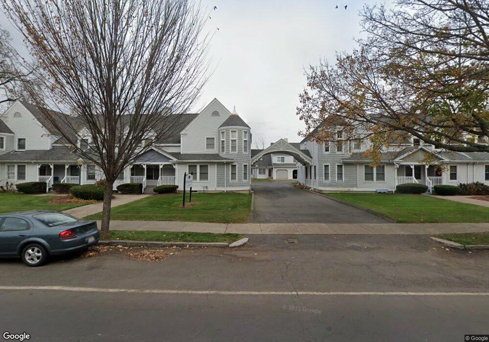
169 Main St Unit 6 West Springfield, MA 01089
Estimated Value: $239,000 - $257,000
2
Beds
2
Baths
1,369
Sq Ft
$181/Sq Ft
Est. Value
About This Home
This home is located at 169 Main St Unit 6, West Springfield, MA 01089 and is currently estimated at $247,129, approximately $180 per square foot. 169 Main St Unit 6 is a home located in Hampden County with nearby schools including Hampden Charter School of Science West.
Ownership History
Date
Name
Owned For
Owner Type
Purchase Details
Closed on
Mar 3, 2005
Sold by
Bessette Roy D
Bought by
Lincoln Marguerite M and Murat Mary J
Current Estimated Value
Home Financials for this Owner
Home Financials are based on the most recent Mortgage that was taken out on this home.
Original Mortgage
$118,000
Interest Rate
5.66%
Mortgage Type
Purchase Money Mortgage
Purchase Details
Closed on
Aug 24, 2000
Sold by
Pellegrini Alfred and Pellegrini Susan E
Bought by
Bessette Roy D
Home Financials for this Owner
Home Financials are based on the most recent Mortgage that was taken out on this home.
Original Mortgage
$63,350
Interest Rate
8.06%
Mortgage Type
Purchase Money Mortgage
Purchase Details
Closed on
Aug 7, 1991
Sold by
Heritage Lndg Inc
Bought by
Pellegrini Alfred and Pellegrini Susan E
Create a Home Valuation Report for This Property
The Home Valuation Report is an in-depth analysis detailing your home's value as well as a comparison with similar homes in the area
Home Values in the Area
Average Home Value in this Area
Purchase History
| Date | Buyer | Sale Price | Title Company |
|---|---|---|---|
| Lincoln Marguerite M | $153,250 | -- | |
| Bessette Roy D | $84,500 | -- | |
| Pellegrini Alfred | $90,000 | -- |
Source: Public Records
Mortgage History
| Date | Status | Borrower | Loan Amount |
|---|---|---|---|
| Open | Pellegrini Alfred | $111,554 | |
| Closed | Lincoln Marguerite M | $118,000 | |
| Previous Owner | Pellegrini Alfred | $117,000 | |
| Previous Owner | Pellegrini Alfred | $63,350 | |
| Previous Owner | Pellegrini Alfred | $67,500 |
Source: Public Records
Tax History Compared to Growth
Tax History
| Year | Tax Paid | Tax Assessment Tax Assessment Total Assessment is a certain percentage of the fair market value that is determined by local assessors to be the total taxable value of land and additions on the property. | Land | Improvement |
|---|---|---|---|---|
| 2025 | $2,659 | $178,800 | $0 | $178,800 |
| 2024 | $2,931 | $197,900 | $0 | $197,900 |
| 2023 | $2,786 | $179,300 | $0 | $179,300 |
| 2022 | $2,616 | $166,000 | $0 | $166,000 |
| 2021 | $2,633 | $155,800 | $0 | $155,800 |
| 2020 | $2,640 | $155,400 | $0 | $155,400 |
| 2019 | $2,636 | $155,400 | $0 | $155,400 |
| 2018 | $2,650 | $155,400 | $0 | $155,400 |
| 2017 | $2,650 | $155,400 | $0 | $155,400 |
| 2016 | $2,800 | $164,800 | $0 | $164,800 |
| 2015 | $2,744 | $161,500 | $0 | $161,500 |
| 2014 | $2,650 | $161,500 | $0 | $161,500 |
Source: Public Records
Map
Nearby Homes
- 169 Main St Unit 16
- 169 Main St Unit 15
- 169 Main St Unit 14
- 169 Main St Unit 13
- 169 Main St Unit 12
- 169 Main St Unit 11
- 169 Main St Unit 10
- 169 Main St Unit 9
- 169 Main St Unit 8
- 169 Main St Unit 7
- 169 Main St Unit 5
- 169 Main St Unit 4
- 169 Main St Unit 3
- 169 Main St Unit 2
- 169 Main St Unit 1
- 169 Main St Unit 1
- 154 Main St
- 164 Main St
- 172 Main St Unit 174
- 134 Main St