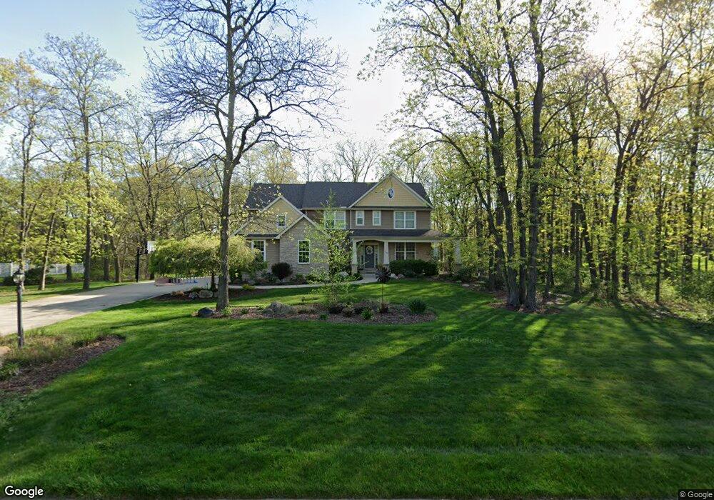
169 Wexford Rd Valparaiso, IN 46385
Porter County NeighborhoodEstimated Value: $566,000 - $670,988
5
Beds
4
Baths
3,153
Sq Ft
$202/Sq Ft
Est. Value
About This Home
This home is located at 169 Wexford Rd, Valparaiso, IN 46385 and is currently estimated at $637,247, approximately $202 per square foot. 169 Wexford Rd is a home located in Porter County with nearby schools including Union Township Middle School and Wheeler High School.
Ownership History
Date
Name
Owned For
Owner Type
Purchase Details
Closed on
Nov 28, 2005
Sold by
Rohder Daniel J and Rohder Laurie G
Bought by
Stevenson Doug P and Stevenson Daphne D
Current Estimated Value
Home Financials for this Owner
Home Financials are based on the most recent Mortgage that was taken out on this home.
Original Mortgage
$343,700
Interest Rate
7.15%
Mortgage Type
Purchase Money Mortgage
Create a Home Valuation Report for This Property
The Home Valuation Report is an in-depth analysis detailing your home's value as well as a comparison with similar homes in the area
Home Values in the Area
Average Home Value in this Area
Purchase History
| Date | Buyer | Sale Price | Title Company |
|---|---|---|---|
| Stevenson Doug P | -- | Metropolitan Title Co |
Source: Public Records
Mortgage History
| Date | Status | Borrower | Loan Amount |
|---|---|---|---|
| Closed | Stevenson Doug P | $343,700 |
Source: Public Records
Tax History Compared to Growth
Tax History
| Year | Tax Paid | Tax Assessment Tax Assessment Total Assessment is a certain percentage of the fair market value that is determined by local assessors to be the total taxable value of land and additions on the property. | Land | Improvement |
|---|---|---|---|---|
| 2024 | $4,579 | $575,400 | $118,400 | $457,000 |
| 2023 | $4,439 | $561,500 | $112,800 | $448,700 |
| 2022 | $4,240 | $514,900 | $112,800 | $402,100 |
| 2021 | $4,010 | $465,500 | $112,800 | $352,700 |
| 2020 | $3,732 | $446,000 | $102,500 | $343,500 |
| 2019 | $3,803 | $425,100 | $102,500 | $322,600 |
| 2018 | $3,974 | $408,900 | $102,500 | $306,400 |
| 2017 | $4,024 | $453,500 | $102,500 | $351,000 |
| 2016 | $3,517 | $401,200 | $100,500 | $300,700 |
| 2014 | $3,599 | $391,900 | $94,900 | $297,000 |
| 2013 | -- | $393,200 | $107,100 | $286,100 |
Source: Public Records
Map
Nearby Homes
- 194 Wexford Rd
- 148 Timber Point Ct
- 143 N 500 W
- 459 Amhurst Rd
- 464 Roxbury Rd
- 460 Roxbury Rd
- 454 Roxbury Rd
- 220 N 500 W
- 175 Shorewood Dr
- 459 Surrey Hill Ln
- 447 Scarborough Rd
- 149 Westchester Ln
- 536 W Us Highway 30
- 446 Surrey Hill Ln
- 528 W 100 N
- 419 Scarborough Rd
- 397 Shorewood Ct
- 122 Shorewood Dr
- 421 Chadwick Cir
- 394 W Ashton Ln
- 171 Wexford Rd
- 503 Roxbury Rd
- 170 Wexford Rd
- 168 Wexford Rd
- 173 Wexford Rd
- 170 Burnham Ct
- 166 Burnham Ct
- 498 Ashford Ln
- 496 Ashford Ln
- 500 Ashford Ln
- 494 Ashford Ln
- 172 Wexford Rd
- 492 Ashford Ln
- 173 Burnham Ct
- 13907 Centre Ave
- 174 Burnham Ct
- 174 Wexford Rd
- 490 Ashford Ln
- 176 Wexford Rd
- 502 Roxbury Rd