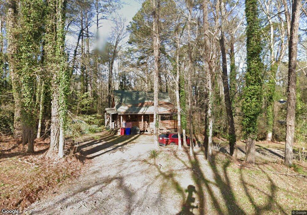
1690 Briarcliff Rd Macon, GA 31211
Shirley Hills Historic District NeighborhoodEstimated Value: $149,000 - $194,000
1
Bed
3
Baths
936
Sq Ft
$176/Sq Ft
Est. Value
About This Home
This home is located at 1690 Briarcliff Rd, Macon, GA 31211 and is currently estimated at $164,693, approximately $175 per square foot. 1690 Briarcliff Rd is a home located in Bibb County with nearby schools including Martin Luther King Jr. Elementary School, Appling Middle School, and Northeast High School.
Ownership History
Date
Name
Owned For
Owner Type
Purchase Details
Closed on
Apr 21, 2023
Sold by
Camera Anthony Joseph
Bought by
Camera Anthony Joseph and Lugo-Camera Frances
Current Estimated Value
Home Financials for this Owner
Home Financials are based on the most recent Mortgage that was taken out on this home.
Original Mortgage
$126,170
Outstanding Balance
$122,532
Interest Rate
6.6%
Mortgage Type
FHA
Estimated Equity
$42,161
Purchase Details
Closed on
Aug 31, 2015
Sold by
Germany Robert A
Bought by
Camera Anthony and Camera Frances
Home Financials for this Owner
Home Financials are based on the most recent Mortgage that was taken out on this home.
Original Mortgage
$76,500
Interest Rate
4.02%
Mortgage Type
New Conventional
Purchase Details
Closed on
Dec 22, 1980
Sold by
Macon Fed Savg & Loan Assn
Bought by
Germany Robert A
Create a Home Valuation Report for This Property
The Home Valuation Report is an in-depth analysis detailing your home's value as well as a comparison with similar homes in the area
Home Values in the Area
Average Home Value in this Area
Purchase History
| Date | Buyer | Sale Price | Title Company |
|---|---|---|---|
| Camera Anthony Joseph | -- | None Listed On Document | |
| Camera Anthony | -- | -- | |
| Germany Robert A | -- | -- |
Source: Public Records
Mortgage History
| Date | Status | Borrower | Loan Amount |
|---|---|---|---|
| Open | Camera Anthony Joseph | $126,170 | |
| Previous Owner | Camera Anthony | $76,500 |
Source: Public Records
Tax History Compared to Growth
Tax History
| Year | Tax Paid | Tax Assessment Tax Assessment Total Assessment is a certain percentage of the fair market value that is determined by local assessors to be the total taxable value of land and additions on the property. | Land | Improvement |
|---|---|---|---|---|
| 2025 | $998 | $47,623 | $14,352 | $33,271 |
| 2024 | $948 | $44,311 | $11,040 | $33,271 |
| 2023 | $380 | $39,971 | $11,040 | $28,931 |
| 2022 | $1,484 | $49,874 | $15,678 | $34,196 |
| 2021 | $1,512 | $46,799 | $14,253 | $32,546 |
| 2020 | $1,380 | $42,553 | $14,253 | $28,300 |
| 2019 | $1,318 | $40,661 | $13,540 | $27,121 |
| 2018 | $1,971 | $36,878 | $12,115 | $24,763 |
| 2017 | $1,119 | $36,878 | $12,115 | $24,763 |
| 2016 | $1,325 | $38,303 | $13,540 | $24,763 |
| 2015 | $1,876 | $38,303 | $13,540 | $24,763 |
| 2014 | $755 | $40,195 | $14,253 | $25,942 |
Source: Public Records
Map
Nearby Homes
- 1755 Waverland Cir
- 1728 Waverland Cir
- 1575 Briarcliff Rd
- 1964 Woodland Dr
- 1485 Lone Oak Dr
- 1346 Waverland Dr
- 1464 Twin Pines Dr
- 1435 Twin Pines Dr
- 1916 Flintwood Dr
- 1831 Upper River Rd
- 1735 Foster Place
- 1715 Foster Place
- 1746 Upper River Rd
- 1585 Engle Dr
- 1957 Deerwood Place
- 1949 Deerwood Place
- 1158 Jackson Springs Rd
- 1615 Engle Dr
- 1965 Deerwood Place
- 1776 Waverland Cir
- 1680 Briarcliff Rd
- 1770 Waverland Cir
- 1761 Waverland Cir
- 1773 Waverland Cir
- 1782 Waverland Cir
- 1749 Waverland Cir
- 1656 Briarcliff Rd
- 1801 Waverland Cir
- 1742 Waverland Cir
- 1813 Waverland Cir
- 1817 Waverland Cir
- 1809 Waverland Cir
- 1786 Waverland Cir
- 1620 Waverland Dr
- 1821 Waverland Cir
- 1743 Waverland Cir
- 1648 Briarcliff Rd
- 1736 Waverland Cir
- 1825 Waverland Cir