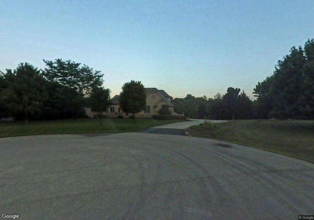
1690 Cranbrook Dr New Carlisle, OH 45344
Estimated Value: $447,000 - $476,045
3
Beds
3
Baths
2,672
Sq Ft
$175/Sq Ft
Est. Value
About This Home
This home is located at 1690 Cranbrook Dr, New Carlisle, OH 45344 and is currently estimated at $467,511, approximately $174 per square foot. 1690 Cranbrook Dr is a home located in Clark County with nearby schools including Northwestern Elementary School and Northwestern Junior/Senior High School.
Ownership History
Date
Name
Owned For
Owner Type
Purchase Details
Closed on
May 9, 2014
Sold by
Patrick David M and Patrick Rose E
Bought by
Craig Jennifer L and Craig William W
Current Estimated Value
Home Financials for this Owner
Home Financials are based on the most recent Mortgage that was taken out on this home.
Original Mortgage
$311,557
Outstanding Balance
$238,151
Interest Rate
4.41%
Mortgage Type
VA
Estimated Equity
$229,360
Purchase Details
Closed on
Oct 10, 2008
Sold by
Lorig Nancy L and The Nancy L Lorig Living Trust
Bought by
Patrick David M and Patrick Rose E
Purchase Details
Closed on
Aug 1, 2000
Sold by
Lorig Gerald F and Lorig Nancy L
Bought by
Lorig Nancy L and Nancy L Lorig Living Trust
Purchase Details
Closed on
Apr 2, 1996
Sold by
Donnels Run Farm Assoc
Bought by
Lorig Gerald F and Lorig Nancy F
Create a Home Valuation Report for This Property
The Home Valuation Report is an in-depth analysis detailing your home's value as well as a comparison with similar homes in the area
Home Values in the Area
Average Home Value in this Area
Purchase History
| Date | Buyer | Sale Price | Title Company |
|---|---|---|---|
| Craig Jennifer L | $305,000 | Home Services Title | |
| Patrick David M | $330,000 | Rels Title | |
| Lorig Nancy L | -- | -- | |
| Lorig Gerald F | $35,000 | -- |
Source: Public Records
Mortgage History
| Date | Status | Borrower | Loan Amount |
|---|---|---|---|
| Open | Craig Jennifer L | $311,557 |
Source: Public Records
Tax History Compared to Growth
Tax History
| Year | Tax Paid | Tax Assessment Tax Assessment Total Assessment is a certain percentage of the fair market value that is determined by local assessors to be the total taxable value of land and additions on the property. | Land | Improvement |
|---|---|---|---|---|
| 2024 | $6,005 | $131,460 | $22,620 | $108,840 |
| 2023 | $6,005 | $131,460 | $22,620 | $108,840 |
| 2022 | $5,440 | $131,460 | $22,620 | $108,840 |
| 2021 | $5,465 | $103,520 | $17,540 | $85,980 |
| 2020 | $5,520 | $103,520 | $17,540 | $85,980 |
| 2019 | $5,469 | $103,520 | $17,540 | $85,980 |
| 2018 | $4,797 | $89,240 | $14,730 | $74,510 |
| 2017 | $4,799 | $104,552 | $14,728 | $89,824 |
| 2016 | $4,704 | $104,552 | $14,728 | $89,824 |
| 2015 | $4,712 | $95,690 | $14,028 | $81,662 |
| 2014 | $4,249 | $95,690 | $14,028 | $81,662 |
| 2013 | $2,110 | $95,690 | $14,028 | $81,662 |
Source: Public Records
Map
Nearby Homes
- 6439 Greenridge Ave
- 6105 New Carlisle Pike
- 2430 Myers Rd
- 5171 New Carlisle Pike
- 4904 Alpha Rd
- 1 Folk Ream Rd
- 00 Folk Ream Rd
- 96 Eastwood Dr
- 3172 Folk Ream Rd
- 245 Gordon Rd
- 5095 W National Rd
- 4461 New Carlisle Pike
- 17 Sunset Dr
- 2470 Leon Ln
- 323 Saint Paul Ave
- 224 E Downey Dr
- 6580 Shaler Dr
- 3888 Folk Ream Rd
- 3390 Spence Rd
- 5889 Troy Rd
- 1650 Cranbrook Dr
- 1710 Cranbrook Dr
- 6351 Greenridge Ave
- 6405 Winding Tree Dr
- 6367 Greenridge Ave
- 1726 Cranbrook Dr
- 6420 Winding Tree Dr
- 6345 Greenridge Ave
- 6411 Winding Tree Dr
- 6358 Greenridge Ave
- 6350 Greenridge Ave
- 6426 Winding Tree Dr
- 6342 Greenridge Ave
- 6366 Greenridge Ave
- 6417 Winding Tree Dr
- 6427 Greenridge Ave
- 6374 Greenridge Ave
- 6407 Greenridge Ave
- 6397 Greenridge Ave
- 6433 Greenridge Ave