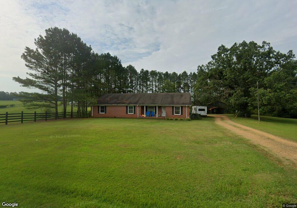
16905 Highway 171 Northport, AL 35475
Estimated Value: $154,000 - $280,000
--
Bed
1
Bath
1,968
Sq Ft
$118/Sq Ft
Est. Value
About This Home
This home is located at 16905 Highway 171, Northport, AL 35475 and is currently estimated at $231,806, approximately $117 per square foot. 16905 Highway 171 is a home located in Tuscaloosa County with nearby schools including Walker Elementary School, Northside Middle School, and Northside High School.
Ownership History
Date
Name
Owned For
Owner Type
Purchase Details
Closed on
Nov 19, 2008
Sold by
Montgomery Robert R Et
Bought by
Pierce Sandra
Current Estimated Value
Home Financials for this Owner
Home Financials are based on the most recent Mortgage that was taken out on this home.
Original Mortgage
$107,100
Outstanding Balance
$70,407
Interest Rate
6.11%
Estimated Equity
$161,399
Purchase Details
Closed on
Oct 29, 2008
Sold by
Pierce Sandra
Bought by
Montgomery Vincent R
Home Financials for this Owner
Home Financials are based on the most recent Mortgage that was taken out on this home.
Original Mortgage
$107,100
Outstanding Balance
$70,407
Interest Rate
6.11%
Estimated Equity
$161,399
Create a Home Valuation Report for This Property
The Home Valuation Report is an in-depth analysis detailing your home's value as well as a comparison with similar homes in the area
Home Values in the Area
Average Home Value in this Area
Purchase History
| Date | Buyer | Sale Price | Title Company |
|---|---|---|---|
| Pierce Sandra | $147,000 | -- | |
| Montgomery Vincent R | $126,100 | -- |
Source: Public Records
Mortgage History
| Date | Status | Borrower | Loan Amount |
|---|---|---|---|
| Open | Montgomery Vincent R | $107,100 |
Source: Public Records
Tax History Compared to Growth
Tax History
| Year | Tax Paid | Tax Assessment Tax Assessment Total Assessment is a certain percentage of the fair market value that is determined by local assessors to be the total taxable value of land and additions on the property. | Land | Improvement |
|---|---|---|---|---|
| 2024 | $510 | $30,620 | $2,000 | $28,620 |
| 2023 | $510 | $30,620 | $2,000 | $28,620 |
| 2022 | $510 | $30,620 | $2,000 | $28,620 |
| 2021 | $510 | $30,620 | $2,000 | $28,620 |
| 2020 | $555 | $16,530 | $1,000 | $15,530 |
| 2019 | $555 | $16,530 | $1,000 | $15,530 |
| 2018 | $508 | $15,250 | $1,000 | $14,250 |
| 2017 | $462 | $0 | $0 | $0 |
| 2016 | $443 | $0 | $0 | $0 |
| 2015 | $435 | $0 | $0 | $0 |
| 2014 | -- | $13,210 | $700 | $12,510 |
Source: Public Records
Map
Nearby Homes
- 0 Brownville Rd Unit 24273268
- 17505 Mormon Rd
- 0 Brown Rd
- 7 Tilly Branch Rd
- 1 Tilly Branch Rd
- 15797 Dundee Dr
- 03 Mormon Rd
- 0 Morman 11 Rd
- 0 Morman 12 Rd
- 0 Morman 10 Rd
- 0 Morman 9 Rd
- 0 Morman 8 Rd
- 0 Morman 7 Rd
- 0 Morman 6 Rd
- 0 Morman 5 Rd
- 0 Morman 2 Rd
- 15498 Northside Rd
- 13447 Rocky Ridge Dr
- 16662 Old Fayette Rd
- 16614 Old Fayette Rd
- 16901 Highway 171
- 16895 Highway 171
- 16811 Highway 171
- 16776 Highway 171
- 16780 Highway 171
- 3 Brownville Rd Unit 3
- 2 Brownville Rd Unit 2
- 3 Brownville Rd
- 16771 Highway 171
- 17001 Highway 171
- 16725 Alabama 171
- 16725 Highway 171
- 17030 Highway 171
- 15809 Northview Ln
- 16731 Highway 171
- 15839 Northview Ln
- 17051 Highway 171
- 16735 Highway 171
- 16856 Mormon Rd