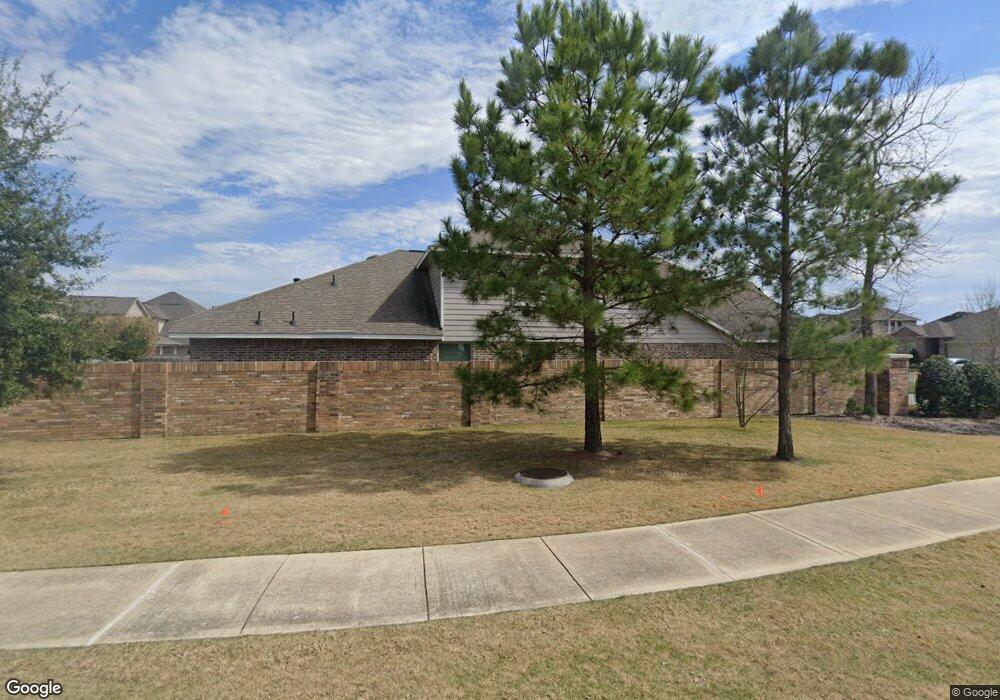
16907 Upper Ridge Ln Humble, TX 77346
Estimated Value: $305,291 - $349,000
4
Beds
3
Baths
2,017
Sq Ft
$162/Sq Ft
Est. Value
About This Home
This home is located at 16907 Upper Ridge Ln, Humble, TX 77346 and is currently estimated at $327,323, approximately $162 per square foot. 16907 Upper Ridge Ln is a home with nearby schools including Atascocita Springs Elementary School, Westlake Middle, and Atascocita High School.
Ownership History
Date
Name
Owned For
Owner Type
Purchase Details
Closed on
Jul 13, 2022
Sold by
Wahaib Jennifer J
Bought by
Ali Suhail and Amiraly Shireen
Current Estimated Value
Purchase Details
Closed on
Aug 25, 2015
Sold by
Chesmar Homes Ltd
Bought by
Wahaib Jennifer J and Silas Justin C
Home Financials for this Owner
Home Financials are based on the most recent Mortgage that was taken out on this home.
Original Mortgage
$234,022
Interest Rate
3.75%
Mortgage Type
FHA
Create a Home Valuation Report for This Property
The Home Valuation Report is an in-depth analysis detailing your home's value as well as a comparison with similar homes in the area
Home Values in the Area
Average Home Value in this Area
Purchase History
| Date | Buyer | Sale Price | Title Company |
|---|---|---|---|
| Ali Suhail | $268,000 | None Listed On Document | |
| Wahaib Jennifer J | -- | None Available |
Source: Public Records
Mortgage History
| Date | Status | Borrower | Loan Amount |
|---|---|---|---|
| Previous Owner | Wahaib Jennifer J | $234,022 |
Source: Public Records
Tax History Compared to Growth
Tax History
| Year | Tax Paid | Tax Assessment Tax Assessment Total Assessment is a certain percentage of the fair market value that is determined by local assessors to be the total taxable value of land and additions on the property. | Land | Improvement |
|---|---|---|---|---|
| 2025 | $8,458 | $315,530 | $62,406 | $253,124 |
| 2024 | $8,458 | $328,722 | $39,713 | $289,009 |
| 2023 | $8,458 | $328,722 | $39,713 | $289,009 |
| 2022 | $7,622 | $307,467 | $39,713 | $267,754 |
| 2021 | $7,323 | $251,386 | $39,713 | $211,673 |
| 2020 | $7,270 | $236,582 | $39,713 | $196,869 |
| 2019 | $7,025 | $220,000 | $34,670 | $185,330 |
| 2018 | $3,128 | $218,295 | $34,670 | $183,625 |
| 2017 | $6,926 | $218,295 | $34,670 | $183,625 |
| 2016 | $6,926 | $218,295 | $34,670 | $183,625 |
| 2015 | -- | $34,670 | $34,670 | $0 |
Source: Public Records
Map
Nearby Homes
- 16914 Upper Ridge Ln
- 17010 Upper Ridge Ln
- 13303 Canton Cliff Ct
- 13118 Clover Creek Point Ln
- 17522 Mineral Bluff Ln
- 12914 Picket Hills Ln
- 13026 Clover Creek Point Ln
- 13027 Freemont Peak Ln
- 13207 Itasca Pine Dr
- 17406 Lazy Shadow Ct
- 17215 Inyo National Dr
- 16815 Holtwood Oak Dr
- 13315 Tarkine Ct
- 17411 Mount Riga Dr
- 12751 Sweet Root Ln
- 13002 Fernbank Forest Dr
- 12718 Madison Boulder Ln
- 17703 Indian Mountain Ln
- 17315 Cumberland Park Ln
- 17314 Lake Clark Ln
- 16911 Upper Ridge Ln
- 16915 Upper Ridge Ln
- 13703 Brayden Rock Ln
- 13102 Maywater Crest Ct
- 13106 Maywater Crest Ct
- 16919 Upper Ridge Ln
- 13110 Maywater Crest Ct
- 17307 Brayden Rock Ln
- 16923 Upper Ridge Ln
- 13114 Maywater Crest Ct
- 17311 Brayden Rock Ln
- 16910 Upper Ridge Ln
- 16902 Upper Ridge Ln
- 16906 Upper Ridge Ln
- 17315 Brayden Rock Ln
- 16927 Upper Ridge Ln
- 13118 Maywater Crest Ct
- 16918 Upper Ridge Ln
- 17319 Brayden Rock Ln
- 16922 Upper Ridge Ln