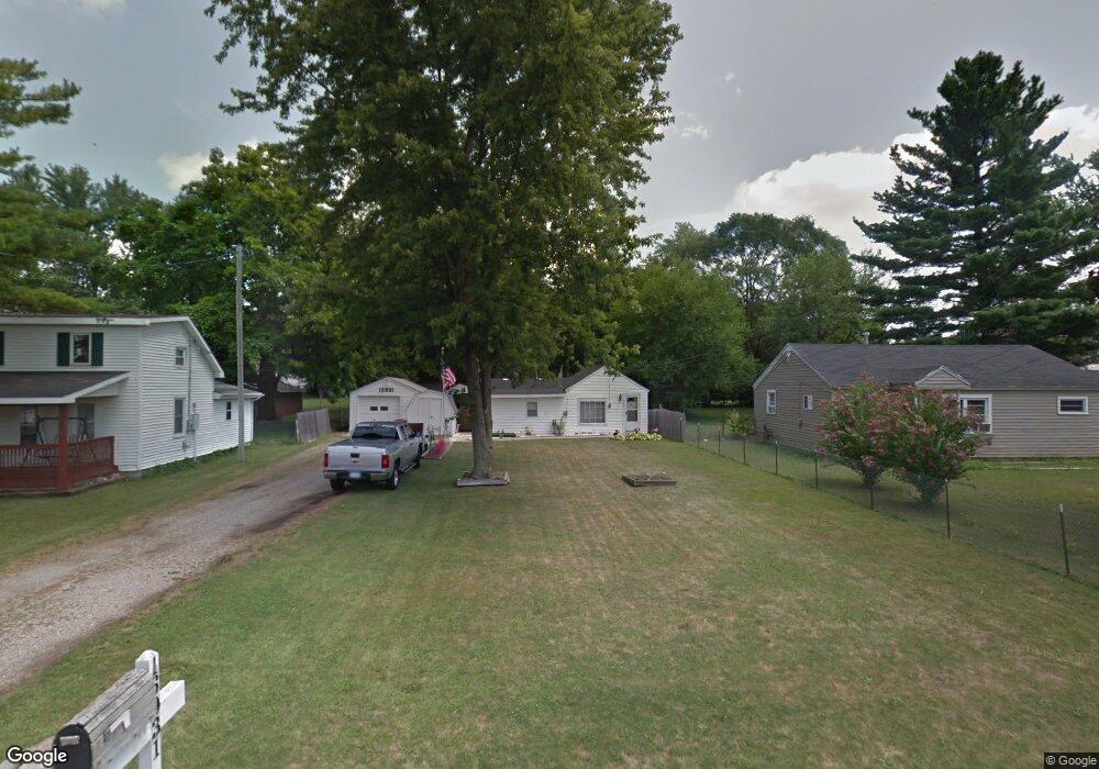
16931 Cedar St Unit 50 Lansing, MI 48906
Estimated Value: $70,000 - $112,203
2
Beds
1
Bath
950
Sq Ft
$101/Sq Ft
Est. Value
About This Home
This home is located at 16931 Cedar St Unit 50, Lansing, MI 48906 and is currently estimated at $95,801, approximately $100 per square foot. 16931 Cedar St Unit 50 is a home located in Clinton County with nearby schools including Gier Park School, Pattengill Academy, and Eastern High School.
Ownership History
Date
Name
Owned For
Owner Type
Purchase Details
Closed on
Feb 16, 2018
Sold by
Monroe Victoria M
Bought by
Sweeney Shane H
Current Estimated Value
Home Financials for this Owner
Home Financials are based on the most recent Mortgage that was taken out on this home.
Original Mortgage
$38,250
Outstanding Balance
$21,751
Interest Rate
3.99%
Mortgage Type
New Conventional
Estimated Equity
$74,050
Create a Home Valuation Report for This Property
The Home Valuation Report is an in-depth analysis detailing your home's value as well as a comparison with similar homes in the area
Home Values in the Area
Average Home Value in this Area
Purchase History
| Date | Buyer | Sale Price | Title Company |
|---|---|---|---|
| Sweeney Shane H | $42,500 | First American Title Ins Co |
Source: Public Records
Mortgage History
| Date | Status | Borrower | Loan Amount |
|---|---|---|---|
| Open | Sweeney Shane H | $38,250 |
Source: Public Records
Tax History
| Year | Tax Paid | Tax Assessment Tax Assessment Total Assessment is a certain percentage of the fair market value that is determined by local assessors to be the total taxable value of land and additions on the property. | Land | Improvement |
|---|---|---|---|---|
| 2025 | $942 | $36,700 | $7,800 | $28,900 |
| 2024 | $6 | $34,300 | $7,200 | $27,100 |
| 2023 | $799 | $30,700 | $0 | $0 |
| 2022 | $851 | $26,600 | $6,400 | $20,200 |
| 2021 | $822 | $23,400 | $6,100 | $17,300 |
| 2020 | $831 | $22,400 | $5,800 | $16,600 |
| 2019 | $1,164 | $21,600 | $5,800 | $15,800 |
| 2018 | $771 | $19,800 | $4,100 | $15,700 |
| 2017 | $595 | $19,200 | $4,000 | $15,200 |
| 2016 | $584 | $19,500 | $4,100 | $15,400 |
| 2015 | $617 | $18,700 | $0 | $0 |
| 2011 | -- | $19,900 | $0 | $0 |
Source: Public Records
Map
Nearby Homes
- 152 Donald Ave Unit 152
- 61 Beejay Dr
- 93 Nettie Ave Unit 93
- 92 Nettie Ave Unit 92
- 816 Orchard Glen Ave
- 86 Nettie Ave Unit 86
- 134 Desander Dr Unit 134
- 27 Beejay Dr Unit 27
- 16550 S Us 27
- 82 Nettie Ave Unit 82
- 3425 Turner Rd
- 310 W Frederick Ave
- 504 W Fairfield Ave
- 2701 Creston Ave
- 1230 W Wieland Rd
- 840 E Harris St
- 627 W Frederick Ave
- 16967 Jones Lake Rd
- 213 E Thomas St
- 205 E Thomas St
- 16931 Cedar St
- 16951 N Cedar St
- 16913 Cedar St
- 16901 Cedar St
- 16961 Cedar St
- 1130 Meadowlawn Ave
- 16891 N Cedar St
- 16891 Cedar St
- 1125 Meadowlawn Ave
- 1122 Meadowlawn Ave
- 16881 Cedar St
- 16890 Cedar St
- 505 E Sheridan Rd
- 503 E Sheridan Rd
- 507 E Sheridan Rd
- 1127 Greenwood Ave
- 1120 Meadowlawn Ave
- 16880 Cedar St
- 421 E Sheridan Rd
Your Personal Tour Guide
Ask me questions while you tour the home.