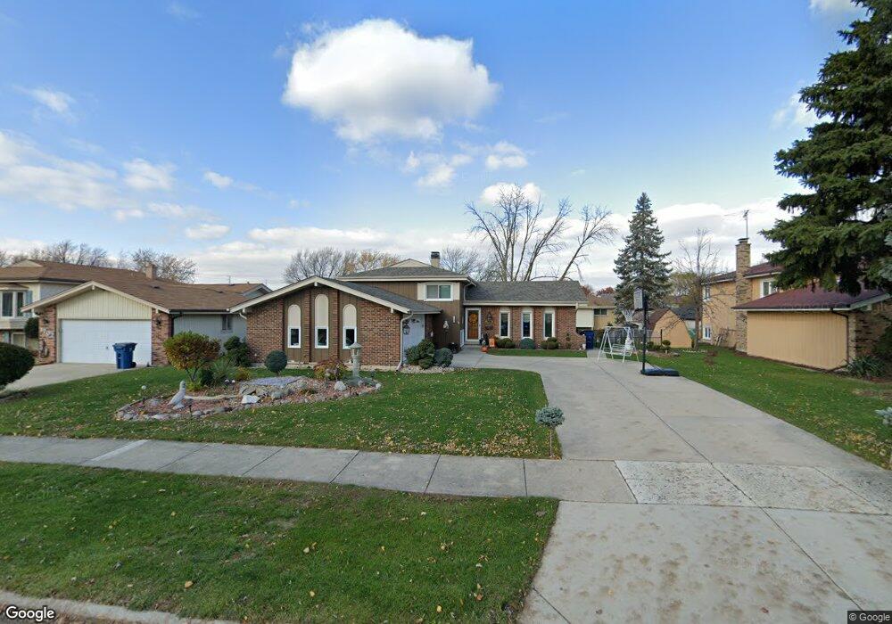
1694 W Rampart Rd Addison, IL 60101
Estimated Value: $356,000 - $533,000
--
Bed
1
Bath
1,933
Sq Ft
$218/Sq Ft
Est. Value
About This Home
This home is located at 1694 W Rampart Rd, Addison, IL 60101 and is currently estimated at $421,721, approximately $218 per square foot. 1694 W Rampart Rd is a home located in DuPage County with nearby schools including Stone Elementary School, Indian Trail Jr High School, and Addison Trail High School.
Ownership History
Date
Name
Owned For
Owner Type
Purchase Details
Closed on
Mar 13, 1998
Sold by
Miceli Marie A
Bought by
Parnell Jeffrey A and Parnell Ronimarie
Current Estimated Value
Home Financials for this Owner
Home Financials are based on the most recent Mortgage that was taken out on this home.
Original Mortgage
$126,000
Interest Rate
6.87%
Purchase Details
Closed on
Mar 22, 1995
Sold by
Jornd Russell M and Jornd Grace E
Bought by
Miceli Marie A
Home Financials for this Owner
Home Financials are based on the most recent Mortgage that was taken out on this home.
Original Mortgage
$115,000
Interest Rate
6.25%
Create a Home Valuation Report for This Property
The Home Valuation Report is an in-depth analysis detailing your home's value as well as a comparison with similar homes in the area
Home Values in the Area
Average Home Value in this Area
Purchase History
| Date | Buyer | Sale Price | Title Company |
|---|---|---|---|
| Parnell Jeffrey A | $157,500 | Attorneys Title Guaranty Fun | |
| Miceli Marie A | $150,000 | Attorneys Title Guaranty Fun |
Source: Public Records
Mortgage History
| Date | Status | Borrower | Loan Amount |
|---|---|---|---|
| Previous Owner | Parnell Jeffrey A | $126,000 | |
| Previous Owner | Miceli Marie A | $115,000 |
Source: Public Records
Tax History Compared to Growth
Tax History
| Year | Tax Paid | Tax Assessment Tax Assessment Total Assessment is a certain percentage of the fair market value that is determined by local assessors to be the total taxable value of land and additions on the property. | Land | Improvement |
|---|---|---|---|---|
| 2024 | $6,824 | $114,817 | $47,602 | $67,215 |
| 2023 | $6,445 | $105,550 | $43,760 | $61,790 |
| 2022 | $6,522 | $101,550 | $42,060 | $59,490 |
| 2021 | $5,921 | $97,270 | $40,290 | $56,980 |
| 2020 | $6,030 | $93,170 | $38,590 | $54,580 |
| 2019 | $6,509 | $89,590 | $37,110 | $52,480 |
| 2018 | $6,392 | $84,740 | $35,330 | $49,410 |
| 2017 | $6,224 | $80,990 | $33,770 | $47,220 |
| 2016 | $6,053 | $74,780 | $31,180 | $43,600 |
| 2015 | $5,897 | $69,080 | $28,800 | $40,280 |
| 2014 | $5,627 | $65,810 | $29,700 | $36,110 |
| 2013 | $5,515 | $67,160 | $30,310 | $36,850 |
Source: Public Records
Map
Nearby Homes
- 1711 W Woodland Ave
- 1750 W Woodland Ave
- 522 N Castle Rd
- 1795 W Jo Ann Ln
- 823 N Cambridge Row
- 1741 W Goldengate Dr Unit 2
- 1701 W Goldengate Dr
- 20W561 Army Trail Blvd
- 1801 W Army Trail Rd
- 580 N Highlander Way
- 1560 W Goldengate Dr
- 802 N Tamarac Blvd Unit Z5
- 943 N Rohlwing Rd Unit 101H
- 1313 W Byron Ave
- 953 N Rohlwing Rd Unit GB
- 953 N Rohlwing Rd Unit 201A
- 865 N Tamarac Blvd
- 1259 W Lake St Unit 304
- 881 N Swift Rd Unit 306
- 881 N Swift Rd Unit 106
- 1686 W Rampart Rd
- 1702 W Rampart Rd
- 1687 W Woodland Ave
- 1695 W Woodland Ave
- 1710 W Rampart Rd
- 1679 W Woodland Ave
- 1703 W Woodland Ave
- 534 N Monarch Ln
- 1671 W Woodland Ave
- 1662 W Rampart Rd
- 1703 W Rampart Rd
- 1718 W Rampart Rd
- 1667 W Rampart Rd
- 4914 Monarch Dr
- 4874 Monarch Dr
- 4871 Monarch Dr
- 4866 Monarch Dr
- 1663 W Woodland Ave
- 1719 W Woodland Ave
- 535 N Castle Rd