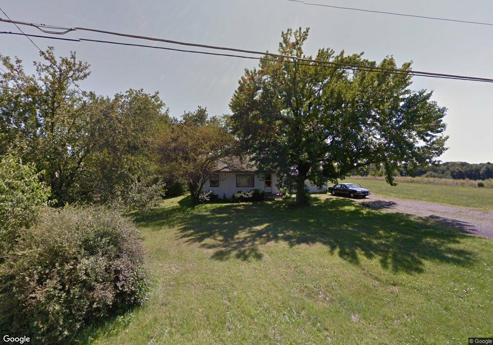
1695 Hubbard Thomas Rd Hubbard, OH 44425
Estimated Value: $93,368 - $175,000
2
Beds
1
Bath
800
Sq Ft
$166/Sq Ft
Est. Value
About This Home
This home is located at 1695 Hubbard Thomas Rd, Hubbard, OH 44425 and is currently estimated at $133,092, approximately $166 per square foot. 1695 Hubbard Thomas Rd is a home located in Trumbull County with nearby schools including Hubbard Elementary School, Hubbard Middle School, and Hubbard High School.
Ownership History
Date
Name
Owned For
Owner Type
Purchase Details
Closed on
Dec 7, 2017
Sold by
Notman Thomas Norman
Bought by
Notman Thomas Norman and Notman Elizabeth A
Current Estimated Value
Purchase Details
Closed on
Feb 15, 2016
Sold by
Notman Thomas Norman and Notman Donald Paul
Bought by
Notman Thomas Norman
Purchase Details
Closed on
Jan 1, 1990
Bought by
Nina J Notman
Create a Home Valuation Report for This Property
The Home Valuation Report is an in-depth analysis detailing your home's value as well as a comparison with similar homes in the area
Home Values in the Area
Average Home Value in this Area
Purchase History
| Date | Buyer | Sale Price | Title Company |
|---|---|---|---|
| Notman Thomas Norman | -- | None Available | |
| Notman Thomas Norman | -- | None Available | |
| Nina J Notman | -- | -- |
Source: Public Records
Tax History
| Year | Tax Paid | Tax Assessment Tax Assessment Total Assessment is a certain percentage of the fair market value that is determined by local assessors to be the total taxable value of land and additions on the property. | Land | Improvement |
|---|---|---|---|---|
| 2024 | $1,077 | $18,590 | $3,430 | $15,160 |
| 2023 | $1,079 | $18,590 | $3,430 | $15,160 |
| 2022 | $1,111 | $17,050 | $3,190 | $13,860 |
| 2021 | $1,116 | $17,050 | $3,190 | $13,860 |
| 2020 | $1,120 | $17,050 | $3,190 | $13,860 |
| 2019 | $1,039 | $14,980 | $2,940 | $12,040 |
| 2018 | $1,009 | $14,980 | $2,940 | $12,040 |
| 2017 | $1,006 | $14,980 | $2,940 | $12,040 |
| 2016 | $898 | $14,000 | $2,940 | $11,060 |
| 2015 | $901 | $14,000 | $2,940 | $11,060 |
| 2014 | $884 | $14,000 | $2,940 | $11,060 |
| 2013 | $882 | $14,000 | $2,940 | $11,060 |
Source: Public Records
Map
Nearby Homes
- 7058 Pine Grove Dr
- 1400 Thomas Hubbard Rd
- 1952 Hubbard Masury Rd
- 7839 Locust St
- 7911 1st St
- 928 Bedford Rd
- 1017 Broadway St
- 868 Saul Dr
- 132 Drummond Ave
- 1029 N Main St
- 7291 Oakwood Dr Unit B
- 784 Elmwood Dr
- 396 Elizabeth St
- 917 S Irvine Ave
- 805 Johnny K Blvd
- 8198 Erie St
- 780 S Irvine Ave
- 330 Myron St Unit 3
- 766 S Irvine Ave
- 7086 Warren Sharon Rd
- 1669 Hubbard Thomas Rd
- 1661 Thomas Rd
- 1661 Hubbard Thomas Rd
- 0 Thomas Hubbard Rd
- 1610 Thomas Hubbard Rd
- 1610 Hubbard Thomas
- 7238 Pine Grove Dr
- 7226 Pine Grove Dr
- 7220 Pine Grove Dr
- 7208 Pine Grove Dr
- 7200 Pine Grove Dr
- 7215 Pine Grove Dr
- 7305 Chestnut Ridge Rd
- 1607 Hubbard Thomas Rd
- 7194 Pine Grove Dr
- 7317 Chestnut Ridge Rd
- 7329 Chestnut Ridge Rd
- 1797 Hubbard Thomas Rd
- 7259 Chestnut Ridge Rd
- 7187 Pine Grove Dr
Your Personal Tour Guide
Ask me questions while you tour the home.