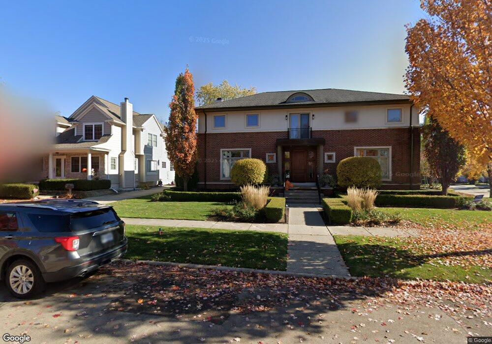
1695 S Bates St Birmingham, MI 48009
Estimated Value: $1,453,746 - $1,778,000
4
Beds
5
Baths
3,723
Sq Ft
$437/Sq Ft
Est. Value
About This Home
This home is located at 1695 S Bates St, Birmingham, MI 48009 and is currently estimated at $1,626,187, approximately $436 per square foot. 1695 S Bates St is a home located in Oakland County with nearby schools including Pierce Elementary School, Derby Middle School, and Ernest W. Seaholm High School.
Ownership History
Date
Name
Owned For
Owner Type
Purchase Details
Closed on
Feb 17, 2004
Sold by
Gilbert Wolk & Novick Llc
Bought by
Price Ralph L and Price Christine M
Current Estimated Value
Home Financials for this Owner
Home Financials are based on the most recent Mortgage that was taken out on this home.
Original Mortgage
$490,000
Outstanding Balance
$231,881
Interest Rate
5.96%
Mortgage Type
Purchase Money Mortgage
Estimated Equity
$1,394,306
Purchase Details
Closed on
Mar 9, 2000
Sold by
Stackpole R W
Bought by
Novick Gilbert Wolk
Create a Home Valuation Report for This Property
The Home Valuation Report is an in-depth analysis detailing your home's value as well as a comparison with similar homes in the area
Home Values in the Area
Average Home Value in this Area
Purchase History
| Date | Buyer | Sale Price | Title Company |
|---|---|---|---|
| Price Ralph L | $895,000 | Philip R Seaver Title Co Inc | |
| Novick Gilbert Wolk | $240,000 | -- |
Source: Public Records
Mortgage History
| Date | Status | Borrower | Loan Amount |
|---|---|---|---|
| Open | Price Ralph L | $490,000 |
Source: Public Records
Tax History Compared to Growth
Tax History
| Year | Tax Paid | Tax Assessment Tax Assessment Total Assessment is a certain percentage of the fair market value that is determined by local assessors to be the total taxable value of land and additions on the property. | Land | Improvement |
|---|---|---|---|---|
| 2024 | $16,414 | $604,690 | $0 | $0 |
| 2023 | $15,729 | $656,440 | $0 | $0 |
| 2022 | $16,864 | $617,450 | $0 | $0 |
| 2021 | $17,013 | $631,250 | $0 | $0 |
| 2020 | $15,158 | $647,550 | $0 | $0 |
| 2019 | $17,154 | $625,690 | $0 | $0 |
| 2018 | $17,022 | $590,610 | $0 | $0 |
| 2017 | $16,993 | $581,250 | $0 | $0 |
| 2016 | $17,025 | $580,350 | $0 | $0 |
| 2015 | -- | $553,740 | $0 | $0 |
| 2014 | -- | $478,630 | $0 | $0 |
| 2011 | -- | $358,910 | $0 | $0 |
Source: Public Records
Map
Nearby Homes
- 1886 Henrietta St
- 1978 Henrietta St
- 150 Bird Ave Unit 20
- 16975 W Fourteen Mile Rd
- 1748 Stanley Blvd
- 251 E 14 Mile Rd
- 1419 Henrietta St
- 350 Catalpa Dr
- 16991 Kirkshire Ave
- 1626 Maryland Blvd
- 1323 Washington Blvd
- 1723 Birmingham Blvd
- 1205 S Bates St
- 1541 Shipman Blvd
- 16281 Buckingham Ave
- 1850 Shipman Blvd
- 15858 Kirkshire Ave
- 1992 Shipman Blvd
- 955 S Bates St
- 16950 Kinross Ave
- 1675 S Bates St
- 1657 S Bates St
- 1698 Henrietta St
- 1684 Henrietta St
- 1717 S Bates St
- 1650 Henrietta St
- 1721 S Bates St
- 1712 Henrietta St
- 1632 Henrietta St
- 1680 S Bates St
- 1698 S Bates St
- 1668 S Bates St
- 1734 Henrietta St Unit Bldg-Unit
- 1734 Henrietta St
- 1737 S Bates St
- 1620 Henrietta St
- 1607 S Bates St
- 1646 S Bates St
- 1708 S Bates St
- 1622 S Bates St