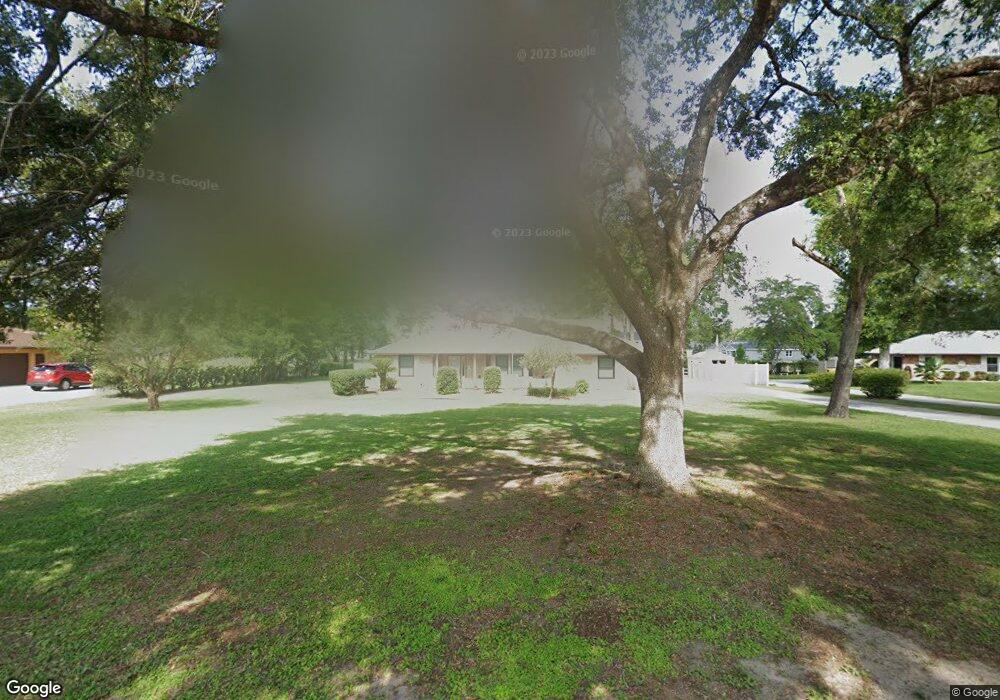
1696 Miller Dr Deland, FL 32720
North DeLand NeighborhoodEstimated Value: $359,000 - $436,000
3
Beds
2
Baths
1,844
Sq Ft
$216/Sq Ft
Est. Value
About This Home
This home is located at 1696 Miller Dr, Deland, FL 32720 and is currently estimated at $398,902, approximately $216 per square foot. 1696 Miller Dr is a home located in Volusia County with nearby schools including Citrus Grove Elementary, Deland High School, and Deland Middle School.
Ownership History
Date
Name
Owned For
Owner Type
Purchase Details
Closed on
Feb 20, 2025
Sold by
Hand Gary L
Bought by
Gary L Hand Revocable Trust and Hand
Current Estimated Value
Purchase Details
Closed on
May 1, 2023
Sold by
Hand Gary L Le
Bought by
Hand Gary L and Beckman Jeanette Lyn
Purchase Details
Closed on
Mar 30, 2015
Sold by
Kinney Bonnie and Clinard Mary
Bought by
Hand Paulette Lee and Hand Gary L
Purchase Details
Closed on
Jul 17, 2001
Sold by
Marland George B and Marland Lois W
Bought by
Marland George
Purchase Details
Closed on
Mar 15, 1990
Bought by
Hand Paulette Lee and Hand Gary L
Purchase Details
Closed on
Aug 15, 1986
Bought by
Hand Paulette Lee and Hand Gary L
Purchase Details
Closed on
Jun 15, 1979
Bought by
Hand Paulette Lee and Hand Gary L
Create a Home Valuation Report for This Property
The Home Valuation Report is an in-depth analysis detailing your home's value as well as a comparison with similar homes in the area
Home Values in the Area
Average Home Value in this Area
Purchase History
| Date | Buyer | Sale Price | Title Company |
|---|---|---|---|
| Gary L Hand Revocable Trust | $100 | None Listed On Document | |
| Gary L Hand Revocable Trust | $100 | None Listed On Document | |
| Hand Gary L | $100 | None Listed On Document | |
| Hand Gary L | $100 | None Listed On Document | |
| Hand Paulette Lee | $176,000 | Volusia Title Services | |
| Marland George | -- | -- | |
| Hand Paulette Lee | $85,000 | -- | |
| Hand Paulette Lee | $14,000 | -- | |
| Hand Paulette Lee | $7,500 | -- |
Source: Public Records
Tax History Compared to Growth
Tax History
| Year | Tax Paid | Tax Assessment Tax Assessment Total Assessment is a certain percentage of the fair market value that is determined by local assessors to be the total taxable value of land and additions on the property. | Land | Improvement |
|---|---|---|---|---|
| 2025 | $4,263 | $282,760 | -- | -- |
| 2024 | $4,263 | $274,792 | -- | -- |
| 2023 | $4,263 | $266,789 | $0 | $0 |
| 2022 | $4,190 | $259,018 | $0 | $0 |
| 2021 | $4,351 | $251,474 | $0 | $0 |
| 2020 | $4,291 | $248,002 | $0 | $0 |
| 2019 | $4,439 | $242,426 | $0 | $0 |
| 2018 | $3,444 | $192,129 | $21,600 | $170,529 |
| 2017 | $4,338 | $179,735 | $21,600 | $158,135 |
| 2016 | $3,974 | $167,705 | $0 | $0 |
| 2015 | $4,214 | $173,377 | $0 | $0 |
| 2014 | $1,472 | $124,497 | $0 | $0 |
Source: Public Records
Map
Nearby Homes
- 865 Asterfield Ln
- 882 Asterfield Ln
- 887 Asterfield Ln
- 897 Honey Petal Ln
- 903 Honey Petal Ln
- 580 Mercers Fernery Rd
- 1937 N Spring Garden Ave
- 0 Greens Dairy Rd Unit 1216610
- 0 Vacant Land Unit MFRA4667659
- 0 Vacant Land Unit MFRGC533353
- 1110 Mercers Fernery Rd
- 1221 Bramley Ln
- 2285 Wilmhurst Rd
- 975 Rolling Acres Dr
- 2172 N Spring Garden Ave
- 1224 Bexley Ct
- 305 Violetwood Rd
- 425 Mercers Fernery Rd
- 1346 Rolling River Rd
- 905 Cascade Falls Ln
- 1690 Miller Dr
- 1700 Miller Dr
- 1685 Miller Dr
- 1710 Miller Dr
- 1705 Miller Dr
- 1687 Miller Dr
- 1676 Miller Dr
- 1715 Miller Dr
- 861 Asterfield Ln
- 863 Asterfield Ln
- 859 Asterfield Ln
- 1675 Miller Dr
- 867 Asterfield Ln
- 857 Asterfield Ln
- 1664 Miller Dr
- 855 Asterfield Ln
- 869 Asterfield Ln
- 1665 Miller Dr
- 871 Honey Petal Ln
- 870 Asterfield Ln