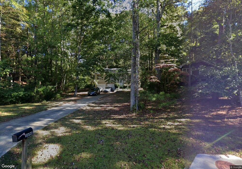
1696 Norton Estates Cir Unit 1 Snellville, GA 30078
Estimated Value: $308,384 - $361,000
3
Beds
2
Baths
1,149
Sq Ft
$292/Sq Ft
Est. Value
About This Home
This home is located at 1696 Norton Estates Cir Unit 1, Snellville, GA 30078 and is currently estimated at $335,096, approximately $291 per square foot. 1696 Norton Estates Cir Unit 1 is a home located in Gwinnett County with nearby schools including Brookwood Elementary School, Alton C. Crews Middle School, and Brookwood High School.
Ownership History
Date
Name
Owned For
Owner Type
Purchase Details
Closed on
Feb 8, 2002
Sold by
Adamson Cynthia C
Bought by
Hughes Felicia D
Current Estimated Value
Home Financials for this Owner
Home Financials are based on the most recent Mortgage that was taken out on this home.
Original Mortgage
$132,050
Outstanding Balance
$64,434
Interest Rate
10%
Mortgage Type
New Conventional
Estimated Equity
$270,662
Create a Home Valuation Report for This Property
The Home Valuation Report is an in-depth analysis detailing your home's value as well as a comparison with similar homes in the area
Home Values in the Area
Average Home Value in this Area
Purchase History
| Date | Buyer | Sale Price | Title Company |
|---|---|---|---|
| Hughes Felicia D | $139,000 | -- |
Source: Public Records
Mortgage History
| Date | Status | Borrower | Loan Amount |
|---|---|---|---|
| Open | Hughes Felicia D | $132,050 |
Source: Public Records
Tax History Compared to Growth
Tax History
| Year | Tax Paid | Tax Assessment Tax Assessment Total Assessment is a certain percentage of the fair market value that is determined by local assessors to be the total taxable value of land and additions on the property. | Land | Improvement |
|---|---|---|---|---|
| 2025 | $3,261 | $136,280 | $22,200 | $114,080 |
| 2024 | $3,291 | $81,800 | $23,200 | $58,600 |
| 2023 | $3,291 | $81,800 | $23,200 | $58,600 |
| 2022 | $3,249 | $97,920 | $23,200 | $74,720 |
| 2021 | $2,557 | $61,640 | $14,800 | $46,840 |
| 2020 | $2,570 | $61,640 | $14,800 | $46,840 |
| 2019 | $1,931 | $61,640 | $14,800 | $46,840 |
| 2018 | $1,927 | $46,000 | $11,600 | $34,400 |
| 2016 | $1,818 | $42,364 | $9,860 | $32,504 |
| 2015 | $1,910 | $44,480 | $8,800 | $35,680 |
| 2014 | -- | $28,000 | $8,000 | $20,000 |
Source: Public Records
Map
Nearby Homes
- 3063 Bruckner Blvd
- 1686 Norton Estates Dr
- 1845 Lisa Springs Dr
- 1953 Watson Park Dr
- 1750 Manor Brook Way
- Kenwood Plan at Watson Park
- Stockbridge Plan at Watson Park
- Aiken Plan at Watson Park
- Lawrence Plan at Watson Park
- Easton Plan at Watson Park
- 3207 Aspen Cir SW
- 1809 Mornington Ln
- 3075 Oak Meadow Dr
- 1220 Edgebrook Ln
- 1916 Oakwood Grove Dr Unit 1
- 3173 Falconhurst Dr SW
- 2691 Holly Springs Dr
- 1937 Crescent Dr
- 1526 Lechemin Dr
- 1700 Norton Estates Cir
- 1692 Norton Estates Cir
- 2956 Ripple Ct
- 3070 W Point Cir
- 3060 NE Westpoint Cir Unit LOT 34
- 3070 W Point Cir Unit 35
- 3050 W Point Cir
- 3050 W Point Cir Unit 33
- 3040 W Point Cir Unit 32
- 2957 Pebble Ln
- 1684 Norton Estates Cir
- 2947 Pebble Ln
- 2955 Ripple Ct
- 2042 Clay Rd
- 2387 Foley Park St
- 2062 Clay Rd
- 3070 Westpoint Cir
- 3060 Westpoint Cir Unit LOT 34
- 3030 Westpoint Cir Unit 31
- 3020 Westpoint Cir Unit 31