Estimated Value: $754,924
--
Bed
--
Bath
2,856
Sq Ft
$264/Sq Ft
Est. Value
About This Home
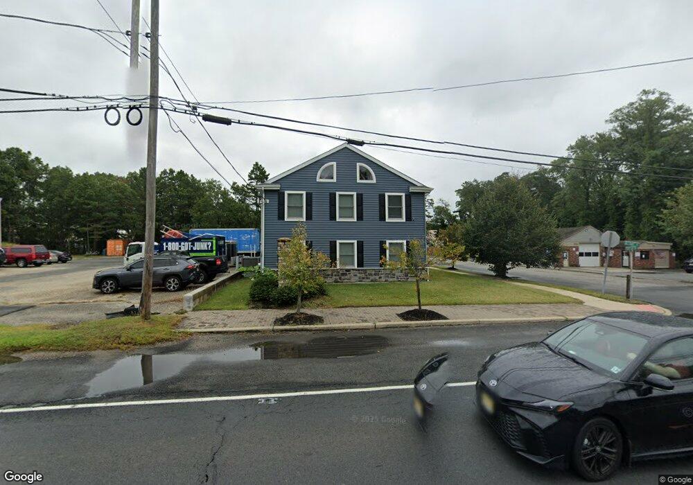
This home is located at 1696 Route 88, Brick, NJ 08724 and is currently estimated at $754,924, approximately $264 per square foot. 1696 Route 88 is a home located in Ocean County with nearby schools including Lanes Mill Elementary School, Veterans Memorial Middle School, and Brick Township Memorial High School.
Ownership History
Date
Name
Owned For
Owner Type
Purchase Details
Closed on
Jun 13, 2023
Sold by
Rotolo Real Estate Llc
Bought by
1696 Route 88 Brick Llc
Current Estimated Value
Home Financials for this Owner
Home Financials are based on the most recent Mortgage that was taken out on this home.
Original Mortgage
$462,000
Interest Rate
6.96%
Mortgage Type
New Conventional
Purchase Details
Closed on
Apr 7, 2017
Sold by
Rotolo & Howard Realty Associates Llc
Bought by
Rotolo Real Estate Llc
Home Financials for this Owner
Home Financials are based on the most recent Mortgage that was taken out on this home.
Original Mortgage
$60,000
Interest Rate
4.21%
Mortgage Type
Commercial
Purchase Details
Closed on
May 13, 2008
Sold by
New York Community Bank
Bought by
Rotolo & Howard Realty Associates Llc
Create a Home Valuation Report for This Property
The Home Valuation Report is an in-depth analysis detailing your home's value as well as a comparison with similar homes in the area
Home Values in the Area
Average Home Value in this Area
Purchase History
| Date | Buyer | Sale Price | Title Company |
|---|---|---|---|
| 1696 Route 88 Brick Llc | $660,000 | Clear To Close Title | |
| 1696 Route 88 Brick Llc | $660,000 | Clear To Close Title | |
| Rotolo Real Estate Llc | -- | -- | |
| Rotolo & Howard Realty Associates Llc | $375,000 | New Jersey Title Ins Company |
Source: Public Records
Mortgage History
| Date | Status | Borrower | Loan Amount |
|---|---|---|---|
| Previous Owner | 1696 Route 88 Brick Llc | $462,000 | |
| Previous Owner | Rotolo Real Estate Llc | $60,000 | |
| Previous Owner | Rotolo Real Estate Llc | $440,000 |
Source: Public Records
Tax History Compared to Growth
Tax History
| Year | Tax Paid | Tax Assessment Tax Assessment Total Assessment is a certain percentage of the fair market value that is determined by local assessors to be the total taxable value of land and additions on the property. | Land | Improvement |
|---|---|---|---|---|
| 2025 | $12,176 | $466,500 | $181,500 | $285,000 |
| 2024 | $11,555 | $466,500 | $181,500 | $285,000 |
| 2023 | $11,387 | $466,500 | $181,500 | $285,000 |
| 2022 | $11,387 | $466,500 | $181,500 | $285,000 |
| 2021 | $11,149 | $466,500 | $181,500 | $285,000 |
| 2020 | $11,005 | $466,500 | $181,500 | $285,000 |
| 2019 | $10,809 | $466,500 | $181,500 | $285,000 |
| 2018 | $10,562 | $466,500 | $181,500 | $285,000 |
| 2017 | $10,277 | $466,500 | $181,500 | $285,000 |
| 2016 | $10,221 | $466,500 | $181,500 | $285,000 |
| 2015 | $9,955 | $466,500 | $181,500 | $285,000 |
| 2014 | $9,871 | $466,500 | $181,500 | $285,000 |
Source: Public Records
Map
Nearby Homes
- 982 Falkenberg Rd
- 210 Chard Place
- 53 Albert Cucci Dr
- 1595 Forge Pond Rd
- 5 B Trail
- 3 C Trail
- 11 B Trail
- 1 Princeton Pines Place
- 80 Robbins Ct
- 59 Joseph Byrne Dr
- 39 Marlow Ave
- 24 Laurelhurst Dr
- 119 Celebration Blvd Unit 919
- 301 Prosper Way
- 303 Prosper Way Unit 203
- 15B Court a
- 8 Holmes Ct
- 12 D Trail
- 11C Court a
- 29 Robbins St
- 1695 New Jersey 88
- 1691 Route 88
- 1681 Laurelton St
- 1683 New Jersey 88
- 1700 W Princeton Ave
- 1682 Laurelton St
- 1683 Laurelton St
- 1704 W Princeton Ave
- 107 John St
- 1710 W Princeton Ave
- 1682 W Princeton Ave
- 1684 W Princeton Ave
- 1678 W Princeton Ave
- 1716 W Princeton Ave
- 119 John St
- 1691 Laurelton St
- 1699 W Princeton Ave
- 1676 W Princeton Ave
- 1674 W Princeton Ave
- 123 John St