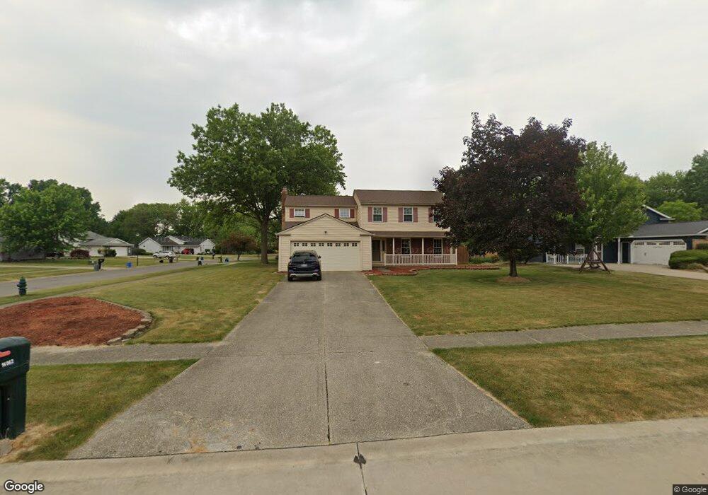
16962 Ringneck Cir Strongsville, OH 44136
Estimated Value: $329,297 - $389,000
4
Beds
3
Baths
2,035
Sq Ft
$177/Sq Ft
Est. Value
About This Home
This home is located at 16962 Ringneck Cir, Strongsville, OH 44136 and is currently estimated at $360,324, approximately $177 per square foot. 16962 Ringneck Cir is a home located in Cuyahoga County with nearby schools including Strongsville High School and Sts Joseph & John Interparochial School.
Ownership History
Date
Name
Owned For
Owner Type
Purchase Details
Closed on
Jan 27, 2010
Sold by
Heslop Bruce C and Heslop Julia F
Bought by
Deal Julie M
Current Estimated Value
Home Financials for this Owner
Home Financials are based on the most recent Mortgage that was taken out on this home.
Original Mortgage
$181,649
Outstanding Balance
$121,537
Interest Rate
5.25%
Mortgage Type
FHA
Estimated Equity
$238,787
Purchase Details
Closed on
Aug 13, 1975
Bought by
Heslop Bruce C and Heslop Julia F
Purchase Details
Closed on
Jan 1, 1975
Bought by
J D Land Co
Create a Home Valuation Report for This Property
The Home Valuation Report is an in-depth analysis detailing your home's value as well as a comparison with similar homes in the area
Home Values in the Area
Average Home Value in this Area
Purchase History
| Date | Buyer | Sale Price | Title Company |
|---|---|---|---|
| Deal Julie M | $185,000 | Progressive Land Title | |
| Heslop Bruce C | $48,900 | -- | |
| J D Land Co | -- | -- |
Source: Public Records
Mortgage History
| Date | Status | Borrower | Loan Amount |
|---|---|---|---|
| Open | Deal Julie M | $181,649 |
Source: Public Records
Tax History Compared to Growth
Tax History
| Year | Tax Paid | Tax Assessment Tax Assessment Total Assessment is a certain percentage of the fair market value that is determined by local assessors to be the total taxable value of land and additions on the property. | Land | Improvement |
|---|---|---|---|---|
| 2024 | $4,903 | $104,440 | $20,930 | $83,510 |
| 2023 | $5,034 | $80,400 | $19,390 | $61,010 |
| 2022 | $4,998 | $80,400 | $19,390 | $61,010 |
| 2021 | $4,958 | $80,400 | $19,390 | $61,010 |
| 2020 | $4,595 | $65,910 | $15,890 | $50,020 |
| 2019 | $4,460 | $188,300 | $45,400 | $142,900 |
| 2018 | $4,048 | $65,910 | $15,890 | $50,020 |
| 2017 | $4,124 | $62,160 | $12,810 | $49,350 |
| 2016 | $4,090 | $62,160 | $12,810 | $49,350 |
| 2015 | $4,148 | $62,160 | $12,810 | $49,350 |
| 2014 | $4,148 | $62,160 | $12,810 | $49,350 |
Source: Public Records
Map
Nearby Homes
- 16650 Lanier Ave
- 17159 Turkey Meadow Ln
- 17024 Bear Creek Ln
- 17682 Drake Rd
- 16486 S Red Rock Dr
- 16450 Howe Rd
- 17130 Golden Star Dr
- 17069 Partridge Dr
- 18294 Drake Rd
- 17934 Cambridge Oval
- 18229 Howe Rd
- 18162 Fawn Cir
- 15639 Indianhead Ln
- 18411 Yorktown Oval
- 16711 Beech Cir
- 18630 Shurmer Rd
- 14826 Lenox Dr
- 14703 Lenox Dr Unit 103
- 17259 Woodshire Dr
- 19311 Bradford Ct
- 16958 Ringneck Cir
- 19015 Quail Hollow Dr
- 16950 Ringneck Cir
- 19005 Quail Hollow Dr
- 19020 Quail Hollow Dr
- 19026 Quail Hollow Dr
- 16963 Ringneck Cir
- 19016 Quail Hollow Dr
- 16957 Ringneck Cir
- 19001 Quail Hollow Dr
- 16946 Ringneck Cir
- 19012 Quail Hollow Dr
- 19038 Quail Hollow Dr
- 16949 Ringneck Cir
- 19008 Quail Hollow Dr
- 19047 Quail Hollow Dr
- 19044 Quail Hollow Dr
- 16711 Lanier Ave
- 16942 Ringneck Cir
- 16719 Lanier Ave