Estimated Value: $621,306 - $703,000
3
Beds
3
Baths
1,856
Sq Ft
$357/Sq Ft
Est. Value
About This Home
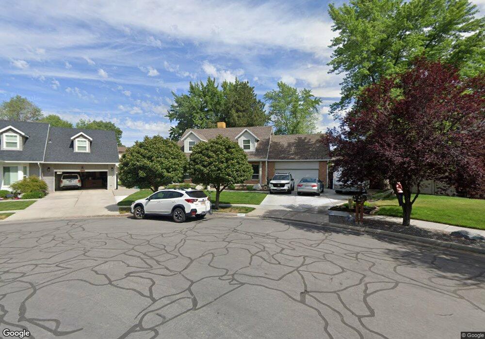
This home is located at 1697 Kimsbrough Rd, Sandy, UT 84092 and is currently estimated at $662,577, approximately $356 per square foot. 1697 Kimsbrough Rd is a home located in Salt Lake County with nearby schools including Willow Canyon Elementary School, Eastmont Middle School, and Jordan High.
Ownership History
Date
Name
Owned For
Owner Type
Purchase Details
Closed on
Jan 6, 2026
Sold by
Robbins Stewart M and Robbins Elizabeth B
Bought by
Robbins Family Trust and Robbins
Current Estimated Value
Purchase Details
Closed on
May 19, 2003
Sold by
Robbins Stewart and Robbins Elizabeth
Bought by
Robbins Stewart M and Robbins Elizabeth B
Home Financials for this Owner
Home Financials are based on the most recent Mortgage that was taken out on this home.
Original Mortgage
$222,300
Interest Rate
5.77%
Mortgage Type
Unknown
Purchase Details
Closed on
Jun 29, 1998
Sold by
Kershaw Damon L and Kershaw Carolyn
Bought by
Robbins Stewart and Robbins Elizabeth
Home Financials for this Owner
Home Financials are based on the most recent Mortgage that was taken out on this home.
Original Mortgage
$183,825
Interest Rate
7.17%
Purchase Details
Closed on
Aug 30, 1995
Sold by
Choi Man Kyu and Choi Gil Ja
Bought by
Kershaw Damon L and Kershaw Carolyn
Home Financials for this Owner
Home Financials are based on the most recent Mortgage that was taken out on this home.
Original Mortgage
$124,400
Interest Rate
7.63%
Create a Home Valuation Report for This Property
The Home Valuation Report is an in-depth analysis detailing your home's value as well as a comparison with similar homes in the area
Home Values in the Area
Average Home Value in this Area
Purchase History
| Date | Buyer | Sale Price | Title Company |
|---|---|---|---|
| Robbins Family Trust | -- | None Listed On Document | |
| Robbins Stewart M | -- | Integrated Title Ins Service | |
| Robbins Stewart | -- | -- | |
| Kershaw Damon L | -- | -- |
Source: Public Records
Mortgage History
| Date | Status | Borrower | Loan Amount |
|---|---|---|---|
| Previous Owner | Robbins Stewart M | $222,300 | |
| Previous Owner | Robbins Stewart | $183,825 | |
| Previous Owner | Kershaw Damon L | $124,400 |
Source: Public Records
Tax History
| Year | Tax Paid | Tax Assessment Tax Assessment Total Assessment is a certain percentage of the fair market value that is determined by local assessors to be the total taxable value of land and additions on the property. | Land | Improvement |
|---|---|---|---|---|
| 2025 | $2,993 | $587,700 | $247,400 | $340,300 |
| 2024 | $2,993 | $582,000 | $238,100 | $343,900 |
| 2023 | $2,785 | $532,900 | $228,900 | $304,000 |
| 2022 | $2,854 | $537,400 | $224,400 | $313,000 |
| 2021 | $2,745 | $440,600 | $179,500 | $261,100 |
| 2020 | $2,397 | $363,300 | $179,500 | $183,800 |
| 2019 | $2,532 | $350,500 | $169,300 | $181,200 |
| 2018 | $2,134 | $330,900 | $169,300 | $161,600 |
| 2017 | $1,965 | $291,700 | $169,300 | $122,400 |
| 2016 | $1,898 | $272,700 | $152,600 | $120,100 |
| 2015 | $1,800 | $239,800 | $166,300 | $73,500 |
| 2014 | $1,684 | $220,500 | $157,200 | $63,300 |
Source: Public Records
Map
Nearby Homes
- 1650 E Budding Dr
- 9979 S Albury Rd
- 9971 Pinehurst Dr
- 10158 Buttercup Dr
- 9828 Pinehurst Dr
- 10240 Locksley Rd
- 1563 E Tameron Dr
- 1584 Petunia Way
- 10172 Snow Iris Way
- 1602 E Sego Lily Dr
- 10346 Wood Glen Cir
- 1420 E Firelight Way
- 1469 Winterwood Cir
- 9968 S Blossom Dr
- 1447 E Edgecliff Dr
- 1952 E Bluffside Cir
- 9976 Tamara St E
- 2009 E Sweetbriar Ln
- 10538 S Bay Meadow Dr
- 9472 S Tramway Dr
- 1705 Kimsbrough Rd
- 1693 E Kimsbrough Rd
- 1693 Kimsbrough Rd
- 1705 E Kimsbrough Rd
- 10029 Countrywood Dr
- 10029 S Countrywood Dr
- 1700 Abbedale Ln
- 1708 Abbedale Ln
- 10039 Countrywood Dr
- 10039 S Countrywood Dr
- 10013 Countrywood Dr
- 1716 Abbedale Ln
- 10072 Kimsbrough Rd
- 1713 E Kimsbrough Rd
- 1713 Kimsbrough Rd
- 10051 Countrywood Dr
- 1706 E Kimsbrough Rd
- 1706 Kimsbrough Rd
- 1724 Abbedale Ln
- 1723 E Kimsbrough Rd
Your Personal Tour Guide
Ask me questions while you tour the home.