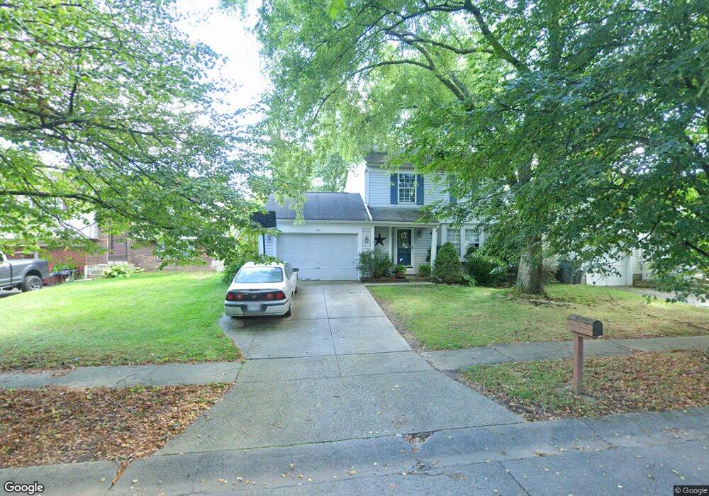
1697 Laramie Dr Powell, OH 43065
Western Hills NeighborhoodEstimated Value: $318,000 - $375,000
3
Beds
2
Baths
1,206
Sq Ft
$279/Sq Ft
Est. Value
About This Home
This home is located at 1697 Laramie Dr, Powell, OH 43065 and is currently estimated at $337,076, approximately $279 per square foot. 1697 Laramie Dr is a home located in Franklin County with nearby schools including Liberty Elementary School, McCord Middle School, and Worthington Kilbourne High School.
Ownership History
Date
Name
Owned For
Owner Type
Purchase Details
Closed on
Jan 30, 2003
Sold by
Irwin Gary W and Irwin Lori E
Bought by
Steller William J and Steller Theresa M
Current Estimated Value
Purchase Details
Closed on
Feb 22, 1995
Sold by
Shadoan Brent S
Bought by
Irwin Gary W and Irwin Lori E
Home Financials for this Owner
Home Financials are based on the most recent Mortgage that was taken out on this home.
Original Mortgage
$96,300
Interest Rate
9.21%
Mortgage Type
New Conventional
Purchase Details
Closed on
Jun 26, 1990
Purchase Details
Closed on
Jul 1, 1985
Create a Home Valuation Report for This Property
The Home Valuation Report is an in-depth analysis detailing your home's value as well as a comparison with similar homes in the area
Home Values in the Area
Average Home Value in this Area
Purchase History
| Date | Buyer | Sale Price | Title Company |
|---|---|---|---|
| Steller William J | $134,000 | Title First Agency Inc | |
| Irwin Gary W | $96,900 | -- | |
| -- | $82,500 | -- | |
| -- | $59,900 | -- |
Source: Public Records
Mortgage History
| Date | Status | Borrower | Loan Amount |
|---|---|---|---|
| Closed | Irwin Gary W | $96,300 |
Source: Public Records
Tax History Compared to Growth
Tax History
| Year | Tax Paid | Tax Assessment Tax Assessment Total Assessment is a certain percentage of the fair market value that is determined by local assessors to be the total taxable value of land and additions on the property. | Land | Improvement |
|---|---|---|---|---|
| 2024 | $5,766 | $93,910 | $27,230 | $66,680 |
| 2023 | $5,513 | $93,905 | $27,230 | $66,675 |
| 2022 | $4,962 | $64,060 | $14,460 | $49,600 |
| 2021 | $4,373 | $64,060 | $14,460 | $49,600 |
| 2020 | $4,323 | $64,060 | $14,460 | $49,600 |
| 2019 | $3,900 | $53,520 | $12,040 | $41,480 |
| 2018 | $3,522 | $53,520 | $12,040 | $41,480 |
| 2017 | $3,380 | $53,520 | $12,040 | $41,480 |
| 2016 | $3,266 | $46,000 | $12,500 | $33,500 |
| 2015 | $3,266 | $46,000 | $12,500 | $33,500 |
| 2014 | $3,265 | $46,000 | $12,500 | $33,500 |
| 2013 | $1,625 | $45,990 | $12,495 | $33,495 |
Source: Public Records
Map
Nearby Homes
- 8266 Waco Ln
- 1486 Clubview Blvd S
- 1914 Laramie Dr Unit 26
- 1827 Calico Ct
- 1399 Briarmeadow Dr
- 8345 Smoky Row Rd Unit 8345
- 8351 Smoky Row Rd Unit 48351
- 2053 Stancrest Rd
- 1768 Gardenstone Dr
- 1949 Hamrock Dr
- 8594 Broadacre Dr
- 2074 Hard Rd
- 8011 Golfview Ct
- 1865 Weather Stone Ln
- 2120 Sharwood Ct
- 1938 Slaton Ct
- 8292 Breckenridge Way
- 2280 Saberly Ct
- 1827 Watertower Dr Unit 1827
- 1825 Watertower Dr Unit 1825
- 1689 Laramie Dr
- 1705 Laramie Dr
- 1681 Laramie Dr
- 1713 Laramie Dr
- 1698 Laramie Dr
- 1700 Laredo Ct
- 1694 Laredo Ct
- 1710 Laredo Ct
- 1721 Laramie Dr
- 1673 Laramie Dr
- 1686 Laredo Ct
- 1706 Laramie Dr
- 1718 Laredo Ct
- 1682 Laramie Dr
- 1680 Laredo Ct
- 1714 Laramie Dr
- 1676 Laramie Dr
- 1724 Laredo Ct
- 1729 Laramie Dr
- 1722 Laramie Dr