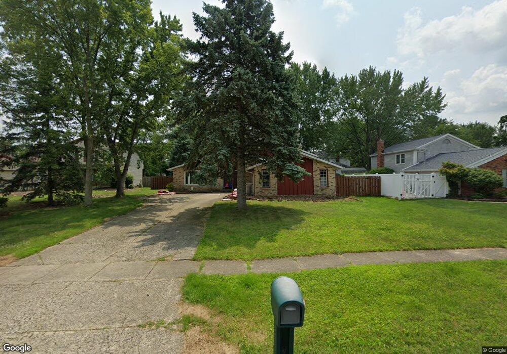
16989 Bob White Cir Strongsville, OH 44136
Estimated Value: $327,617 - $403,000
4
Beds
3
Baths
2,100
Sq Ft
$170/Sq Ft
Est. Value
About This Home
This home is located at 16989 Bob White Cir, Strongsville, OH 44136 and is currently estimated at $356,654, approximately $169 per square foot. 16989 Bob White Cir is a home located in Cuyahoga County with nearby schools including Strongsville High School and Sts Joseph & John Interparochial School.
Ownership History
Date
Name
Owned For
Owner Type
Purchase Details
Closed on
Oct 20, 2008
Sold by
Mccann John P
Bought by
Hajjar Ahmad
Current Estimated Value
Home Financials for this Owner
Home Financials are based on the most recent Mortgage that was taken out on this home.
Original Mortgage
$117,600
Outstanding Balance
$78,126
Interest Rate
6.41%
Mortgage Type
Purchase Money Mortgage
Estimated Equity
$278,528
Purchase Details
Closed on
Sep 23, 1977
Bought by
Mccann John P
Purchase Details
Closed on
Jan 1, 1977
Bought by
Chestnut Homes
Create a Home Valuation Report for This Property
The Home Valuation Report is an in-depth analysis detailing your home's value as well as a comparison with similar homes in the area
Home Values in the Area
Average Home Value in this Area
Purchase History
| Date | Buyer | Sale Price | Title Company |
|---|---|---|---|
| Hajjar Ahmad | $147,000 | Title Access Llc | |
| Mccann John P | $67,500 | -- | |
| Chestnut Homes | -- | -- |
Source: Public Records
Mortgage History
| Date | Status | Borrower | Loan Amount |
|---|---|---|---|
| Open | Hajjar Ahmad | $117,600 |
Source: Public Records
Tax History Compared to Growth
Tax History
| Year | Tax Paid | Tax Assessment Tax Assessment Total Assessment is a certain percentage of the fair market value that is determined by local assessors to be the total taxable value of land and additions on the property. | Land | Improvement |
|---|---|---|---|---|
| 2024 | $4,846 | $100,800 | $22,995 | $77,805 |
| 2023 | $4,904 | $76,660 | $19,430 | $57,230 |
| 2022 | $4,869 | $76,650 | $19,425 | $57,225 |
| 2021 | $4,835 | $76,650 | $19,430 | $57,230 |
| 2020 | $4,479 | $62,830 | $15,930 | $46,900 |
| 2019 | $4,350 | $179,500 | $45,500 | $134,000 |
| 2018 | $3,957 | $62,830 | $15,930 | $46,900 |
| 2017 | $3,899 | $57,300 | $12,850 | $44,450 |
| 2016 | $3,868 | $57,300 | $12,850 | $44,450 |
| 2015 | $3,924 | $57,300 | $12,850 | $44,450 |
| 2014 | $3,924 | $57,300 | $12,850 | $44,450 |
Source: Public Records
Map
Nearby Homes
- 17024 Bear Creek Ln
- 17682 Drake Rd
- 17159 Turkey Meadow Ln
- 18294 Drake Rd
- 17934 Cambridge Oval
- 16650 Lanier Ave
- 16486 S Red Rock Dr
- 17069 Partridge Dr
- 18411 Yorktown Oval
- 18162 Fawn Cir
- 17130 Golden Star Dr
- 16450 Howe Rd
- 17259 Woodshire Dr
- 19297 Lauren Way
- 18229 Howe Rd
- 19311 Bradford Ct
- 16711 Beech Cir
- 18848 Pearl Rd
- 18630 Shurmer Rd
- 15639 Indianhead Ln
- 16981 Bob White Cir
- 16997 Bob White Cir
- 17005 Bear Creek Ln
- 16973 Bob White Cir
- 17013 Bear Creek Ln
- 16990 Bob White Cir
- 16974 Bob White Cir
- 17021 Bear Creek Ln
- 16966 Bob White Cir
- 17040 Hawks Lookout Ln
- 17032 Bear Creek Ln
- 17276 Hampton Chase
- 17016 Bear Creek Ln
- 17244 Hampton Chase
- 17029 Bear Creek Ln
- 17008 Bear Creek Ln
- 17212 Hampton Chase
- 16993 Antler Ln
- 17180 Hampton Chase
- 17048 Hawks Lookout Ln