Estimated Value: $365,793 - $449,000
About This Home
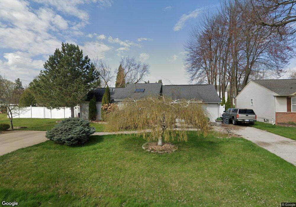
This home is located at 1699 Enterprise Dr, Troy, MI 48083 and is currently estimated at $400,198, approximately $194 per square foot. 1699 Enterprise Dr is a home located in Oakland County with nearby schools including Morse Elementary School, Baker Middle School, and Troy High School.
Ownership History
We collect this data history from publicly available records. To have your information removed, we recommend requesting removal directly through your county’s website.
Purchase Details
Home Financials for this Owner
Home Financials are based on the most recent Mortgage that was taken out on this home.Purchase Details
Purchase Details
Purchase Details
Home Financials for this Owner
Home Financials are based on the most recent Mortgage that was taken out on this home.Purchase Details
Purchase Details
Home Financials for this Owner
Home Financials are based on the most recent Mortgage that was taken out on this home.Home Values in the Area
Average Home Value in this Area
Purchase History
We collect this data history from publicly available records. To have your information removed, we recommend requesting removal directly through your county’s website.
| Date | Buyer | Sale Price | Title Company |
|---|---|---|---|
| -- | None Listed On Document | ||
| -- | None Available | ||
| $175,500 | Capital Title Ins Agency | ||
| -- | Title Source Inc | ||
| -- | -- | ||
| $138,500 | -- |
Mortgage History
We collect this data history from publicly available records. To have your information removed, we recommend requesting removal directly through your county’s website.
| Date | Status | Borrower | Loan Amount |
|---|---|---|---|
| Open | $236,250 | ||
| Previous Owner | $134,400 | ||
| Previous Owner | $25,000 | ||
| Previous Owner | $34,000 | ||
| Previous Owner | $110,800 |
Tax History
We collect this data history from publicly available records. To have your information removed, we recommend requesting removal directly through your county’s website.
| Year | Tax Paid | Tax Assessment Tax Assessment Total Assessment is a certain percentage of the fair market value that is determined by local assessors to be the total taxable value of land and additions on the property. | Land | Improvement |
|---|---|---|---|---|
| 2022 | $4,696 | $129,710 | $0 | $0 |
| 2015 | $4,438 | $88,330 | $0 | $0 |
| 2014 | -- | $78,370 | $0 | $0 |
| 2011 | -- | $81,520 | $0 | $0 |
Map
- 1842 Enterprise Dr
- 1975 Enterprise Dr
- 1090 Rochester Rd
- 160 Chopin St
- 1410 Allen Dr
- 141 Woodslee Dr
- 193 Hickory Dr
- 113 Algansee Dr
- 569 Hendrickson Blvd
- 71 Biltmore Dr
- 579 E Baker Ave
- VACANT E Maple Rd
- 1040 Goodale Ave
- 31 Starr Dr
- 104 Leroy Ave
- 35 Starr Dr
- 519 Essex St
- 865 Grant Ave
- 3941 Capstan Ct
- 3929 Capstan Ct
- 1649 Enterprise Dr
- 1723 Enterprise Dr
- 1733 Enterprise Dr
- 1674 van Courtland Dr
- 1716 van Courtland Dr
- 1690 van Courtland Dr
- 1692 van Courtland Dr
- 1747 Enterprise Dr
- 1732 van Courtland Dr
- 685 E Maple Rd
- 1738 van Courtland Dr
- 1757 Enterprise Dr
- 1748 van Courtland Dr
- 675 E Maple Rd
- 1647 Rochester Rd
- 1767 Enterprise Dr
- 1760 van Courtland Dr
- 1729 Rochester Rd
- 1701 Rochester Rd Unit 1729
- 1777 Enterprise Dr
Ask me questions while you tour the home.