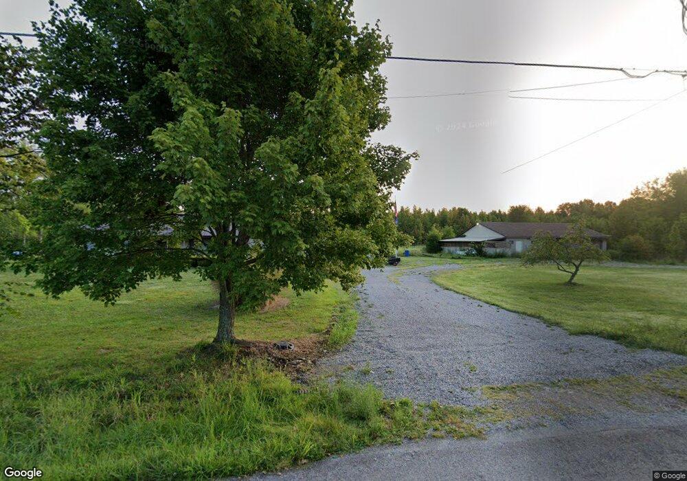
1699 Maple Grove Rd Mount Orab, OH 45154
Estimated Value: $315,000 - $430,000
3
Beds
2
Baths
2,092
Sq Ft
$179/Sq Ft
Est. Value
About This Home
This home is located at 1699 Maple Grove Rd, Mount Orab, OH 45154 and is currently estimated at $375,340, approximately $179 per square foot. 1699 Maple Grove Rd is a home located in Brown County with nearby schools including Western Brown High School.
Ownership History
Date
Name
Owned For
Owner Type
Purchase Details
Closed on
Dec 22, 2023
Sold by
Girton Clinton W and Girton Patience A
Bought by
Girton Clinton W and Girton Patience A
Current Estimated Value
Create a Home Valuation Report for This Property
The Home Valuation Report is an in-depth analysis detailing your home's value as well as a comparison with similar homes in the area
Home Values in the Area
Average Home Value in this Area
Purchase History
| Date | Buyer | Sale Price | Title Company |
|---|---|---|---|
| Girton Clinton W | -- | None Listed On Document | |
| Girton Clinton W | -- | None Listed On Document | |
| Privett Stephen | $57,000 | None Listed On Document | |
| Privett Stephen | $57,000 | None Listed On Document |
Source: Public Records
Tax History Compared to Growth
Tax History
| Year | Tax Paid | Tax Assessment Tax Assessment Total Assessment is a certain percentage of the fair market value that is determined by local assessors to be the total taxable value of land and additions on the property. | Land | Improvement |
|---|---|---|---|---|
| 2024 | $3,072 | $117,710 | $44,590 | $73,120 |
| 2023 | $3,072 | $93,630 | $34,060 | $59,570 |
| 2022 | $2,488 | $93,630 | $34,060 | $59,570 |
| 2021 | $2,459 | $93,630 | $34,060 | $59,570 |
| 2020 | $1,941 | $73,500 | $23,860 | $49,640 |
| 2019 | $2,087 | $73,500 | $23,860 | $49,640 |
| 2018 | $2,070 | $73,500 | $23,860 | $49,640 |
| 2017 | $1,797 | $64,370 | $21,600 | $42,770 |
| 2016 | $1,797 | $64,370 | $21,600 | $42,770 |
| 2015 | $1,745 | $64,370 | $21,600 | $42,770 |
| 2014 | $1,745 | $62,410 | $19,640 | $42,770 |
| 2013 | $1,741 | $62,410 | $19,640 | $42,770 |
Source: Public Records
Map
Nearby Homes
- 2017 Maple Grove Rd
- 1921 Amiott Ln
- 1993 Old State Rd
- 2079 Old State Rd
- 13045 Lower Cumberland Rd
- 3722 Coon Ave
- 2437 Tri County Hwy
- 3644 Deer Trace
- 101 Julian Ln
- 3657 Bootjack Corner Rd
- 133 Kelly Dr
- 117 Kelly Dr
- 3690 Todds Run Foster Rd
- 0 Deer Trace Rd
- Harmony Plan at Cornerstone Crossing
- Fairton Plan at Cornerstone Crossing
- Bellamy Plan at Cornerstone Crossing
- Aldridge Plan at Cornerstone Crossing
- 12570 Liming van Thompson Rd
- 130 Cornerstone Dr
- 13920 New Harmony Salem Rd
- 3.33ac Maple Grove Rd
- Lots 6-7 New Harmony-Salem Rd
- 14170 New Harmony-Salem Rd
- 7566 Maple Grove Rd
- 13892 New Harmony Salem Rd
- 13872 New Harmony Salem Rd
- 13893 New Harmony Salem Rd
- 13862 New Harmony Salem Rd
- 1714 Maple Grove Rd
- 1598 Maple Grove Rd
- 1604 Maple Grove Rd
- 13848 New Harmony Salem Rd
- 1731 Maple Grove Rd
- 1741 Maple Grove Rd
- 13984 New Harmony Salem Rd
- 13834 New Harmony Salem Rd
- 1620 Maple Grove Rd
- 13837 New Harmony Salem Rd
- 1740 Maple Grove Rd