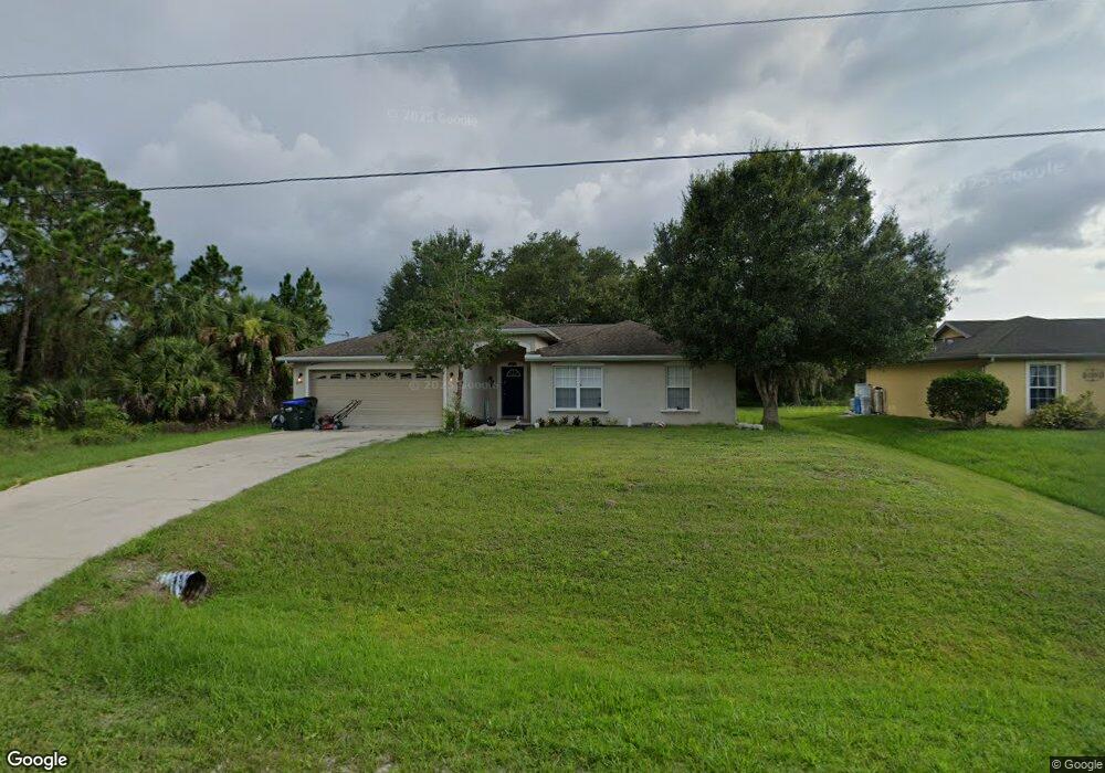
1699 Oakland Rd North Port, FL 34286
Estimated Value: $253,923 - $371,000
3
Beds
2
Baths
1,325
Sq Ft
$231/Sq Ft
Est. Value
About This Home
This home is located at 1699 Oakland Rd, North Port, FL 34286 and is currently estimated at $306,481, approximately $231 per square foot. 1699 Oakland Rd is a home located in Sarasota County with nearby schools including Toledo Blade Elementary School, North Port High School, and Woodland Middle School.
Ownership History
Date
Name
Owned For
Owner Type
Purchase Details
Closed on
Sep 8, 2025
Sold by
Mccarthy Thomas and Mccarthy Lisa
Bought by
Thomas And Lisa Mccarthy Living Trust and Mccarthy
Current Estimated Value
Purchase Details
Closed on
Apr 7, 2006
Sold by
Tarlowski Robert
Bought by
Mccarthy Thomas and Mccarthy Lisa
Home Financials for this Owner
Home Financials are based on the most recent Mortgage that was taken out on this home.
Original Mortgage
$172,000
Interest Rate
6.23%
Mortgage Type
New Conventional
Purchase Details
Closed on
Sep 27, 2002
Sold by
Maner Bernice R
Bought by
Tarlowski Robert
Create a Home Valuation Report for This Property
The Home Valuation Report is an in-depth analysis detailing your home's value as well as a comparison with similar homes in the area
Home Values in the Area
Average Home Value in this Area
Purchase History
| Date | Buyer | Sale Price | Title Company |
|---|---|---|---|
| Thomas And Lisa Mccarthy Living Trust | $100 | None Listed On Document | |
| Mccarthy Thomas | $215,000 | First American Title Ins Co | |
| Tarlowski Robert | $1,600 | -- |
Source: Public Records
Mortgage History
| Date | Status | Borrower | Loan Amount |
|---|---|---|---|
| Previous Owner | Mccarthy Thomas | $172,000 |
Source: Public Records
Tax History Compared to Growth
Tax History
| Year | Tax Paid | Tax Assessment Tax Assessment Total Assessment is a certain percentage of the fair market value that is determined by local assessors to be the total taxable value of land and additions on the property. | Land | Improvement |
|---|---|---|---|---|
| 2024 | $3,559 | $198,188 | -- | -- |
| 2023 | $3,559 | $219,000 | $15,300 | $203,700 |
| 2022 | $3,574 | $224,700 | $21,000 | $203,700 |
| 2021 | $3,018 | $150,100 | $10,200 | $139,900 |
| 2020 | $2,843 | $138,000 | $9,700 | $128,300 |
| 2019 | $2,749 | $137,900 | $9,200 | $128,700 |
| 2018 | $2,470 | $130,400 | $8,700 | $121,700 |
| 2017 | $2,362 | $105,939 | $0 | $0 |
| 2016 | $2,209 | $111,500 | $4,800 | $106,700 |
| 2015 | $2,038 | $93,400 | $4,300 | $89,100 |
| 2014 | $1,889 | $72,358 | $0 | $0 |
Source: Public Records
Map
Nearby Homes
- 0 Oceanside St Unit MFRC7513409
- 0 Oceanside St Unit MFRA4623444
- 1721 Nicollett Ave
- 0 Alliance Ave Unit C7435995
- 1608 Alliance Ave
- 0 Ponds St Unit MFRO6332113
- 0 Minneapolis Ave Unit MFRA4587634
- 0 Boca Chica Ave
- 2533 Cincinnati St
- 2983 Point St
- 2738 N Chamberlain Blvd
- 3018 Oceanside St
- 0 Lansdale Ave
- 00 Lansdale Ave
- 2343 Cincinnati St
- 2004 Boca Chica Ave
- 3113 Point St
- 3152 Point St
- 3139 Point St
- 0962090632 Lindsay Ave
- 1715 Oakland Rd
- 1600 Boca Chica Ave
- 1731 Oakland Rd
- 1644 Boca Chica Ave
- 1556 Boca Chica Ave
- 1676 Oakland Rd
- 1666 Boca Chica Ave
- 0 Oakland Rd
- 0 Oakland Lot 18 Rd Unit MFRD6133736
- 1685 Nicollett Ave
- 1688 Boca Chica Ave
- 1512 Boca Chica Ave
- 1619 Oakland Rd
- 1762 Oakland Rd
- 2711 Oceanside St
- 0 Oceanside St Unit C7240008
- 0 Oceanside St Unit MFRD6142196
- 0 Oceanside St Unit MFRA4623926
- 0 Oceanside St Unit MFRC7496547