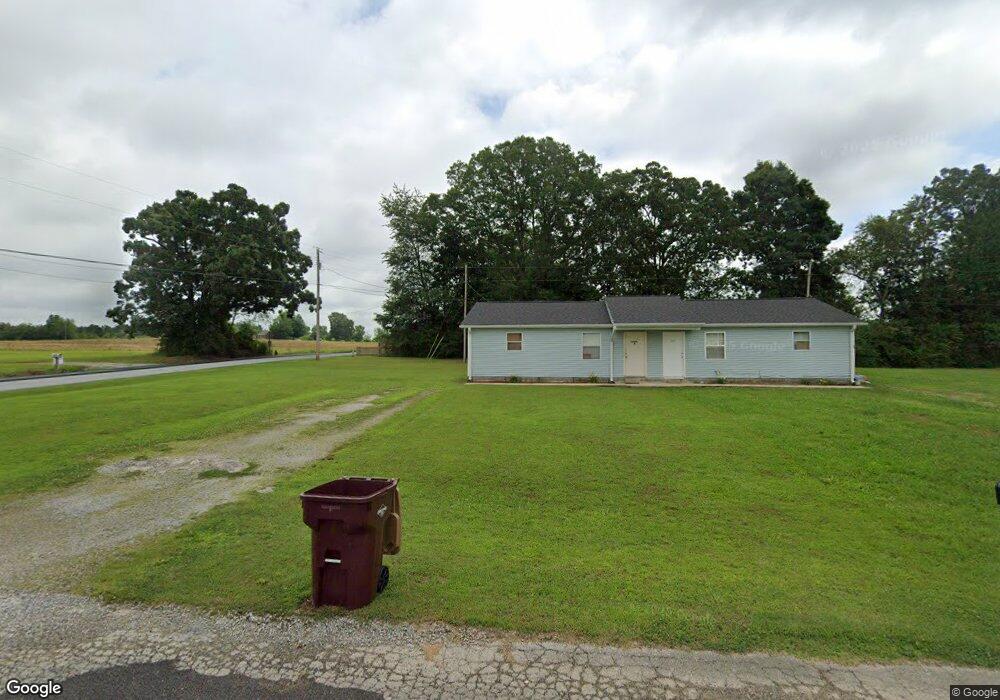
16992Q Carter Cir Athens, AL 35611
Coxey-Lawngate NeighborhoodEstimated Value: $235,000 - $783,667
--
Bed
1
Bath
1,680
Sq Ft
$227/Sq Ft
Est. Value
About This Home
This home is located at 16992Q Carter Cir, Athens, AL 35611 and is currently estimated at $380,917, approximately $226 per square foot. 16992Q Carter Cir is a home with nearby schools including Blue Springs Elementary School and Clements High School.
Ownership History
Date
Name
Owned For
Owner Type
Purchase Details
Closed on
Feb 28, 2018
Sold by
Lackey Betty B
Bought by
Dbp Llc
Current Estimated Value
Purchase Details
Closed on
Oct 25, 2017
Bought by
Briley Steven L
Home Financials for this Owner
Home Financials are based on the most recent Mortgage that was taken out on this home.
Original Mortgage
$113,400
Interest Rate
3.88%
Create a Home Valuation Report for This Property
The Home Valuation Report is an in-depth analysis detailing your home's value as well as a comparison with similar homes in the area
Home Values in the Area
Average Home Value in this Area
Purchase History
| Date | Buyer | Sale Price | Title Company |
|---|---|---|---|
| Dbp Llc | $477,400 | None Available | |
| Briley Steven L | -- | -- |
Source: Public Records
Mortgage History
| Date | Status | Borrower | Loan Amount |
|---|---|---|---|
| Previous Owner | Briley Steven L | $113,400 | |
| Previous Owner | Briley Steven L | -- |
Source: Public Records
Tax History Compared to Growth
Tax History
| Year | Tax Paid | Tax Assessment Tax Assessment Total Assessment is a certain percentage of the fair market value that is determined by local assessors to be the total taxable value of land and additions on the property. | Land | Improvement |
|---|---|---|---|---|
| 2024 | $1,073 | $35,780 | $0 | $0 |
| 2023 | $1,103 | $33,200 | $0 | $0 |
| 2022 | $858 | $27,600 | $0 | $0 |
| 2021 | $652 | $20,720 | $0 | $0 |
| 2020 | $614 | $19,480 | $0 | $0 |
| 2019 | $590 | $18,680 | $0 | $0 |
| 2018 | $2,673 | $82,100 | $0 | $0 |
| 2017 | $3,106 | $103,520 | $0 | $0 |
| 2016 | $3,106 | $517,600 | $0 | $0 |
| 2015 | $3,316 | $103,520 | $0 | $0 |
| 2014 | $3,236 | $0 | $0 | $0 |
Source: Public Records
Map
Nearby Homes
- 14450 Quinn Rd
- 14471 Quinn Rd
- 16633 Zehner Rd
- 007 Quinn Rd
- HALLE II Plan at Lucas Ferry Farms
- Newlin Plan at Lucas Ferry Farms
- BRIO II Plan at Lucas Ferry Farms
- CHARLE II Plan at Lucas Ferry Farms
- TREVI II Plan at Lucas Ferry Farms
- Beckman Plan at Lucas Ferry Farms
- Littleton Plan at Lucas Ferry Farms
- 17896 Emma Jo Ln
- 14931 U S 72
- 12069 New Cut Rd
- 11991 New Cut Rd
- 12051 New Cut Rd
- 12035 New Cut Rd
- 12017 New Cut Rd
- 12003 New Cut Rd
- 15153 New Cut Rd
- 16968 P & O Carter Cir
- 14514 Quinn Rd
- 16942M Carter Cir
- 16957 Carter Cir
- 16933 Carter Cir
- Carter Cir Unit 1022520
- Carter Cir Unit 1022511
- Carter Cir Unit 1036137
- Carter Cir
- 16928 Carter Cir Unit 1-14
- 16922K Carter Cir
- 16609 Carter Cir
- 16635 Carter Cir
- 16907 Carter Cir
- 16902I Carter Cir
- 16657 Carter Cir
- 14380 Quinn Rd
- 16885 Carter Cir
- 14584 Quinn Rd
- 16610 Carter Cir