Estimated Value: $1,071,497 - $1,629,000
4
Beds
2
Baths
3,089
Sq Ft
$415/Sq Ft
Est. Value
About This Home
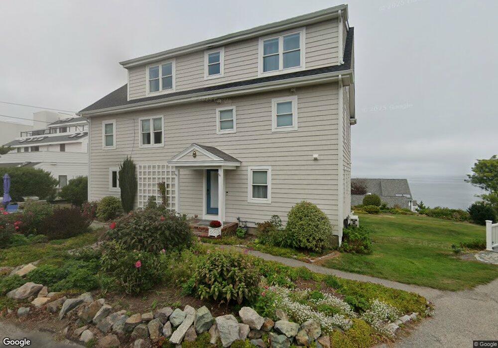
This home is located at 16A State Park Rd, Hull, MA 02045 and is currently estimated at $1,281,624, approximately $414 per square foot. 16A State Park Rd is a home with nearby schools including Lillian M. Jacobs Elementary School, Memorial Middle School, and Hull High School.
Ownership History
Date
Name
Owned For
Owner Type
Purchase Details
Closed on
Oct 31, 2011
Sold by
Nugent Peter F and Jackson Kathleen
Bought by
Mcgrath John P and Mcgrath Michelle A
Current Estimated Value
Home Financials for this Owner
Home Financials are based on the most recent Mortgage that was taken out on this home.
Original Mortgage
$300,000
Outstanding Balance
$205,458
Interest Rate
4.11%
Mortgage Type
Purchase Money Mortgage
Estimated Equity
$1,076,166
Create a Home Valuation Report for This Property
The Home Valuation Report is an in-depth analysis detailing your home's value as well as a comparison with similar homes in the area
Purchase History
| Date | Buyer | Sale Price | Title Company |
|---|---|---|---|
| Mcgrath John P | $390,000 | -- |
Source: Public Records
Mortgage History
| Date | Status | Borrower | Loan Amount |
|---|---|---|---|
| Open | Mcgrath John P | $300,000 |
Source: Public Records
Tax History
| Year | Tax Paid | Tax Assessment Tax Assessment Total Assessment is a certain percentage of the fair market value that is determined by local assessors to be the total taxable value of land and additions on the property. | Land | Improvement |
|---|---|---|---|---|
| 2025 | $11,174 | $997,700 | $381,300 | $616,400 |
| 2024 | $10,978 | $942,300 | $358,100 | $584,200 |
| 2023 | $10,920 | $897,300 | $344,100 | $553,200 |
| 2022 | $10,926 | $871,300 | $344,100 | $527,200 |
| 2021 | $9,879 | $779,100 | $316,200 | $462,900 |
| 2020 | $7,383 | $575,900 | $316,200 | $259,700 |
| 2019 | $6,927 | $530,800 | $279,000 | $251,800 |
| 2018 | $6,635 | $499,300 | $279,000 | $220,300 |
| 2017 | $6,635 | $483,600 | $279,000 | $204,600 |
| 2016 | $6,519 | $483,600 | $279,000 | $204,600 |
| 2015 | $6,647 | $476,800 | $279,000 | $197,800 |
| 2014 | $6,058 | $436,800 | $241,800 | $195,000 |
Source: Public Records
Map
Nearby Homes
- 62 Oceanside Dr
- 6 State Park Rd Unit 2
- 1 Longbeach Ave Unit 202
- 48 Valley Beach Ave Unit 2
- 121 Nantasket Ave Unit 503
- 18 Valley Beach Ave
- 4 Atherton Rd
- 22 Berkley Rd Unit B
- 23 Wyola Rd
- 155 George Washington Blvd Unit 402
- 45 Ocean Ledge Dr
- 8 Hampton Cir
- 166 Hull St
- 134 Hampton Cir
- 127 Hampton Cir
- 3 3rd St
- 597 Jerusalem Rd
- 107 Hull St
- 114 Hull St
- LOT 1B Rockland St
- 16 State Park Rd
- 14 0ceanside Dr Watrfrnt Unit 14
- 42 Oceanside Dr
- 60 Oceanside Dr
- 52 Oceanside Dr
- 41 Oceanside Dr
- 39 Oceanside Dr
- 38 Oceanside Dr
- 33 Oceanside Dr
- 32 Oceanside Dr
- 28 Oceanside Dr
- 25 Oceanside Dr
- 41 Oceanside Dr Unit 41
- 38 Oceanside Dr Unit 38
- 63 Oceanside Dr
- 61 Oceanside Dr
- 59 Oceanside Dr
- 58 Oceanside Dr
- 57 Oceanside Dr
- 56 Oceanside Dr