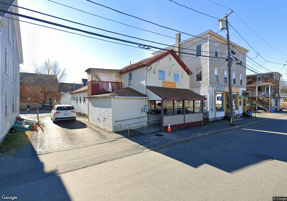
17 1/2 Mill St Brunswick, ME 04011
Estimated Value: $326,000 - $668,000
3
Beds
3
Baths
2,490
Sq Ft
$211/Sq Ft
Est. Value
About This Home
This home is located at 17 1/2 Mill St, Brunswick, ME 04011 and is currently estimated at $524,333, approximately $210 per square foot. 17 1/2 Mill St is a home located in Cumberland County with nearby schools including Priest Elementary-Middle School, Kate Furbish Elementary School, and Brunswick Jr High School.
Ownership History
Date
Name
Owned For
Owner Type
Purchase Details
Closed on
Mar 20, 2017
Sold by
Mcmorrow J Brendan
Bought by
Taggart Realty Llc
Current Estimated Value
Purchase Details
Closed on
Dec 3, 2015
Sold by
Us Dept Of Agriculture
Bought by
Mcmorrow J Brendan
Purchase Details
Closed on
Aug 13, 2015
Sold by
Everbank
Bought by
Department Of Housing & Urban Dev
Purchase Details
Closed on
Mar 11, 2015
Sold by
Department Of Housing & Urban Dev
Bought by
Everbank
Purchase Details
Closed on
Sep 22, 2014
Sold by
Atwood Deborah R and Everbank Na
Bought by
Department Of Housing & Urban Dev
Purchase Details
Closed on
Jan 19, 2006
Sold by
Willette Judith R and Willette Kent E
Bought by
Atwood Deborah R
Home Financials for this Owner
Home Financials are based on the most recent Mortgage that was taken out on this home.
Original Mortgage
$136,422
Interest Rate
6.33%
Mortgage Type
FHA
Create a Home Valuation Report for This Property
The Home Valuation Report is an in-depth analysis detailing your home's value as well as a comparison with similar homes in the area
Home Values in the Area
Average Home Value in this Area
Purchase History
| Date | Buyer | Sale Price | Title Company |
|---|---|---|---|
| Taggart Realty Llc | -- | -- | |
| Mcmorrow J Brendan | -- | -- | |
| Department Of Housing & Urban Dev | -- | -- | |
| Everbank | -- | -- | |
| Department Of Housing & Urban Dev | -- | -- | |
| Atwood Deborah R | -- | -- |
Source: Public Records
Mortgage History
| Date | Status | Borrower | Loan Amount |
|---|---|---|---|
| Previous Owner | Atwood Deborah R | $136,422 |
Source: Public Records
Tax History Compared to Growth
Tax History
| Year | Tax Paid | Tax Assessment Tax Assessment Total Assessment is a certain percentage of the fair market value that is determined by local assessors to be the total taxable value of land and additions on the property. | Land | Improvement |
|---|---|---|---|---|
| 2024 | $2,640 | $110,700 | $24,500 | $86,200 |
| 2023 | $2,578 | $110,700 | $24,500 | $86,200 |
| 2022 | $2,401 | $110,700 | $24,500 | $86,200 |
| 2021 | $2,309 | $110,700 | $24,500 | $86,200 |
| 2020 | $2,255 | $110,700 | $24,500 | $86,200 |
| 2019 | $2,183 | $110,700 | $24,500 | $86,200 |
| 2018 | $2,094 | $110,700 | $24,500 | $86,200 |
| 2017 | $2,034 | $110,700 | $24,500 | $86,200 |
| 2016 | $2,392 | $81,500 | $13,200 | $68,300 |
| 2015 | $2,311 | $81,500 | $13,200 | $68,300 |
| 2014 | $2,233 | $81,500 | $13,200 | $68,300 |
| 2013 | -- | $81,500 | $13,200 | $68,300 |
Source: Public Records
Map
Nearby Homes
- 11 Lincoln St
- 19 Mason St
- 29 Winter St
- 27 Front St
- 5 Summer St
- 8 Mckeen St
- 21 Barrows Dr
- 4 Wilson St
- 57 Winter St
- 15 Minat Ave
- 44 Forest Glen Ln
- 28 Forest Glen Ln
- 118 Main St
- 12 Mallett Dr
- 43 Forest Glen Ln
- 35 Bath Rd
- 35 & 35.5 Bath Rd
- 35.5 Bath Rd
- Lot 196 Mckeen St Unit 16
- Lot 196 Mckeen St Unit 17