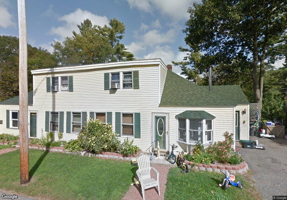
17-19 Macdougal St Kittery, ME 03904
Estimated Value: $509,000 - $1,008,000
6
Beds
2
Baths
2,177
Sq Ft
$329/Sq Ft
Est. Value
About This Home
This home is located at 17-19 Macdougal St, Kittery, ME 03904 and is currently estimated at $717,238, approximately $329 per square foot. 17-19 Macdougal St is a home located in York County with nearby schools including Shapleigh School, Horace Mitchell Primary School, and Robert W Traip Academy.
Ownership History
Date
Name
Owned For
Owner Type
Purchase Details
Closed on
Sep 26, 2016
Sold by
17-19 Macdougal Llc
Bought by
Rammer Heidi J
Current Estimated Value
Purchase Details
Closed on
May 27, 2016
Sold by
Rammer Heidi J
Bought by
17-19 Macdougal Llc
Purchase Details
Closed on
Aug 24, 2015
Sold by
Wells Fargo Bank Na Tr
Bought by
Rammer Heidi J
Purchase Details
Closed on
Feb 27, 2015
Sold by
Wells Fargo Bank Na
Bought by
Federal National Mortgage Association
Purchase Details
Closed on
May 16, 2014
Sold by
Byrne Eugene J
Bought by
Wells Fargo Bank Na
Purchase Details
Closed on
Jul 11, 2005
Sold by
Debutts Sherry G
Bought by
Chappell Kortnee O and Byrne Eugene J
Home Financials for this Owner
Home Financials are based on the most recent Mortgage that was taken out on this home.
Original Mortgage
$229,500
Interest Rate
0.08%
Mortgage Type
Adjustable Rate Mortgage/ARM
Create a Home Valuation Report for This Property
The Home Valuation Report is an in-depth analysis detailing your home's value as well as a comparison with similar homes in the area
Home Values in the Area
Average Home Value in this Area
Purchase History
| Date | Buyer | Sale Price | Title Company |
|---|---|---|---|
| Rammer Heidi J | -- | -- | |
| 17-19 Macdougal Llc | -- | -- | |
| Rammer Heidi J | -- | -- | |
| Federal National Mortgage Association | -- | -- | |
| Wells Fargo Bank Na | -- | -- | |
| Chappell Kortnee O | -- | -- |
Source: Public Records
Mortgage History
| Date | Status | Borrower | Loan Amount |
|---|---|---|---|
| Previous Owner | Chappell Kortnee O | $229,500 |
Source: Public Records
Tax History
| Year | Tax Paid | Tax Assessment Tax Assessment Total Assessment is a certain percentage of the fair market value that is determined by local assessors to be the total taxable value of land and additions on the property. | Land | Improvement |
|---|---|---|---|---|
| 2024 | $4,761 | $335,300 | $113,700 | $221,600 |
| 2023 | $4,563 | $335,300 | $113,700 | $221,600 |
| 2022 | $4,520 | $335,300 | $113,700 | $221,600 |
| 2021 | $4,359 | $335,300 | $113,700 | $221,600 |
| 2020 | $4,325 | $335,300 | $113,700 | $221,600 |
| 2019 | $3,976 | $228,500 | $65,900 | $162,600 |
| 2018 | $3,839 | $228,500 | $65,900 | $162,600 |
| 2017 | $3,465 | $210,000 | $65,900 | $144,100 |
| 2016 | $3,399 | $211,800 | $65,900 | $145,900 |
| 2015 | $3,291 | $210,000 | $65,900 | $144,100 |
| 2014 | $3,259 | $210,000 | $65,900 | $144,100 |
| 2013 | $3,196 | $210,000 | $65,900 | $144,100 |
Source: Public Records
Map
Nearby Homes
- 13 Cross St
- 12 Gillis Dr Unit 3
- 4 Trefethen Ave
- 8 Spruce Point Rd
- 100 Shepard's Cove Rd Unit F204
- 100 Shepard's Cove Rd Unit G107
- 100 Shepards Cove Rd Unit F204
- 29 Main St
- 30-3 Regency Cir Unit 3
- 19 Aspen Cir
- 5 Spinney Way Unit 9
- 30 Drake Ln
- 35 Badgers Island W Unit 203
- 35 Badgers Island W Unit 301
- 35 Badgers Island W Unit 302
- 35 Badgers Island W Unit 103
- 27 Oak Terrace
- 25 Oak Terrace
- 36 State St
- 10 Bayview Ln
- 17 Macdougal St
- 21 Macdougal St
- 13-15 Macdougal St
- 14 Macdougal St Unit 14
- 12 Macdougal St Unit 12
- 12-14 Macdougal St
- 16-18 Macdougal St
- 25 Macdougal St
- 11 Macdougal St
- 20 Macdougal St
- 173 Manson Ave
- 169-171 Manson Ave
- 46 Macdougal St
- 169 Manson Ave
- 6 Moore St
- 4 Moore St
- 165 Manson Ave Unit 167
- 165 Manson Ave
- 5 Macdougal St
- 165 - 167 Manson Ave
Your Personal Tour Guide
Ask me questions while you tour the home.