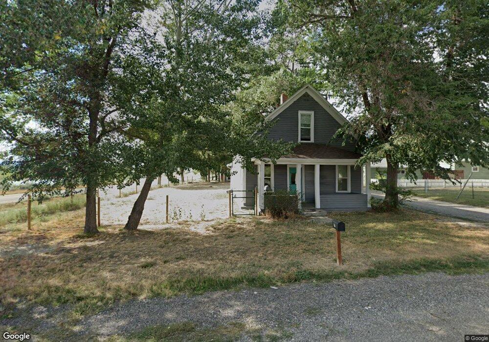
17 A St Columbus, MT 59019
Estimated Value: $215,000 - $294,000
3
Beds
1
Bath
1,113
Sq Ft
$224/Sq Ft
Est. Value
About This Home
This home is located at 17 A St, Columbus, MT 59019 and is currently estimated at $248,834, approximately $223 per square foot. 17 A St is a home with nearby schools including Columbus Elementary School and Columbus Middle School.
Ownership History
Date
Name
Owned For
Owner Type
Purchase Details
Closed on
Jun 8, 2018
Bought by
Sweet Michael and Sweet Trisha
Current Estimated Value
Purchase Details
Closed on
Jul 12, 2005
Sold by
Maki Charles William and Maki Leona M
Bought by
Maki Charles O
Create a Home Valuation Report for This Property
The Home Valuation Report is an in-depth analysis detailing your home's value as well as a comparison with similar homes in the area
Purchase History
| Date | Buyer | Sale Price | Title Company |
|---|---|---|---|
| Sweet Michael | -- | -- | |
| Maki Charles O | -- | -- |
Source: Public Records
Tax History
| Year | Tax Paid | Tax Assessment Tax Assessment Total Assessment is a certain percentage of the fair market value that is determined by local assessors to be the total taxable value of land and additions on the property. | Land | Improvement |
|---|---|---|---|---|
| 2025 | $1,115 | $213,600 | $0 | $0 |
| 2024 | $1,479 | $186,500 | $0 | $0 |
| 2023 | $1,435 | $186,500 | $0 | $0 |
| 2022 | $1,133 | $137,800 | $0 | $0 |
| 2021 | $1,138 | $137,800 | $0 | $0 |
| 2020 | $949 | $111,400 | $0 | $0 |
| 2019 | $1,002 | $111,400 | $0 | $0 |
| 2018 | $686 | $81,457 | $0 | $0 |
| 2017 | $715 | $81,457 | $0 | $0 |
| 2016 | $760 | $89,352 | $0 | $0 |
| 2015 | $730 | $89,352 | $0 | $0 |
| 2014 | $653 | $43,882 | $0 | $0 |
Source: Public Records
Map
Nearby Homes
- 115 2nd St
- 157 Melody Ln
- 326 E 2nd Ave N
- 345 N 3rd St
- TBD Centennial Rd
- 526 E 2nd Ave N
- 140 Annin Ave
- 15 Sanctuary Ln
- 723 E 3rd Ave S
- 692 Quarry Rd
- 158 N Fork Eagle Mountain Rd
- 94 Upper Flat Rd
- 96 Wagon Trail Rd
- 147 Stillwater Loop
- 27 Kestrel Trail
- 6 Shane Ridge Rd
- 79 Myers Rd
- 79 Meyers Rd
- 42 Bozeman Trail
- 26 Yates Rd
Your Personal Tour Guide
Ask me questions while you tour the home.