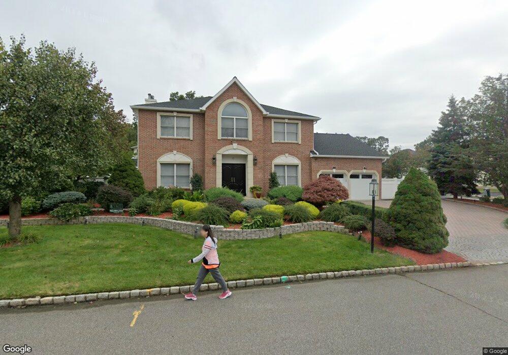
17 Allerton Rd Parsippany, NJ 07054
Estimated Value: $938,000 - $1,084,000
--
Bed
--
Bath
2,804
Sq Ft
$364/Sq Ft
Est. Value
About This Home
This home is located at 17 Allerton Rd, Parsippany, NJ 07054 and is currently estimated at $1,019,415, approximately $363 per square foot. 17 Allerton Rd is a home located in Morris County with nearby schools including Northvail Elementary School, Central Middle School, and Parsippany High School.
Ownership History
Date
Name
Owned For
Owner Type
Purchase Details
Closed on
Apr 14, 2005
Sold by
Mullagiri Parijatha
Bought by
Viraj Verma and Verma Anjali
Current Estimated Value
Home Financials for this Owner
Home Financials are based on the most recent Mortgage that was taken out on this home.
Original Mortgage
$628,000
Outstanding Balance
$327,644
Interest Rate
5.95%
Mortgage Type
New Conventional
Estimated Equity
$691,771
Purchase Details
Closed on
Oct 25, 2001
Sold by
Deve Forge Pond
Bought by
Mullagiri Parijatha and Boga Murali
Home Financials for this Owner
Home Financials are based on the most recent Mortgage that was taken out on this home.
Original Mortgage
$347,900
Interest Rate
6.82%
Create a Home Valuation Report for This Property
The Home Valuation Report is an in-depth analysis detailing your home's value as well as a comparison with similar homes in the area
Home Values in the Area
Average Home Value in this Area
Purchase History
| Date | Buyer | Sale Price | Title Company |
|---|---|---|---|
| Viraj Verma | $785,000 | -- | |
| Mullagiri Parijatha | $435,000 | -- |
Source: Public Records
Mortgage History
| Date | Status | Borrower | Loan Amount |
|---|---|---|---|
| Open | Viraj Verma | $628,000 | |
| Previous Owner | Mullagiri Parijatha | $347,900 |
Source: Public Records
Tax History Compared to Growth
Tax History
| Year | Tax Paid | Tax Assessment Tax Assessment Total Assessment is a certain percentage of the fair market value that is determined by local assessors to be the total taxable value of land and additions on the property. | Land | Improvement |
|---|---|---|---|---|
| 2025 | $16,255 | $476,700 | $163,800 | $312,900 |
| 2024 | $15,955 | $476,700 | $163,800 | $312,900 |
| 2023 | $15,955 | $476,700 | $163,800 | $312,900 |
| 2022 | $14,916 | $476,700 | $163,800 | $312,900 |
| 2021 | $14,916 | $476,700 | $163,800 | $312,900 |
| 2020 | $14,597 | $476,700 | $163,800 | $312,900 |
| 2019 | $14,201 | $476,700 | $163,800 | $312,900 |
| 2018 | $13,886 | $476,700 | $163,800 | $312,900 |
| 2017 | $13,567 | $476,700 | $163,800 | $312,900 |
| 2016 | $13,324 | $476,700 | $163,800 | $312,900 |
| 2015 | $12,985 | $476,700 | $163,800 | $312,900 |
| 2014 | $12,809 | $476,700 | $163,800 | $312,900 |
Source: Public Records
Map
Nearby Homes