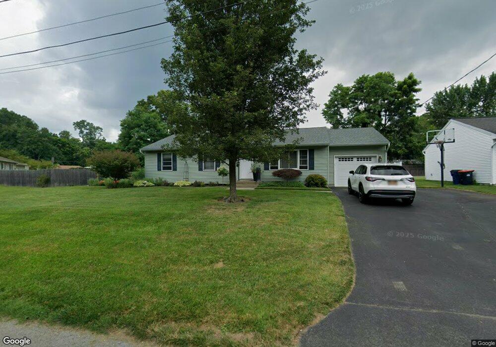
17 Amherst St Red Hook, NY 12571
Estimated Value: $335,000 - $405,000
3
Beds
2
Baths
1,268
Sq Ft
$289/Sq Ft
Est. Value
About This Home
This home is located at 17 Amherst St, Red Hook, NY 12571 and is currently estimated at $366,543, approximately $289 per square foot. 17 Amherst St is a home located in Dutchess County with nearby schools including Mill Road Primary School, Mill Road Intermediate School, and Linden Avenue Middle School.
Ownership History
Date
Name
Owned For
Owner Type
Purchase Details
Closed on
Sep 13, 2023
Sold by
Dietter Teresa
Bought by
Dietter Ft and Silvernail
Current Estimated Value
Purchase Details
Closed on
Nov 2, 2007
Sold by
Dietter-Silvernail Teresa
Bought by
Dietter Teresa
Home Financials for this Owner
Home Financials are based on the most recent Mortgage that was taken out on this home.
Original Mortgage
$22,053
Interest Rate
6.42%
Mortgage Type
Purchase Money Mortgage
Purchase Details
Closed on
Jun 30, 2004
Sold by
Silvernail Brian
Bought by
Silvernail Teresa-Dietter
Create a Home Valuation Report for This Property
The Home Valuation Report is an in-depth analysis detailing your home's value as well as a comparison with similar homes in the area
Home Values in the Area
Average Home Value in this Area
Purchase History
| Date | Buyer | Sale Price | Title Company |
|---|---|---|---|
| Dietter Ft | -- | None Available | |
| Dietter Teresa | -- | -- | |
| Silvernail Teresa-Dietter | -- | -- |
Source: Public Records
Mortgage History
| Date | Status | Borrower | Loan Amount |
|---|---|---|---|
| Previous Owner | Dietter Teresa | $22,053 |
Source: Public Records
Tax History Compared to Growth
Tax History
| Year | Tax Paid | Tax Assessment Tax Assessment Total Assessment is a certain percentage of the fair market value that is determined by local assessors to be the total taxable value of land and additions on the property. | Land | Improvement |
|---|---|---|---|---|
| 2024 | $3,990 | $275,000 | $67,100 | $207,900 |
| 2023 | $5,599 | $259,400 | $63,300 | $196,100 |
| 2022 | $5,469 | $229,600 | $57,000 | $172,600 |
| 2021 | $5,392 | $196,200 | $57,000 | $139,200 |
| 2020 | $4,693 | $188,700 | $57,000 | $131,700 |
| 2019 | $4,767 | $194,700 | $57,000 | $137,700 |
| 2018 | $4,723 | $194,700 | $57,000 | $137,700 |
| 2017 | $4,669 | $194,700 | $57,000 | $137,700 |
| 2016 | $4,627 | $194,700 | $57,000 | $137,700 |
| 2015 | -- | $194,700 | $57,000 | $137,700 |
| 2014 | -- | $194,700 | $57,000 | $137,700 |
Source: Public Records
Map
Nearby Homes
- 28 Albie Rd
- 6 Dogwood St
- 13 Chestnut St
- 10 Aspinwall Rd
- 84 Rockefeller Ln
- 7679 Albany Post Rd
- 7641 N Broadway
- 0 Feller Newmark Rd
- 7 Smith St
- 7441 S Broadway
- 7432 S Broadway
- 234 W Market St
- 33 Thompson St
- 18 Cambridge Dr
- 11 Cambridge Dr
- 30 Old Post Rd N
- 15 Amherst Rd
- 8 Willow Dr
- 252 Route 199
- 10 Glen View Dr
- 21 Amherst St
- 15 Amherst St
- 19 Amherst St
- 18 Princeton St
- 20 Princeton St
- 16 Princeton St
- 20 Amherst St
- 13 Amherst St
- 18 Amherst St
- 16 Amherst St
- 15 Columbia Ave
- 0 Rockefeller W Unit 371380
- 0 Rockefeller W Unit 52928
- 0 Rockefeller W Unit KEYH6325204
- 0 Rockefeller W Unit ONEH6325204
- 0 Rockefeller W Unit 20160782
- 0 Rockefeller W Unit 20150657
- 0 Rockefeller W Unit 101468
- 0 Rockefeller W Unit 107744
- 0 Rockefeller W Unit 385622