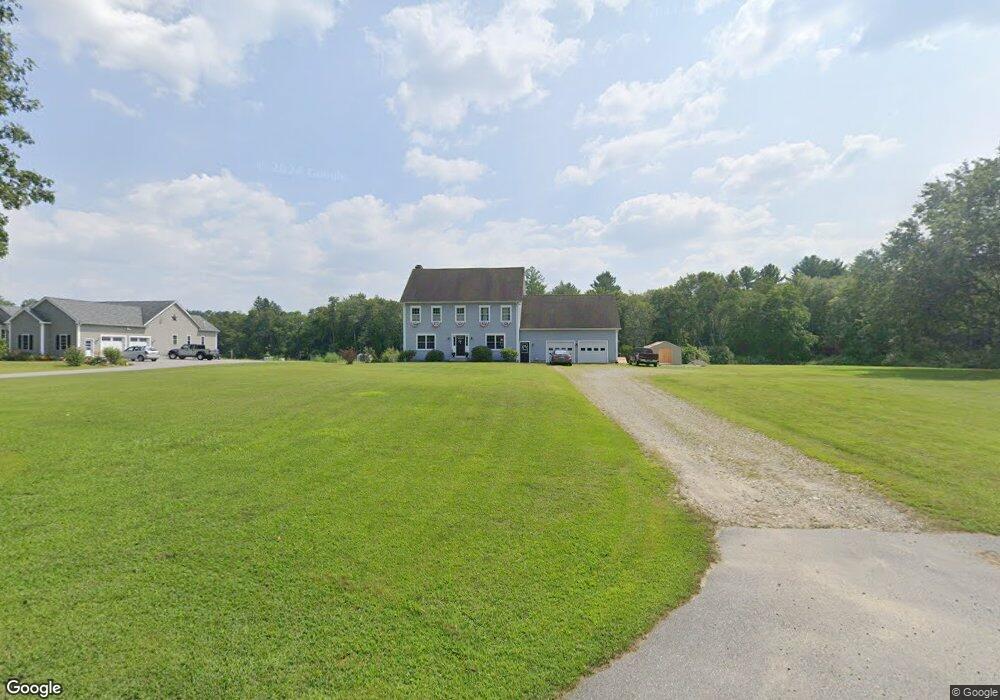
17 Anderson Rd Brooklyn, CT 06234
Brooklyn NeighborhoodEstimated Value: $437,000 - $599,000
3
Beds
3
Baths
2,728
Sq Ft
$194/Sq Ft
Est. Value
About This Home
This home is located at 17 Anderson Rd, Brooklyn, CT 06234 and is currently estimated at $530,078, approximately $194 per square foot. 17 Anderson Rd is a home located in Windham County with nearby schools including Brooklyn Elementary School, Brooklyn Middle School, and Learning Clinic.
Ownership History
Date
Name
Owned For
Owner Type
Purchase Details
Closed on
Oct 7, 2009
Sold by
Sorel Jason P and Sorel Amanda S
Bought by
Sorel Henry L and Sorel Brenda L
Current Estimated Value
Purchase Details
Closed on
Dec 12, 2006
Sold by
Sorel Henry G and Sorel Brenda L
Bought by
Sorel Jason P and Sorel Amanda S
Create a Home Valuation Report for This Property
The Home Valuation Report is an in-depth analysis detailing your home's value as well as a comparison with similar homes in the area
Home Values in the Area
Average Home Value in this Area
Purchase History
| Date | Buyer | Sale Price | Title Company |
|---|---|---|---|
| Sorel Henry L | -- | -- | |
| Sorel Henry L | -- | -- | |
| Sorel Jason P | $231,500 | -- | |
| Sorel Jason P | $231,500 | -- |
Source: Public Records
Mortgage History
| Date | Status | Borrower | Loan Amount |
|---|---|---|---|
| Open | Sorel Jason P | $46,300 | |
| Open | Sorel Jason P | $191,200 | |
| Previous Owner | Sorel Jason P | $134,200 |
Source: Public Records
Tax History
| Year | Tax Paid | Tax Assessment Tax Assessment Total Assessment is a certain percentage of the fair market value that is determined by local assessors to be the total taxable value of land and additions on the property. | Land | Improvement |
|---|---|---|---|---|
| 2025 | $9,258 | $397,680 | $47,110 | $350,570 |
| 2024 | $7,742 | $262,100 | $35,000 | $227,100 |
| 2023 | $7,496 | $262,100 | $35,000 | $227,100 |
| 2022 | $7,203 | $262,100 | $35,000 | $227,100 |
| 2021 | $6,925 | $262,100 | $35,000 | $227,100 |
| 2020 | $6,458 | $223,300 | $41,600 | $181,700 |
| 2019 | $6,458 | $223,300 | $41,600 | $181,700 |
| 2018 | $6,272 | $223,300 | $41,600 | $181,700 |
| 2017 | $6,049 | $223,300 | $41,600 | $181,700 |
| 2016 | $5,882 | $223,300 | $41,600 | $181,700 |
| 2015 | $5,455 | $232,800 | $46,900 | $185,900 |
| 2014 | $5,455 | $232,800 | $46,900 | $185,900 |
Source: Public Records
Map
Nearby Homes
- 68 Anderson Rd
- 159 Old Tatnic Hill Rd
- 165 Old Tatnic Hill Rd Unit Lot 8-5
- 167 Old Tatnic Hill Rd Unit Lot 8-6
- 414 Canterbury Rd
- 31 Mason Hill Rd
- 43 Tatnic Hill Rd
- 279 Gorman Rd
- 4 Short St
- 94 Hartford Rd
- 106 Tripp Hollow Rd
- 38 Canterbury Rd
- 13 Cricket Ln
- 00 Wolf Den Rd
- 232 Paradise Dr
- Lot 89 Paradise Dr
- 105 Paradise Dr
- 26 Bass Ln
- 67 Paradise Dr
- 4 Paradise Dr
- 300 Canterbury Rd
- 21 Anderson Rd
- 25 Anderson Rd
- 280 Canterbury Rd
- 291 Canterbury Rd
- 29 Anderson Rd
- 30 Anderson Rd
- 35 Anderson Rd
- 324 Canterbury Rd
- 279 Canterbury Rd
- 270 Canterbury Rd
- 49 Anderson Rd
- 330 Canterbury Rd
- 260 Canterbury Rd
- 59 Anderson Rd Unit 5
- 59 Anderson Rd Unit 1
- 59 Anderson Rd
- 239 Mason Rd
- 65 Anderson Rd
- 50 Anderson Rd
Your Personal Tour Guide
Ask me questions while you tour the home.