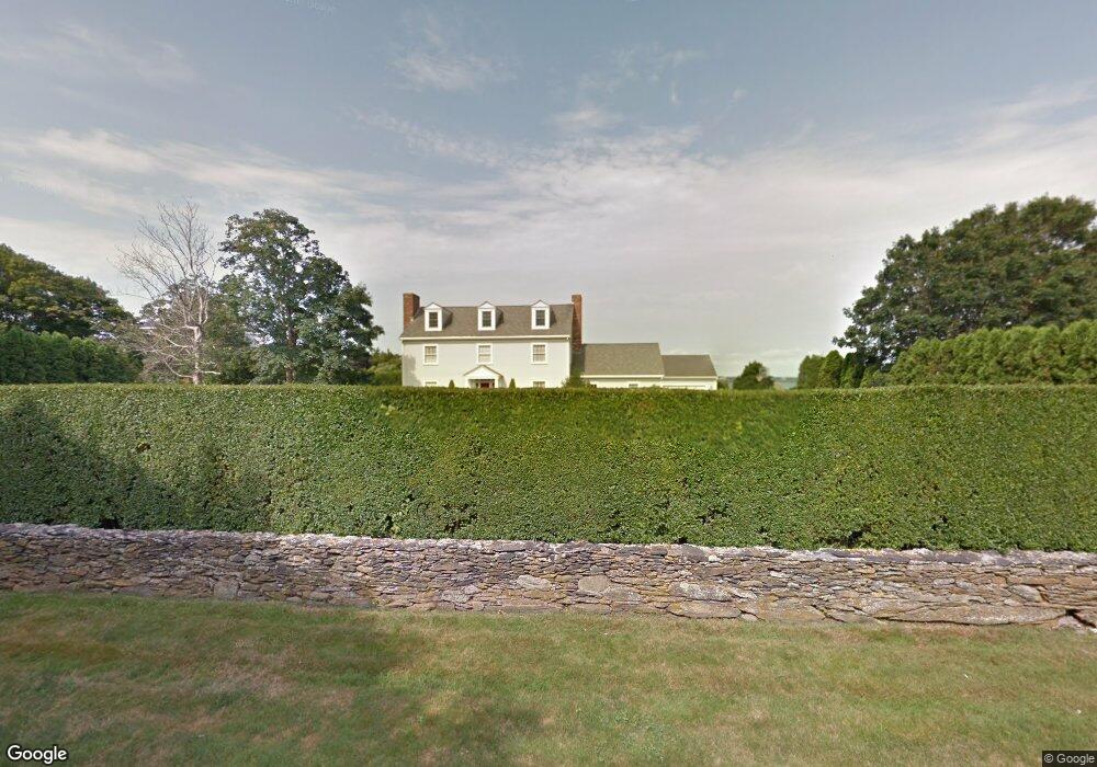
17 Atlantic Ave Newport, RI 02840
Ocean Drive NeighborhoodEstimated Value: $4,469,000 - $5,660,000
4
Beds
5
Baths
3,503
Sq Ft
$1,432/Sq Ft
Est. Value
About This Home
This home is located at 17 Atlantic Ave, Newport, RI 02840 and is currently estimated at $5,015,538, approximately $1,431 per square foot. 17 Atlantic Ave is a home located in Newport County with nearby schools including Rogers High School and St Michael's Country Day School.
Ownership History
Date
Name
Owned For
Owner Type
Purchase Details
Closed on
May 30, 2012
Sold by
Raymond S Perry T
Bought by
Farrick Tamara S
Current Estimated Value
Home Financials for this Owner
Home Financials are based on the most recent Mortgage that was taken out on this home.
Original Mortgage
$1,312,500
Outstanding Balance
$912,590
Interest Rate
3.9%
Estimated Equity
$4,102,948
Create a Home Valuation Report for This Property
The Home Valuation Report is an in-depth analysis detailing your home's value as well as a comparison with similar homes in the area
Home Values in the Area
Average Home Value in this Area
Purchase History
| Date | Buyer | Sale Price | Title Company |
|---|---|---|---|
| Farrick Tamara S | $1,750,000 | -- |
Source: Public Records
Mortgage History
| Date | Status | Borrower | Loan Amount |
|---|---|---|---|
| Open | Farrick Tamara S | $1,312,500 |
Source: Public Records
Tax History Compared to Growth
Tax History
| Year | Tax Paid | Tax Assessment Tax Assessment Total Assessment is a certain percentage of the fair market value that is determined by local assessors to be the total taxable value of land and additions on the property. | Land | Improvement |
|---|---|---|---|---|
| 2025 | $27,568 | $3,839,600 | $2,987,700 | $851,900 |
| 2024 | $26,761 | $3,839,500 | $2,987,700 | $851,800 |
| 2023 | $25,264 | $2,546,800 | $1,917,800 | $629,000 |
| 2022 | $24,475 | $2,546,800 | $1,917,800 | $629,000 |
| 2021 | $23,762 | $2,546,800 | $1,917,800 | $629,000 |
| 2020 | $18,479 | $1,797,600 | $1,261,400 | $536,200 |
| 2019 | $18,479 | $1,797,600 | $1,261,400 | $536,200 |
| 2018 | $17,958 | $1,797,600 | $1,261,400 | $536,200 |
| 2017 | $17,121 | $1,527,300 | $1,019,400 | $507,900 |
| 2016 | $16,693 | $1,527,300 | $1,019,400 | $507,900 |
| 2015 | $16,296 | $1,527,300 | $1,019,400 | $507,900 |
| 2014 | $18,260 | $1,514,100 | $910,200 | $603,900 |
Source: Public Records
Map
Nearby Homes
- 41 Castle Hill Ave
- 65 Ridge Rd Unit P37
- 15 Hammersmith Rd Unit 31
- 127 Harrison Ave Unit 10
- 112 Harrison Ave Unit B
- 112 Harrison Ave
- 11 Ocean Heights Rd
- 111 Harrison Ave Unit 9
- 7 Clarkes Village Rd
- 46 Chastellux Ave Unit M6
- 382 Beavertail Rd
- 73 Old Fort Rd Unit 75
- 21 Bonnet View Dr
- 30 Bonnet View Dr
- 91 Houston Ave
- 70 Carroll Ave Unit 510
- 26 Atlantic St
- 58 Connection St
- 57 Clinton St Unit 57C
- 39 Connection St