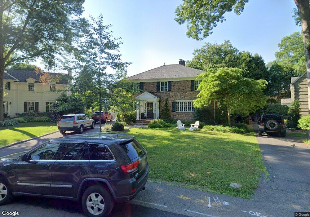
17 Bennett Place Westfield, NJ 07090
Estimated Value: $1,815,000 - $2,502,000
--
Bed
--
Bath
3,192
Sq Ft
$653/Sq Ft
Est. Value
About This Home
This home is located at 17 Bennett Place, Westfield, NJ 07090 and is currently estimated at $2,083,227, approximately $652 per square foot. 17 Bennett Place is a home located in Union County with nearby schools including Wilson Elementary School, Roosevelt Intermediate School, and Westfield Senior High School.
Ownership History
Date
Name
Owned For
Owner Type
Purchase Details
Closed on
May 22, 2002
Sold by
Bonner Helen H
Bought by
Manganello David and Manganello Elaine
Current Estimated Value
Home Financials for this Owner
Home Financials are based on the most recent Mortgage that was taken out on this home.
Original Mortgage
$499,900
Outstanding Balance
$191,532
Interest Rate
5.62%
Mortgage Type
Stand Alone First
Estimated Equity
$1,891,695
Purchase Details
Closed on
Feb 10, 1998
Sold by
Bonner Bertram F and Bonner Helen H
Bought by
Bonner Helen H
Create a Home Valuation Report for This Property
The Home Valuation Report is an in-depth analysis detailing your home's value as well as a comparison with similar homes in the area
Home Values in the Area
Average Home Value in this Area
Purchase History
| Date | Buyer | Sale Price | Title Company |
|---|---|---|---|
| Manganello David | $910,000 | -- | |
| Bonner Helen H | -- | -- |
Source: Public Records
Mortgage History
| Date | Status | Borrower | Loan Amount |
|---|---|---|---|
| Open | Manganello David | $499,900 |
Source: Public Records
Tax History Compared to Growth
Tax History
| Year | Tax Paid | Tax Assessment Tax Assessment Total Assessment is a certain percentage of the fair market value that is determined by local assessors to be the total taxable value of land and additions on the property. | Land | Improvement |
|---|---|---|---|---|
| 2025 | $29,758 | $1,321,400 | $764,600 | $556,800 |
| 2024 | $29,150 | $1,321,400 | $764,600 | $556,800 |
| 2023 | $29,150 | $1,321,400 | $764,600 | $556,800 |
| 2022 | $28,542 | $1,321,400 | $764,600 | $556,800 |
| 2021 | $28,582 | $1,321,400 | $764,600 | $556,800 |
| 2020 | $28,516 | $1,321,400 | $764,600 | $556,800 |
| 2019 | $28,410 | $1,321,400 | $764,600 | $556,800 |
| 2018 | $30,048 | $323,200 | $113,700 | $209,500 |
| 2017 | $29,883 | $323,200 | $113,700 | $209,500 |
| 2016 | $29,182 | $323,200 | $113,700 | $209,500 |
| 2015 | $28,600 | $323,200 | $113,700 | $209,500 |
| 2014 | $27,656 | $323,200 | $113,700 | $209,500 |
Source: Public Records
Map
Nearby Homes
- 824 Grant Ave
- 128 Woodland Ave
- 766 Oak Ave
- 820 E Broad St
- 112 Linden Ave
- 131 Wells St
- 645 Kimball Ave
- 41 C Sandra Cir Unit C3
- 764 Fairacres Ave
- 869 Standish Ave
- 648 E Broad St
- 58 Sandra Cir Unit B-3
- 819 Standish Ave
- 149 Harrison Ave
- 1256 Poplar Ave
- 657 Hillside Ave
- 137 Mountainview Dr
- 629 Tremont Ave
- 415 Highland Ave
- 103 Echo Ridge Way
- 15 Bennett Place
- 421 Woodland Ave
- 21 Bennett Place
- 417 Woodland Ave
- 505 Woodland Ave
- 9 Bennett Place
- 415 Woodland Ave
- 509 Woodland Ave
- 10 Bennett Place
- 5 Bennett Place
- 409 Woodland Ave
- 513 Woodland Ave
- 512 Wychwood Rd
- 420 Wychwood Rd
- 405 Woodland Ave
- 500 Wychwood Rd
- 416 Wychwood Rd
- 941 Kimball Ave
- 931 Kimball Ave
- 520 Wychwood Rd