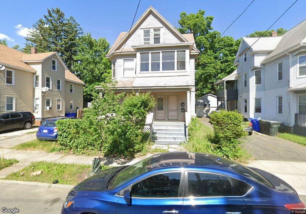
17 Bristol St Unit 19 Springfield, MA 01109
Upper Hill NeighborhoodEstimated Value: $283,689 - $360,000
7
Beds
3
Baths
2,854
Sq Ft
$115/Sq Ft
Est. Value
About This Home
This home is located at 17 Bristol St Unit 19, Springfield, MA 01109 and is currently estimated at $327,672, approximately $114 per square foot. 17 Bristol St Unit 19 is a home located in Hampden County with nearby schools including John J Duggan Middle, Springfield High School of Science and Technology, and Roger L. Putnam Vocational Technical Academy.
Ownership History
Date
Name
Owned For
Owner Type
Purchase Details
Closed on
Feb 1, 1993
Sold by
Fnma
Bought by
Edwards Ruth
Current Estimated Value
Purchase Details
Closed on
Sep 17, 1992
Sold by
Nelson Jacqueline W
Bought by
Federal National Mortgage Association
Purchase Details
Closed on
Apr 12, 1990
Sold by
Daniels Beatrice H
Bought by
Palmer Beverly A
Home Financials for this Owner
Home Financials are based on the most recent Mortgage that was taken out on this home.
Original Mortgage
$89,900
Interest Rate
10.13%
Mortgage Type
Purchase Money Mortgage
Create a Home Valuation Report for This Property
The Home Valuation Report is an in-depth analysis detailing your home's value as well as a comparison with similar homes in the area
Home Values in the Area
Average Home Value in this Area
Purchase History
| Date | Buyer | Sale Price | Title Company |
|---|---|---|---|
| Edwards Ruth | $22,000 | -- | |
| Federal National Mortgage Association | $38,500 | -- | |
| Palmer Beverly A | $99,900 | -- |
Source: Public Records
Mortgage History
| Date | Status | Borrower | Loan Amount |
|---|---|---|---|
| Previous Owner | Palmer Beverly A | $89,900 |
Source: Public Records
Tax History Compared to Growth
Tax History
| Year | Tax Paid | Tax Assessment Tax Assessment Total Assessment is a certain percentage of the fair market value that is determined by local assessors to be the total taxable value of land and additions on the property. | Land | Improvement |
|---|---|---|---|---|
| 2025 | $3,627 | $231,300 | $30,200 | $201,100 |
| 2024 | $3,100 | $193,000 | $30,200 | $162,800 |
| 2023 | $2,440 | $143,100 | $27,500 | $115,600 |
| 2022 | $2,744 | $145,800 | $25,700 | $120,100 |
| 2021 | $2,637 | $139,500 | $18,200 | $121,300 |
| 2020 | $2,449 | $125,400 | $18,200 | $107,200 |
| 2019 | $2,074 | $105,400 | $15,500 | $89,900 |
| 2018 | $2,116 | $101,900 | $15,500 | $86,400 |
| 2017 | $1,866 | $94,900 | $14,600 | $80,300 |
| 2016 | $1,522 | $77,400 | $14,600 | $62,800 |
| 2015 | $1,550 | $78,800 | $14,600 | $64,200 |
Source: Public Records
Map
Nearby Homes
- 62-64 Bristol St
- 43 Colonial Ave
- 67 Carlisle St
- 111 Marlborough St
- 135-137 Suffolk St
- 158 Norfolk St
- 124-126 Westford Cir
- 88 Dunmoreland St
- 58 Willard Ave
- 867 Roosevelt Ave
- 19 Westford Ave
- 179 Albemarle St
- 21 Westford Cir
- 75 Carnavon Cir
- 15 Kenyon St
- 65 Montrose St
- 0 NS (24) Alden St
- 140 Northampton Ave
- 162 Northampton Ave
- 52-56 Andrew St
- 13 Bristol St
- 23 Bristol St
- 11 Bristol St
- 18 Norfolk St
- 24 Norfolk St Unit 26
- 33 Bristol St
- 353 Wilbraham Rd
- 359 Wilbraham Rd
- 357 Wilbraham Rd
- 30 Norfolk St
- 24 Bristol St
- 18 Bristol St
- 362 Wilbraham Rd
- 14 Bristol St Unit 16
- 28 Bristol St
- 34 Norfolk St Unit 36
- 37 Bristol St
- 34 Bristol St
- 346 - 348 Wilbraham Rd
- 40 Norfolk St Unit 2