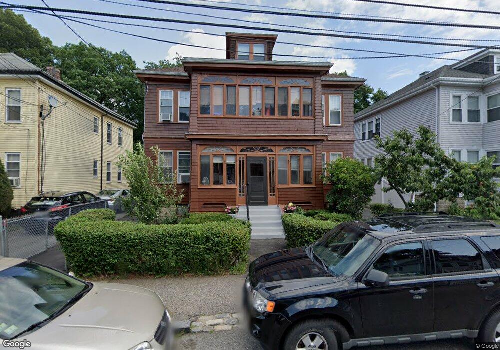
17 Brockton St Mattapan, MA 02126
Southern Mattapan NeighborhoodEstimated Value: $784,000 - $850,000
5
Beds
3
Baths
2,877
Sq Ft
$280/Sq Ft
Est. Value
About This Home
This home is located at 17 Brockton St, Mattapan, MA 02126 and is currently estimated at $806,576, approximately $280 per square foot. 17 Brockton St is a home located in Suffolk County with nearby schools including KIPP Academy Boston Charter School and Berea Seventh-day Adventist Academy.
Ownership History
Date
Name
Owned For
Owner Type
Purchase Details
Closed on
May 3, 1999
Sold by
Kovner Steven B
Bought by
Chandler Patricia
Current Estimated Value
Home Financials for this Owner
Home Financials are based on the most recent Mortgage that was taken out on this home.
Original Mortgage
$166,000
Outstanding Balance
$42,572
Interest Rate
6.95%
Mortgage Type
Purchase Money Mortgage
Estimated Equity
$764,004
Create a Home Valuation Report for This Property
The Home Valuation Report is an in-depth analysis detailing your home's value as well as a comparison with similar homes in the area
Home Values in the Area
Average Home Value in this Area
Purchase History
| Date | Buyer | Sale Price | Title Company |
|---|---|---|---|
| Chandler Patricia | $166,000 | -- |
Source: Public Records
Mortgage History
| Date | Status | Borrower | Loan Amount |
|---|---|---|---|
| Open | Chandler Patricia | $166,000 |
Source: Public Records
Tax History Compared to Growth
Tax History
| Year | Tax Paid | Tax Assessment Tax Assessment Total Assessment is a certain percentage of the fair market value that is determined by local assessors to be the total taxable value of land and additions on the property. | Land | Improvement |
|---|---|---|---|---|
| 2025 | $7,662 | $661,700 | $211,800 | $449,900 |
| 2024 | $6,654 | $610,500 | $188,700 | $421,800 |
| 2023 | $6,185 | $575,900 | $178,000 | $397,900 |
| 2022 | $6,266 | $575,900 | $178,000 | $397,900 |
| 2021 | $5,586 | $523,500 | $161,800 | $361,700 |
| 2020 | $4,976 | $471,200 | $155,300 | $315,900 |
| 2019 | $4,620 | $438,300 | $122,500 | $315,800 |
| 2018 | $4,102 | $391,400 | $122,500 | $268,900 |
| 2017 | $3,985 | $376,300 | $122,500 | $253,800 |
| 2016 | $3,763 | $342,100 | $122,500 | $219,600 |
| 2015 | $3,511 | $289,900 | $122,600 | $167,300 |
| 2014 | $3,345 | $265,900 | $120,800 | $145,100 |
Source: Public Records
Map
Nearby Homes
- 10 Brockton St
- 95 Woodhaven St
- 770 Cummins Hwy Unit 1
- 770 Cummins Hwy Unit 22
- 839-843 Cummins Hwy
- 48-50 Rockdale St
- 231 Itasca St
- 90 Hollingsworth St
- 1465 Blue Hill Ave
- 20 Monterey Ave
- 100 Itasca St
- 60 and 64 Monterey Ave
- 116 Almont St
- 23 Caton St
- 12 Hiawatha Rd
- 34 Ridlon Rd
- 4 Crossman St Unit 4
- 645 River St
- 11 French St
- 14-14R Kennebec St
- 19 Brockton St
- 19 Brockton St Unit 1
- 15 Brockton St
- 9 Brockton St
- 21 Brockton St
- 111 Woodhaven St
- 113 Woodhaven St
- 23 Brockton St
- 7 Brockton St
- 105 Woodhaven St
- 16 Brockton St
- 14 Brockton St
- 20 Brockton St
- 12 Brockton St
- 103 Woodhaven St
- 25 Brockton St
- 10 Brockton St Unit 2
- 22 Brockton St
- 5 Brockton St
- 119 Woodhaven St