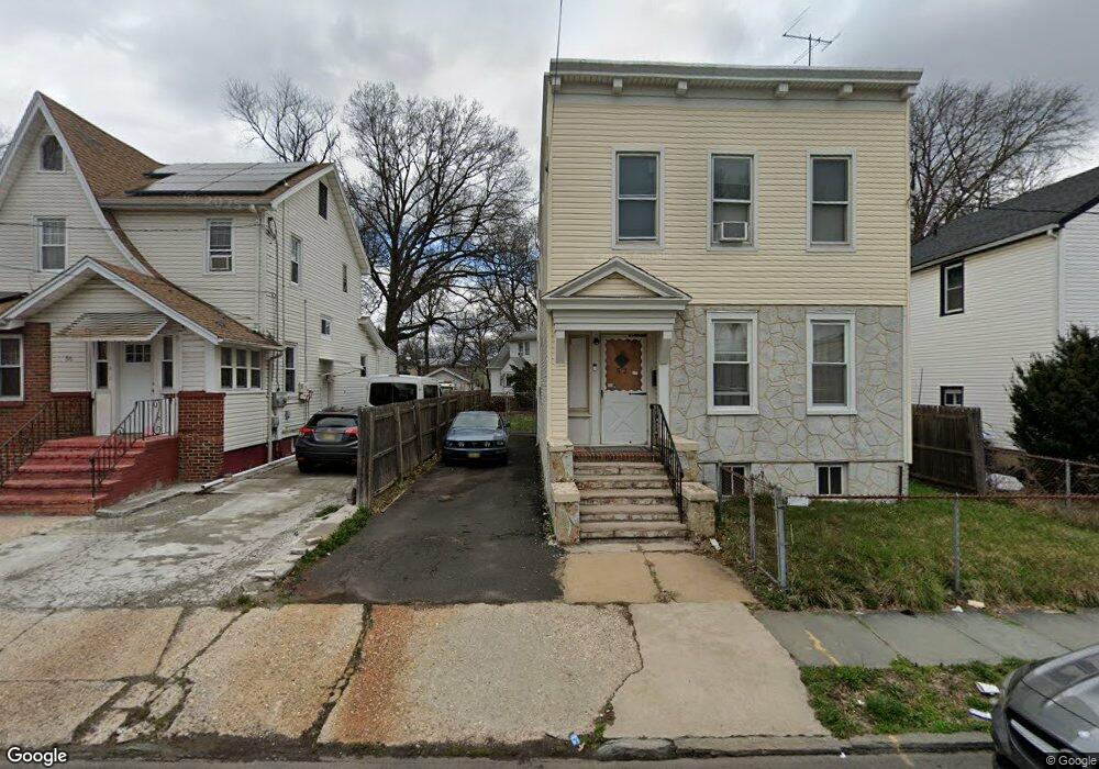
17 Bryant Ct Irvington, NJ 07111
Estimated Value: $343,506 - $442,000
--
Bed
--
Bath
1,260
Sq Ft
$316/Sq Ft
Est. Value
About This Home
This home is located at 17 Bryant Ct, Irvington, NJ 07111 and is currently estimated at $398,127, approximately $315 per square foot. 17 Bryant Ct is a home located in Essex County with nearby schools including Irvington High School.
Ownership History
Date
Name
Owned For
Owner Type
Purchase Details
Closed on
Feb 21, 2006
Sold by
Howard Aaron
Bought by
Rouse George and Rouse Irma
Current Estimated Value
Home Financials for this Owner
Home Financials are based on the most recent Mortgage that was taken out on this home.
Original Mortgage
$240,050
Outstanding Balance
$134,738
Interest Rate
6.15%
Mortgage Type
VA
Estimated Equity
$263,389
Purchase Details
Closed on
Feb 27, 1995
Sold by
Schleeh Helen
Bought by
Howard Aaron and Howard Della
Home Financials for this Owner
Home Financials are based on the most recent Mortgage that was taken out on this home.
Original Mortgage
$86,000
Interest Rate
8.96%
Create a Home Valuation Report for This Property
The Home Valuation Report is an in-depth analysis detailing your home's value as well as a comparison with similar homes in the area
Home Values in the Area
Average Home Value in this Area
Purchase History
| Date | Buyer | Sale Price | Title Company |
|---|---|---|---|
| Rouse George | $235,000 | -- | |
| Howard Aaron | $90,000 | -- |
Source: Public Records
Mortgage History
| Date | Status | Borrower | Loan Amount |
|---|---|---|---|
| Open | Rouse George | $240,050 | |
| Previous Owner | Howard Aaron | $86,000 |
Source: Public Records
Tax History Compared to Growth
Tax History
| Year | Tax Paid | Tax Assessment Tax Assessment Total Assessment is a certain percentage of the fair market value that is determined by local assessors to be the total taxable value of land and additions on the property. | Land | Improvement |
|---|---|---|---|---|
| 2025 | $6,128 | $327,400 | $186,600 | $140,800 |
| 2024 | $6,128 | $100,900 | $18,300 | $82,600 |
| 2022 | $6,015 | $100,900 | $18,300 | $82,600 |
| 2021 | $6,033 | $100,900 | $18,300 | $82,600 |
| 2020 | $6,030 | $100,900 | $18,300 | $82,600 |
| 2019 | $5,866 | $100,900 | $18,300 | $82,600 |
| 2018 | $5,752 | $100,900 | $18,300 | $82,600 |
| 2017 | $5,726 | $100,900 | $18,300 | $82,600 |
| 2016 | $5,602 | $100,900 | $18,300 | $82,600 |
| 2015 | $5,472 | $100,900 | $18,300 | $82,600 |
| 2014 | $5,505 | $100,900 | $18,300 | $82,600 |
Source: Public Records
Map
Nearby Homes
- 57 Rosehill Place
- 5 Norwood Ave
- 10-12 Medbourne Ave
- 70 Welland Ave
- 86 Cleremont Ave
- 52 Melville Place
- 315 Coit St
- 111 Cleremont Ave Unit 119
- 111-119 Cleremont Ave
- 598 Chancellor Ave Unit 600
- 21 Victor Place
- 25 W Denman Place
- 179 Berkshire Place
- 20 Greene Terrace Unit 24
- 31 Yale Ave
- 15 Temple Place
- 37 Philip Place
- 16 Rutgers St
- 107 Howard St
- 33 Dupont Place
- 31 Fern Ave
- 29 Fern Ave
- 33-35 Fern Ave
- 9-15 Bryant Ct
- 9 Bryant Ct
- 33 Fern Ave Unit 35
- 33 Fern Ave Unit 2
- 25 Fern Ave Unit 27
- 25 Fern Ave Unit 3
- 37 Fern Ave Unit 39
- 52 Rosehill Place
- 48 Rosehill Place
- 21 Fern Ave
- 25-27 Fern Ave Unit 3
- 10 Bryant Ct
- 46 Rosehill Place
- 37-39 Fern Ave
- 44 Rosehill Place
- 58 Rosehill Place
- 56 Rosehill Place