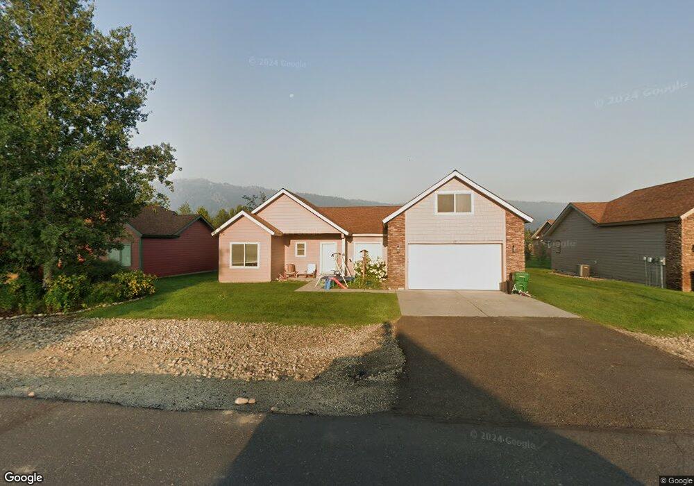
17 Buckskin Rd Donnelly, ID 83615
Estimated Value: $387,000 - $482,000
3
Beds
1
Bath
1,760
Sq Ft
$254/Sq Ft
Est. Value
About This Home
This home is located at 17 Buckskin Rd, Donnelly, ID 83615 and is currently estimated at $446,579, approximately $253 per square foot. 17 Buckskin Rd is a home located in Valley County with nearby schools including Donnelly Elementary School and McCall-Donnelly High School.
Ownership History
Date
Name
Owned For
Owner Type
Purchase Details
Closed on
Sep 26, 2019
Sold by
Ikola Gerry A and Ikola Rachael D
Bought by
Jones Alexander J and Jones Cortnee
Current Estimated Value
Home Financials for this Owner
Home Financials are based on the most recent Mortgage that was taken out on this home.
Original Mortgage
$218,500
Outstanding Balance
$191,807
Interest Rate
3.6%
Mortgage Type
New Conventional
Estimated Equity
$254,772
Purchase Details
Closed on
Aug 19, 2014
Sold by
Hill Patrick S
Bought by
Ikola Gerry A
Home Financials for this Owner
Home Financials are based on the most recent Mortgage that was taken out on this home.
Original Mortgage
$136,972
Interest Rate
3.87%
Mortgage Type
FHA
Purchase Details
Closed on
Oct 8, 2013
Sold by
County Of Valley
Bought by
Hill Patrick S
Purchase Details
Closed on
Aug 26, 2013
Sold by
Ladd Daniel and Ladd Anna
Bought by
Valley County
Create a Home Valuation Report for This Property
The Home Valuation Report is an in-depth analysis detailing your home's value as well as a comparison with similar homes in the area
Home Values in the Area
Average Home Value in this Area
Purchase History
| Date | Buyer | Sale Price | Title Company |
|---|---|---|---|
| Jones Alexander J | -- | Amerititle Cascade | |
| Ikola Gerry A | -- | First American Title | |
| Hill Patrick S | -- | None Available | |
| Valley County | -- | None Available |
Source: Public Records
Mortgage History
| Date | Status | Borrower | Loan Amount |
|---|---|---|---|
| Open | Jones Alexander J | $218,500 | |
| Previous Owner | Ikola Gerry A | $136,972 |
Source: Public Records
Tax History Compared to Growth
Tax History
| Year | Tax Paid | Tax Assessment Tax Assessment Total Assessment is a certain percentage of the fair market value that is determined by local assessors to be the total taxable value of land and additions on the property. | Land | Improvement |
|---|---|---|---|---|
| 2025 | $772 | $416,699 | $26,645 | $390,054 |
| 2023 | $772 | $476,147 | $27,491 | $448,656 |
| 2022 | $975 | $435,142 | $27,491 | $407,651 |
| 2021 | $665 | $252,855 | $21,147 | $231,708 |
| 2020 | $648 | $203,873 | $26,294 | $177,579 |
| 2019 | $991 | $158,463 | $25,042 | $133,421 |
| 2018 | $533 | $148,255 | $23,534 | $124,721 |
| 2017 | $572 | $146,626 | $26,917 | $119,709 |
| 2016 | $560 | $141,231 | $33,000 | $108,231 |
| 2015 | $501 | $118,307 | $0 | $0 |
| 2013 | -- | $115,350 | $0 | $0 |
Source: Public Records
Map
Nearby Homes
- 16 Buckskin Dr
- 22 Charters Dr
- 13111 Cameron Dr
- 13078 Hill House Loop
- 13076 Hill House Loop
- 13098 Hill House Loop
- 13091 Hill House Loop
- Lot 4 Hideout Dr Unit 4
- 24 Mangum Cir Unit 1
- 20 #5 W Mangum Cir Unit 5
- Lot 6 Hideout Dr Unit 6
- 20 Mangum Cir Unit 8
- 24 Mangum Dr Unit # 1 Unit 1
- 35 1 Mangum Cir
- 35 Mangum Cir Unit 1
- 32 Mangum Cir Unit 3
- 32 Mangum Cir
- 106 Forest Place
- 34 Mangum Cir Unit 8
- 13156 Hawks Bay Rd
- 17 Buckskin Dr
- 15 Buckskin Dr
- 17 Buckskin
- 15 Buckskin Rd
- 19 Buckskin Rd
- 19 Buckskin Dr
- 18 Timberline Dr
- 20 Timberline Dr
- 13 Buckskin Dr
- 13 Buckskin Rd
- 21 Buckskin Rd
- 21 Buckskin Dr
- 16 Buckskin Rd
- 14 Timberline Dr
- 18 Buckskin Rd
- 18 Buckskin Dr
- 14 Buckskin Rd
- 14 Buckskin Dr
- 22 Timberline Dr
- 20 Buckskin Dr