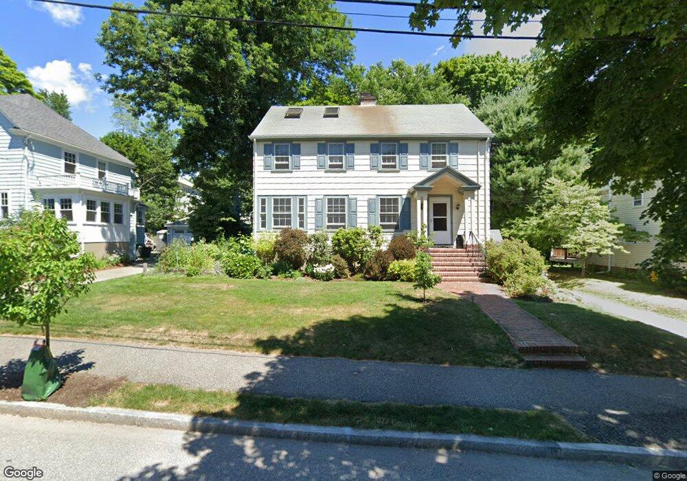
17 Calvin Rd Newtonville, MA 02460
Newtonville NeighborhoodEstimated Value: $1,672,058 - $2,197,000
4
Beds
3
Baths
2,432
Sq Ft
$787/Sq Ft
Est. Value
About This Home
This home is located at 17 Calvin Rd, Newtonville, MA 02460 and is currently estimated at $1,913,015, approximately $786 per square foot. 17 Calvin Rd is a home located in Middlesex County with nearby schools including Cabot Elementary School, F.A. Day Middle School, and Newton North High School.
Ownership History
Date
Name
Owned For
Owner Type
Purchase Details
Closed on
Dec 29, 1986
Bought by
Cashman Daniel F and Cashman Suzanne B
Current Estimated Value
Create a Home Valuation Report for This Property
The Home Valuation Report is an in-depth analysis detailing your home's value as well as a comparison with similar homes in the area
Home Values in the Area
Average Home Value in this Area
Purchase History
| Date | Buyer | Sale Price | Title Company |
|---|---|---|---|
| Cashman Daniel F | -- | -- |
Source: Public Records
Mortgage History
| Date | Status | Borrower | Loan Amount |
|---|---|---|---|
| Open | Cashman Daniel F | $190,000 | |
| Closed | Cashman Daniel F | $150,000 | |
| Closed | Cashman Daniel F | $20,000 |
Source: Public Records
Tax History Compared to Growth
Tax History
| Year | Tax Paid | Tax Assessment Tax Assessment Total Assessment is a certain percentage of the fair market value that is determined by local assessors to be the total taxable value of land and additions on the property. | Land | Improvement |
|---|---|---|---|---|
| 2025 | $14,156 | $1,444,500 | $1,013,200 | $431,300 |
| 2024 | $13,628 | $1,396,300 | $983,700 | $412,600 |
| 2023 | $12,837 | $1,261,000 | $751,200 | $509,800 |
| 2022 | $12,283 | $1,167,600 | $695,600 | $472,000 |
| 2021 | $11,852 | $1,101,500 | $656,200 | $445,300 |
| 2020 | $11,500 | $1,101,500 | $656,200 | $445,300 |
| 2019 | $11,175 | $1,069,400 | $637,100 | $432,300 |
| 2018 | $10,639 | $983,300 | $575,700 | $407,600 |
| 2017 | $10,315 | $927,600 | $543,100 | $384,500 |
| 2016 | $9,865 | $866,900 | $507,600 | $359,300 |
| 2015 | $9,473 | $815,900 | $474,400 | $341,500 |
Source: Public Records
Map
Nearby Homes
- 33 Birch Hill Rd
- 123 Mount Vernon St Unit 2
- 22 Walnut Place Unit 1
- 935 Washington St Unit 8
- 935 Washington St (Rear Facing) Unit 11
- 911 Washington St
- 70 Bigelow Rd
- 4 Wiswall St
- 12 Wiswall St
- 4 Hosmer Cir
- 43 Walker St
- 27 Cross St Unit 27
- 318 Austin St Unit A
- 300 Cabot St
- 154 Beaumont Ave
- 61 Lakeview Ave
- 32-34 Rossmere St
- 10 Washington Park
- 10 Washington Park Unit 2
- 10 Washington Park Unit 1
- 11 Calvin Rd
- 23 Calvin Rd
- 29 Calvin Rd
- 6 Fairfield St
- 315 Lowell Ave Unit 317
- 14 Calvin Rd
- 120 Otis St
- 311 Lowell Ave
- 124 Otis St
- 35 Calvin Rd
- 5 Fairfield St
- 325 Lowell Ave Unit 327
- 325 Lowell Ave Unit 325
- 325 Lowell Ave
- 126 Otis St
- 126 Otis St Unit 1
- 12 Fairfield St
- 331 Lowell Ave Unit 333
- 331 Lowell Ave Unit 1
- 130 Otis St