Estimated Value: $275,485 - $335,000
3
Beds
2
Baths
1,668
Sq Ft
$188/Sq Ft
Est. Value
About This Home
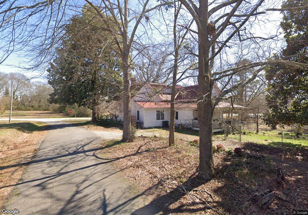
This home is located at 17 Cemetery Cir, Comer, GA 30629 and is currently estimated at $314,371, approximately $188 per square foot. 17 Cemetery Cir is a home located in Madison County with nearby schools including Madison County High School.
Ownership History
Date
Name
Owned For
Owner Type
Purchase Details
Closed on
Nov 28, 2023
Sold by
Ford Juniper Christy
Bought by
Jc Mfg Holding Llc
Current Estimated Value
Purchase Details
Closed on
Feb 12, 2015
Sold by
Burrows Juniper C
Bought by
Ford Juniper Christy
Purchase Details
Closed on
Oct 23, 2012
Sold by
Burrows William S
Bought by
Burrows Juniper C
Home Financials for this Owner
Home Financials are based on the most recent Mortgage that was taken out on this home.
Original Mortgage
$80,000
Interest Rate
3.42%
Mortgage Type
New Conventional
Purchase Details
Closed on
Feb 20, 2003
Sold by
Burrows Juniper C
Bought by
Burrows Juniper C and Burrows William S
Purchase Details
Closed on
Jul 27, 2001
Sold by
Brown Betty M
Bought by
Burrows Juniper C
Purchase Details
Closed on
Jan 1, 1993
Bought by
Brown Betty M
Create a Home Valuation Report for This Property
The Home Valuation Report is an in-depth analysis detailing your home's value as well as a comparison with similar homes in the area
Home Values in the Area
Average Home Value in this Area
Purchase History
| Date | Buyer | Sale Price | Title Company |
|---|---|---|---|
| Jc Mfg Holding Llc | -- | -- | |
| Ford Juniper Christy | -- | -- | |
| Burrows Juniper C | -- | -- | |
| Burrows Juniper C | -- | -- | |
| Burrows Juniper C | $95,000 | -- | |
| Brown Betty M | $50,000 | -- |
Source: Public Records
Mortgage History
| Date | Status | Borrower | Loan Amount |
|---|---|---|---|
| Previous Owner | Burrows Juniper C | $80,000 |
Source: Public Records
Tax History Compared to Growth
Tax History
| Year | Tax Paid | Tax Assessment Tax Assessment Total Assessment is a certain percentage of the fair market value that is determined by local assessors to be the total taxable value of land and additions on the property. | Land | Improvement |
|---|---|---|---|---|
| 2024 | $2,871 | $92,080 | $10,872 | $81,208 |
| 2023 | $2,663 | $85,404 | $9,060 | $76,344 |
| 2022 | $2,378 | $74,350 | $6,231 | $68,119 |
| 2021 | $2,017 | $55,857 | $6,231 | $49,626 |
| 2020 | $1,773 | $54,951 | $5,325 | $49,626 |
| 2019 | $1,764 | $54,040 | $5,325 | $48,715 |
| 2018 | $1,723 | $52,620 | $4,872 | $47,748 |
| 2017 | $1,679 | $48,853 | $4,530 | $44,323 |
| 2016 | $1,294 | $42,928 | $4,118 | $38,810 |
| 2015 | $1,144 | $38,110 | $4,118 | $33,992 |
| 2014 | $1,101 | $36,628 | $6,134 | $30,493 |
| 2013 | -- | $36,628 | $6,134 | $30,493 |
Source: Public Records
Map
Nearby Homes
- 540 Sunset Ave
- 858 Clairmont Ave
- 12 Laurel Ave
- 3 Paoli St
- 470 Gholston St
- 40 Kingston Dr
- Trct 1 Paoli St
- 2649 Paoli St
- 0 Live Oak Ln Unit lot 3
- 0 Live Oak Ln Unit lot 12
- 0 Live Oak Ln Unit lot 5
- 135 Shannons Place
- 15 Shady Oaks Ln
- 0 Lowe Rd Unit 10614126
- 5866 Highway 98 E
- 2975 Georgia 72
- 0 Paoli Rd Unit 23882833
- 57 Pleasant Ln
- 1499 Main St
- 250 Cemetery Cir
- 00 Cemetery Cir
- 0 Cemetery Cir
- 278 Cemetery Cir
- 1470 Main St
- 246 Main St
- 0 Main St Unit CM934353
- 0 Main St Unit CM255401
- 0 Main St Unit 7037592
- 0 Main St Unit 7349886
- 0 Main St Unit 7541325
- 0 Main St Unit 7479660
- 1662 Main St
- 1641 Main St
- 1469 Main St
- 1623 Main St
- 1635 Madison St
- 1639 Madison St
- 1693 Main St