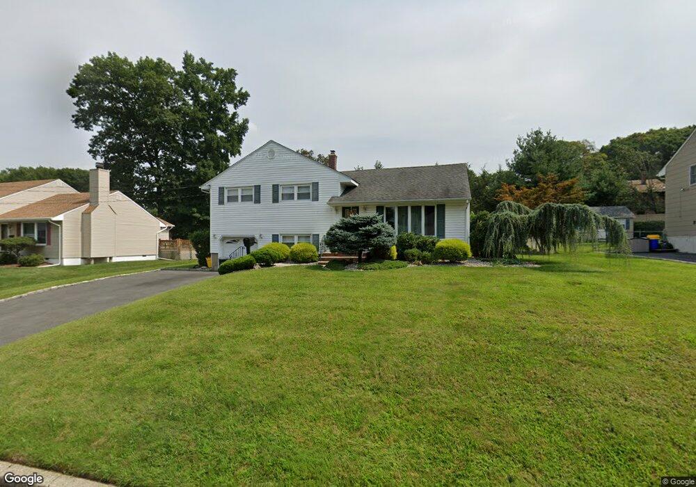
17 Cole Rd Cedar Grove, NJ 07009
Estimated Value: $599,348 - $720,000
--
Bed
--
Bath
1,606
Sq Ft
$417/Sq Ft
Est. Value
About This Home
This home is located at 17 Cole Rd, Cedar Grove, NJ 07009 and is currently estimated at $669,587, approximately $416 per square foot. 17 Cole Rd is a home located in Essex County with nearby schools including Cedar Grove High School, Monarch Montessori School, and Banyan Upper School.
Ownership History
Date
Name
Owned For
Owner Type
Purchase Details
Closed on
Dec 31, 2003
Sold by
Raja Irfan
Bought by
Mangione Rosalyn
Current Estimated Value
Home Financials for this Owner
Home Financials are based on the most recent Mortgage that was taken out on this home.
Original Mortgage
$120,000
Outstanding Balance
$56,041
Interest Rate
5.88%
Estimated Equity
$613,546
Purchase Details
Closed on
Mar 6, 1998
Sold by
Raja Inam
Bought by
Raja Heather and Raja I
Home Financials for this Owner
Home Financials are based on the most recent Mortgage that was taken out on this home.
Original Mortgage
$168,000
Interest Rate
7.11%
Purchase Details
Closed on
Aug 29, 1996
Sold by
Basile Eugene
Bought by
Raja Rizwan and Raja Inam
Home Financials for this Owner
Home Financials are based on the most recent Mortgage that was taken out on this home.
Original Mortgage
$110,000
Interest Rate
8.18%
Create a Home Valuation Report for This Property
The Home Valuation Report is an in-depth analysis detailing your home's value as well as a comparison with similar homes in the area
Home Values in the Area
Average Home Value in this Area
Purchase History
| Date | Buyer | Sale Price | Title Company |
|---|---|---|---|
| Mangione Rosalyn | $401,000 | -- | |
| Raja Heather | $210,000 | -- | |
| Raja Rizwan | $190,000 | -- |
Source: Public Records
Mortgage History
| Date | Status | Borrower | Loan Amount |
|---|---|---|---|
| Open | Mangione Rosalyn | $120,000 | |
| Previous Owner | Raja Heather | $168,000 | |
| Previous Owner | Raja Rizwan | $110,000 |
Source: Public Records
Tax History Compared to Growth
Tax History
| Year | Tax Paid | Tax Assessment Tax Assessment Total Assessment is a certain percentage of the fair market value that is determined by local assessors to be the total taxable value of land and additions on the property. | Land | Improvement |
|---|---|---|---|---|
| 2025 | $10,234 | $392,100 | $241,400 | $150,700 |
| 2024 | $10,234 | $392,100 | $241,400 | $150,700 |
| 2022 | $10,053 | $392,100 | $241,400 | $150,700 |
| 2021 | $9,932 | $392,100 | $241,400 | $150,700 |
| 2020 | $10,077 | $392,100 | $241,400 | $150,700 |
| 2019 | $9,846 | $392,100 | $241,400 | $150,700 |
| 2018 | $9,395 | $392,100 | $241,400 | $150,700 |
| 2017 | $9,293 | $392,100 | $241,400 | $150,700 |
| 2016 | $9,007 | $392,100 | $241,400 | $150,700 |
| 2015 | $8,799 | $392,100 | $241,400 | $150,700 |
| 2014 | $8,618 | $392,100 | $241,400 | $150,700 |
Source: Public Records
Map
Nearby Homes
- 303 Abbe Rd
- 6 Meadow Dr
- 96 Montclair Ave
- 84 Center Ave
- 7 Mountain Ridge Dr Unit 4B
- 4 Mountain Ridge Dr Unit 25
- 4 Mountain Ridge Dr
- 12 Bergen Dr
- 163 Donato Dr
- 157 1st Ave
- 207 Eileen Dr
- 215 Eileen Dr
- 47 1st Ave
- 120 Anderson Pkwy
- 58 Harvest Way
- 10 Harvest Way
- 86 Harvest Way
- 26 Chestnut Ct
- 1 Chestnut Ct
- 185 Wilmore Rd