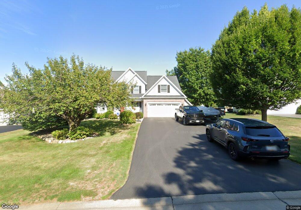
17 Coventry Dr Spencerport, NY 14559
Estimated Value: $492,562 - $538,000
4
Beds
3
Baths
2,433
Sq Ft
$207/Sq Ft
Est. Value
About This Home
This home is located at 17 Coventry Dr, Spencerport, NY 14559 and is currently estimated at $504,641, approximately $207 per square foot. 17 Coventry Dr is a home located in Monroe County with nearby schools including A M Cosgrove Middle School and Spencerport High School.
Ownership History
Date
Name
Owned For
Owner Type
Purchase Details
Closed on
Dec 2, 2010
Sold by
Decosse Scott A and Decosse Elizabeth A
Bought by
Britton Timothy A and Britton Nicole A
Current Estimated Value
Home Financials for this Owner
Home Financials are based on the most recent Mortgage that was taken out on this home.
Original Mortgage
$181,600
Outstanding Balance
$120,041
Interest Rate
4.23%
Mortgage Type
New Conventional
Estimated Equity
$384,600
Purchase Details
Closed on
Jul 19, 2004
Sold by
Gmac Global Relo.
Bought by
Decosse Scott
Purchase Details
Closed on
Nov 7, 2002
Sold by
Lc Jacobs Inc
Bought by
Village Pines Llc
Purchase Details
Closed on
Dec 30, 1998
Sold by
Wohlers Development Corp
Bought by
Carnes Larry E and Carnes Connie T
Create a Home Valuation Report for This Property
The Home Valuation Report is an in-depth analysis detailing your home's value as well as a comparison with similar homes in the area
Home Values in the Area
Average Home Value in this Area
Purchase History
| Date | Buyer | Sale Price | Title Company |
|---|---|---|---|
| Britton Timothy A | $227,000 | None Available | |
| Decosse Scott | $222,000 | -- | |
| Village Pines Llc | -- | Daniel G Schum | |
| Carnes Larry E | $197,000 | -- | |
| Wohlers Development Corp | $41,850 | -- |
Source: Public Records
Mortgage History
| Date | Status | Borrower | Loan Amount |
|---|---|---|---|
| Open | Britton Timothy A | $181,600 |
Source: Public Records
Tax History Compared to Growth
Tax History
| Year | Tax Paid | Tax Assessment Tax Assessment Total Assessment is a certain percentage of the fair market value that is determined by local assessors to be the total taxable value of land and additions on the property. | Land | Improvement |
|---|---|---|---|---|
| 2024 | $11,682 | $399,700 | $60,500 | $339,200 |
| 2023 | $11,396 | $252,000 | $53,000 | $199,000 |
| 2022 | $11,532 | $252,000 | $53,000 | $199,000 |
| 2021 | $11,210 | $252,000 | $53,000 | $199,000 |
| 2020 | $10,443 | $252,000 | $53,000 | $199,000 |
| 2019 | $10,304 | $252,000 | $53,000 | $199,000 |
| 2018 | $10,518 | $252,000 | $53,000 | $199,000 |
| 2017 | $5,109 | $240,000 | $53,000 | $187,000 |
| 2016 | $10,304 | $240,000 | $53,000 | $187,000 |
| 2015 | -- | $240,000 | $53,000 | $187,000 |
| 2014 | -- | $240,000 | $53,000 | $187,000 |
Source: Public Records
Map
Nearby Homes
- 76 Hawthorne Dr
- 24 Birdsong Terrace
- 326 Village Walk Cir
- 87 Highview Dr
- 2283 S Union St
- 154 Amity St
- 0000 Bay Leaf Cir Lot#119
- 000
- 00 Bay Leaf Circle Lot#117
- 0 Unit R1620030
- 78 Clark St
- 49 Hillcrest Dr
- 4028 Canal Rd
- 3375 Brockport Spencerport Rd
- 64 Coleman Ave
- 92 Coolidge Ave
- 28 Coolidge Ave
- 607 Trimmer Rd
- vl Canal Rd
- 15 Chambers St
- 19 Coventry Dr
- 15 Coventry Dr
- 9 Coventry Dr
- 21 Coventry Dr
- 60 Sableridge Ct
- 33 Laurelcrest Dr
- 37 Laurelcrest Dr
- 7 Coventry Dr
- 41 Laurelcrest Dr
- 23 Coventry Dr
- 61 Sableridge Ct
- 62 Sableridge Ct
- 43 Luther Jacobs Way
- 29 Laurelcrest Dr
- 45 Laurelcrest Dr
- 40 Luther Jacobs Way
- 10 Coventry Dr
- 8 Coventry Dr
- 12 Coventry Dr
- 25 Coventry Dr