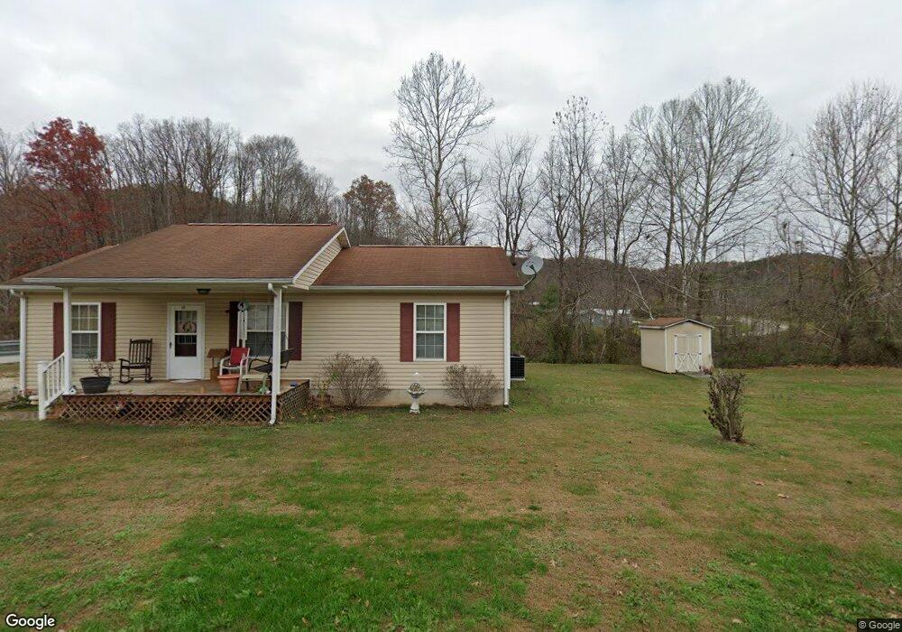
17 Craig Ave Garrison, KY 41141
Estimated Value: $123,000 - $131,000
Studio
--
Bath
--
Sq Ft
14,505
Sq Ft Lot
About This Home
This home is located at 17 Craig Ave, Garrison, KY 41141 and is currently estimated at $127,450. 17 Craig Ave is a home located in Lewis County with nearby schools including Lewis County High School.
Ownership History
Date
Name
Owned For
Owner Type
Purchase Details
Closed on
Aug 22, 2025
Sold by
Johnson Andrea D
Bought by
Fraley Austin and Fraley Elisabeth
Current Estimated Value
Home Financials for this Owner
Home Financials are based on the most recent Mortgage that was taken out on this home.
Original Mortgage
$122,360
Outstanding Balance
$122,254
Interest Rate
6.72%
Mortgage Type
New Conventional
Estimated Equity
$5,196
Purchase Details
Closed on
Mar 15, 2021
Sold by
Ginn Martha Jean and Ginn Phillip
Bought by
Johnson Andrea Ginn and Ginn Christopher Phillip
Purchase Details
Closed on
Aug 10, 2010
Sold by
Madden Kenneth M and Madden Jennifer A
Bought by
Johnson Andrea D
Home Financials for this Owner
Home Financials are based on the most recent Mortgage that was taken out on this home.
Original Mortgage
$48,600
Interest Rate
4.61%
Mortgage Type
USDA
Create a Home Valuation Report for This Property
The Home Valuation Report is an in-depth analysis detailing your home's value as well as a comparison with similar homes in the area
Purchase History
| Date | Buyer | Sale Price | Title Company |
|---|---|---|---|
| Fraley Austin | $128,000 | None Listed On Document | |
| Johnson Andrea Ginn | -- | None Available | |
| Johnson Andrea D | $35,262 | None Available |
Source: Public Records
Mortgage History
| Date | Status | Borrower | Loan Amount |
|---|---|---|---|
| Open | Fraley Austin | $122,360 | |
| Previous Owner | Johnson Andrea D | $48,600 |
Source: Public Records
Tax History
| Year | Tax Paid | Tax Assessment Tax Assessment Total Assessment is a certain percentage of the fair market value that is determined by local assessors to be the total taxable value of land and additions on the property. | Land | Improvement |
|---|---|---|---|---|
| 2025 | $435 | $37,500 | $0 | $0 |
| 2024 | $423 | $37,500 | $0 | $0 |
| 2023 | $417 | $37,500 | $0 | $0 |
| 2022 | $380 | $37,500 | $0 | $0 |
| 2021 | $386 | $37,500 | $0 | $0 |
| 2020 | $387 | $37,500 | $0 | $0 |
| 2019 | $387 | $37,500 | $0 | $0 |
| 2018 | $370 | $35,300 | $0 | $0 |
| 2017 | $361 | $35,300 | $0 | $0 |
| 2016 | -- | $35,300 | $0 | $0 |
| 2015 | -- | $35,300 | $0 | $0 |
| 2013 | -- | $35,300 | $0 | $0 |
Source: Public Records
Map
Nearby Homes
- 4866D U S 52
- 1924 Bill Chain Rd
- 1060 Bill Chain Rd
- TBD Montgomery Rd
- 200 Oak St
- 178 Indian Hills Cir
- 181 Shawnee Dr
- 87 Meadowbrook Rd
- 115 Silver Linden Ln
- 3075 E Ky 8
- Montgomery Rd
- 95 US 52
- 0 Angel Ln Unit 155351
- 0 Aa Hwy
- 118 Bellevue Ave
- 1240 Finger Board Rd
- 142 Carpenter Ln
- 418 Front St
- 0 Daren Dr
- 0 Town Branch Rd
Your Personal Tour Guide
Ask me questions while you tour the home.