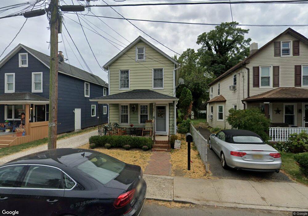
17 Deforrest Ave Red Bank, NJ 07701
Estimated Value: $531,979 - $683,000
3
Beds
1
Bath
1,224
Sq Ft
$479/Sq Ft
Est. Value
About This Home
This home is located at 17 Deforrest Ave, Red Bank, NJ 07701 and is currently estimated at $585,995, approximately $478 per square foot. 17 Deforrest Ave is a home located in Monmouth County with nearby schools including Red Bank Primary School, Red Bank Middle School, and Red Bank Reg High School.
Ownership History
Date
Name
Owned For
Owner Type
Purchase Details
Closed on
Sep 17, 2018
Sold by
Kirk Brian
Bought by
Morgan Thomas
Current Estimated Value
Home Financials for this Owner
Home Financials are based on the most recent Mortgage that was taken out on this home.
Original Mortgage
$237,820
Outstanding Balance
$206,966
Interest Rate
4.5%
Mortgage Type
New Conventional
Estimated Equity
$379,029
Purchase Details
Closed on
May 17, 2017
Sold by
Monmouth County Sheriff
Bought by
Hsbc Bank Na
Home Financials for this Owner
Home Financials are based on the most recent Mortgage that was taken out on this home.
Original Mortgage
$120,000
Interest Rate
3.92%
Mortgage Type
New Conventional
Purchase Details
Closed on
Dec 11, 2013
Sold by
Nap Strategic Investments Llc
Bought by
Wolf Jeffrey
Purchase Details
Closed on
Jan 15, 2009
Sold by
Wolf Jeffrey
Bought by
Nap Strategic Investments Llc
Purchase Details
Closed on
Jul 31, 2006
Sold by
Peterson Gille
Bought by
Wolf Jeffrey
Home Financials for this Owner
Home Financials are based on the most recent Mortgage that was taken out on this home.
Original Mortgage
$230,520
Interest Rate
6.83%
Mortgage Type
New Conventional
Purchase Details
Closed on
Jun 11, 2002
Sold by
Petrone Connie
Bought by
Peterson Gille and Nisonger Robert
Create a Home Valuation Report for This Property
The Home Valuation Report is an in-depth analysis detailing your home's value as well as a comparison with similar homes in the area
Home Values in the Area
Average Home Value in this Area
Purchase History
| Date | Buyer | Sale Price | Title Company |
|---|---|---|---|
| Morgan Thomas | $297,275 | All Ahead Title Agency | |
| Hsbc Bank Na | $124,000 | -- | |
| Wolf Jeffrey | -- | None Available | |
| Nap Strategic Investments Llc | -- | Chicago Title Insurance Co | |
| Wolf Jeffrey | $288,150 | -- | |
| Peterson Gille | $160,000 | -- |
Source: Public Records
Mortgage History
| Date | Status | Borrower | Loan Amount |
|---|---|---|---|
| Open | Morgan Thomas | $237,820 | |
| Previous Owner | Hsbc Bank Na | $120,000 | |
| Previous Owner | Wolf Jeffrey | $230,520 |
Source: Public Records
Tax History Compared to Growth
Tax History
| Year | Tax Paid | Tax Assessment Tax Assessment Total Assessment is a certain percentage of the fair market value that is determined by local assessors to be the total taxable value of land and additions on the property. | Land | Improvement |
|---|---|---|---|---|
| 2025 | $7,392 | $419,700 | $149,500 | $270,200 |
| 2024 | $7,136 | $391,300 | $119,500 | $271,800 |
| 2023 | $7,136 | $373,400 | $114,900 | $258,500 |
| 2022 | $7,009 | $353,100 | $105,600 | $247,500 |
| 2021 | $7,009 | $313,300 | $88,000 | $225,300 |
| 2020 | $6,671 | $293,600 | $88,000 | $205,600 |
| 2019 | $6,244 | $282,400 | $83,000 | $199,400 |
| 2018 | $4,171 | $190,700 | $83,000 | $107,700 |
| 2017 | $3,798 | $180,000 | $73,000 | $107,000 |
| 2016 | $3,736 | $177,300 | $73,000 | $104,300 |
| 2015 | $4,269 | $210,000 | $121,500 | $88,500 |
| 2014 | $5,003 | $261,500 | $173,000 | $88,500 |
Source: Public Records
Map
Nearby Homes
- 32 Earl St
- 195 Bridge Ave
- 24 River St
- 42 Chestnut St
- 38 Bank St
- 24 Cedar Crossing
- 167 River St
- 244 S Bridge Ave
- 23 Cedar Crossing
- 3 Cedar Crossing
- 28 Riverside Ave Unit 2G
- 28 Riverside Ave Unit 2F
- 28 Riverside Ave Unit 1H
- 28 Riverside Ave Unit 9 G
- 130 Bodman Place Unit 15
- 44 Sunset Ave W
- 232 S Pearl St
- 49 Sunset Ave W
- 205 Maple Ave
- 19 Sunset Ave E
- 19 Deforrest Ave
- 15 Deforrest Ave
- 21 Deforrest Ave
- 13 Deforrest Ave
- 23 Deforrest Ave
- 18 Deforrest Ave
- 20 Locust Ave
- 106 Shrewsbury Ave
- 22 Locust Ave
- 16 Locust Ave
- 9 Deforrest Ave Unit 11
- 11 Deforrest Ave
- 24 Locust Ave
- 14 Locust Ave
- 96 Shrewsbury Ave
- 96 Shrewsbury Ave Unit 2
- 28 Locust Ave
- 10 Locust Ave Unit 12
- 108 Shrewsbury Ave
- 32 Locust Ave