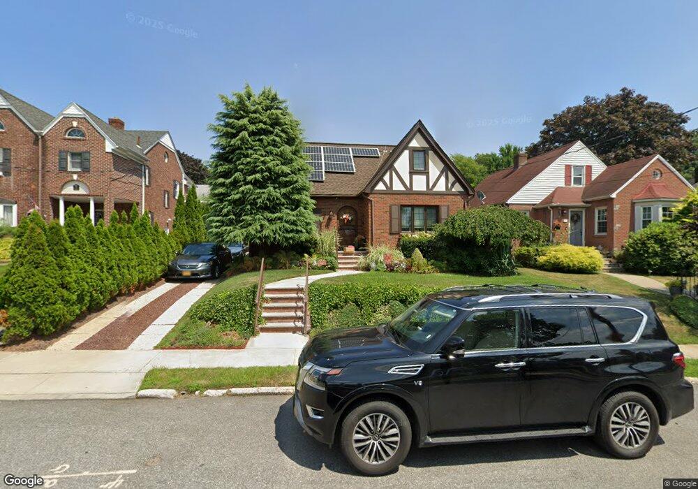
17 Devon Place Staten Island, NY 10301
Randall Manor NeighborhoodEstimated Value: $793,013 - $979,000
4
Beds
2
Baths
1,470
Sq Ft
$600/Sq Ft
Est. Value
About This Home
This home is located at 17 Devon Place, Staten Island, NY 10301 and is currently estimated at $881,753, approximately $599 per square foot. 17 Devon Place is a home located in Richmond County with nearby schools including P.S. 45 John Tyler, Is 61 William A Morris, and Curtis High School.
Ownership History
Date
Name
Owned For
Owner Type
Purchase Details
Closed on
Jan 14, 2004
Sold by
Streckfuss Mary Jane and Ryan John W
Bought by
Blocker Terry J
Current Estimated Value
Home Financials for this Owner
Home Financials are based on the most recent Mortgage that was taken out on this home.
Original Mortgage
$383,200
Interest Rate
5.82%
Mortgage Type
Purchase Money Mortgage
Create a Home Valuation Report for This Property
The Home Valuation Report is an in-depth analysis detailing your home's value as well as a comparison with similar homes in the area
Home Values in the Area
Average Home Value in this Area
Purchase History
| Date | Buyer | Sale Price | Title Company |
|---|---|---|---|
| Blocker Terry J | $479,000 | Homestead Title Agency Inc |
Source: Public Records
Mortgage History
| Date | Status | Borrower | Loan Amount |
|---|---|---|---|
| Previous Owner | Blocker Terry J | $383,200 |
Source: Public Records
Tax History
| Year | Tax Paid | Tax Assessment Tax Assessment Total Assessment is a certain percentage of the fair market value that is determined by local assessors to be the total taxable value of land and additions on the property. | Land | Improvement |
|---|---|---|---|---|
| 2025 | $7,115 | $46,920 | $12,560 | $34,360 |
| 2024 | $7,127 | $50,100 | $11,334 | $38,766 |
| 2023 | $6,065 | $35,782 | $10,379 | $25,403 |
| 2022 | $5,534 | $45,600 | $15,420 | $30,180 |
| 2021 | $6,400 | $37,740 | $15,420 | $22,320 |
| 2020 | $5,527 | $39,240 | $15,420 | $23,820 |
| 2019 | $6,127 | $42,060 | $15,420 | $26,640 |
| 2018 | $5,781 | $29,818 | $13,258 | $16,560 |
| 2017 | $5,435 | $28,132 | $11,386 | $16,746 |
| 2016 | $4,996 | $26,541 | $12,009 | $14,532 |
| 2015 | $4,603 | $26,541 | $12,316 | $14,225 |
| 2014 | $4,603 | $25,574 | $12,520 | $13,054 |
Source: Public Records
Map
Nearby Homes
- 4 Brentwood Ave
- 7 Westbury Ave
- 2 Clinton Ct
- 58 Conyingham Ave
- 60 Valencia Ave
- 26 Valencia Ave
- 585 Castleton Ave Unit 1c
- 117 Tysen St
- 565 Castleton Ave Unit 2B
- 126 Cassidy Place Unit D
- 20 Linden St
- 141 Lafayette Ave
- 94 Hart Blvd
- 434 Castleton Ave
- 84 Elwood Place
- 333 Lafayette Ave
- 260 Brighton Ave
- 171 Silver Lake Rd
- 110 Arnold St
- 180 Fillmore St
- 11 Devon Place
- 21 Devon Place
- 25 Devon Place
- 22 Caldera Place
- 14 Caldera Place
- 5 Devon Place
- 30 Caldera Place
- 250 Henderson Ave
- 14 Devon Place
- 18 Devon Place
- 31 Devon Place
- 8 Devon Place
- 36 Caldera Place
- 272 Henderson Ave
- 32 Devon Place
- 7 Lois Place
- 17 Caldera Place
- 17 Lois Place
- 31 Caldera Place
- 15 Caldera Place
Your Personal Tour Guide
Ask me questions while you tour the home.