
Seller's Agent in 2026
Federico Creatini
eXp Realty
(617) 804-1999
38 Total Sales
Estimated Value: $489,020
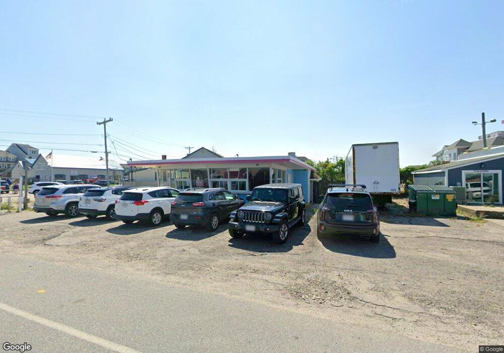
Freestanding commercial building positioned on a corner lot, in the Brant Rock village area of Marshfield, offering approximately 1,016 square feet of flexible interior space on a ~7,700 sq ft parcel. Built in 1966, the structure provides strong street presence, excellent visibility, and multiple potential configurations for retail, food service or professional services. Located steps from Brant Rock beach, dining, town pier, and a neighborhood market. A tap room is currently under construction on the abutting property, as well as an established apparel store, enhancing future foot traffic and commercial synergy. Zoning supports a variety of commercial uses. Coastal village setting with year-round population and strong seasonal demand. Rare opportunity to secure a stand-alone commercial asset in one of Marshfield’s most active waterfront districts.
| Date | Buyer | Sale Price | Title Company |
|---|---|---|---|
| Crowley Ft | -- | -- | |
| Crowley Ft | -- | -- | |
| 17 Dyke Rd T | -- | None Available | |
| 17 Dyke Rd T | -- | None Available | |
| Crowley Ft | -- | -- | |
| Crowley Ft | -- | -- | |
| Crowley Dennis G | $31,000 | -- | |
| Crowley Dennis G | $31,000 | -- |
| Date | Event | Price | List to Sale | Price per Sq Ft |
|---|---|---|---|---|
| 02/10/2026 02/10/26 | For Sale | $499,000 | -- | $491 / Sq Ft |
| Year | Tax Paid | Tax Assessment Tax Assessment Total Assessment is a certain percentage of the fair market value that is determined by local assessors to be the total taxable value of land and additions on the property. | Land | Improvement |
|---|---|---|---|---|
| 2025 | $4,186 | $422,800 | $281,100 | $141,700 |
| 2024 | $4,195 | $403,800 | $264,500 | $139,300 |
| 2023 | $4,451 | $393,200 | $253,500 | $139,700 |
| 2022 | $4,544 | $350,900 | $220,400 | $130,500 |
| 2021 | $4,606 | $349,200 | $209,400 | $139,800 |
| 2020 | $4,655 | $349,200 | $209,400 | $139,800 |
| 2019 | $4,473 | $334,300 | $198,400 | $135,900 |
| 2018 | $4,373 | $327,100 | $192,900 | $134,200 |
| 2017 | $4,208 | $306,700 | $176,400 | $130,300 |
| 2016 | $4,257 | $306,700 | $176,400 | $130,300 |
| 2015 | $4,076 | $306,700 | $176,400 | $130,300 |
| 2014 | $3,733 | $280,900 | $154,300 | $126,600 |
Seller's Agent in 2026
Federico Creatini
eXp Realty
(617) 804-1999
38 Total Sales
Ask me questions while you tour the home.