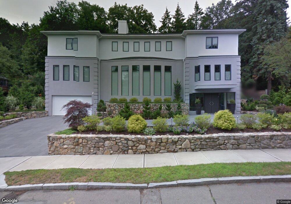
17 Edge Hill Rd Chestnut Hill, MA 02467
Chestnut Hill NeighborhoodEstimated Value: $4,013,000 - $4,731,000
5
Beds
8
Baths
6,183
Sq Ft
$720/Sq Ft
Est. Value
About This Home
This home is located at 17 Edge Hill Rd, Chestnut Hill, MA 02467 and is currently estimated at $4,449,701, approximately $719 per square foot. 17 Edge Hill Rd is a home located in Middlesex County with nearby schools including Ward Elementary School, Bigelow Middle School, and Newton North High School.
Ownership History
Date
Name
Owned For
Owner Type
Purchase Details
Closed on
Jun 11, 2020
Sold by
Stein Israel M and Stein Ellen Z
Bought by
Stein Rt
Current Estimated Value
Purchase Details
Closed on
Aug 1, 1984
Bought by
Stein Israel M and Stein Ellen Z
Create a Home Valuation Report for This Property
The Home Valuation Report is an in-depth analysis detailing your home's value as well as a comparison with similar homes in the area
Home Values in the Area
Average Home Value in this Area
Purchase History
| Date | Buyer | Sale Price | Title Company |
|---|---|---|---|
| Stein Rt | -- | None Available | |
| Stein Israel M | $300,000 | -- |
Source: Public Records
Mortgage History
| Date | Status | Borrower | Loan Amount |
|---|---|---|---|
| Previous Owner | Stein Israel M | $2,000,000 | |
| Previous Owner | Stein Israel M | $1,500,000 | |
| Previous Owner | Stein Israel M | $200,000 | |
| Previous Owner | Stein Israel M | $300,000 |
Source: Public Records
Tax History Compared to Growth
Tax History
| Year | Tax Paid | Tax Assessment Tax Assessment Total Assessment is a certain percentage of the fair market value that is determined by local assessors to be the total taxable value of land and additions on the property. | Land | Improvement |
|---|---|---|---|---|
| 2025 | $45,145 | $4,606,600 | $1,700,900 | $2,905,700 |
| 2024 | $43,651 | $4,472,400 | $1,651,400 | $2,821,000 |
| 2023 | $42,060 | $4,131,600 | $1,272,600 | $2,859,000 |
| 2022 | $40,245 | $3,825,600 | $1,178,300 | $2,647,300 |
| 2021 | $6,172 | $3,609,100 | $1,111,600 | $2,497,500 |
| 2020 | $37,679 | $3,609,100 | $1,111,600 | $2,497,500 |
| 2019 | $36,617 | $3,504,000 | $1,079,200 | $2,424,800 |
| 2018 | $35,494 | $3,280,400 | $993,600 | $2,286,800 |
| 2017 | $34,413 | $3,094,700 | $937,400 | $2,157,300 |
| 2016 | $32,913 | $2,892,200 | $876,100 | $2,016,100 |
| 2015 | $31,382 | $2,703,000 | $818,800 | $1,884,200 |
Source: Public Records
Map
Nearby Homes
- 5 Hammond St
- 9 The Ledges Rd
- 5 Merrill Rd
- 92 Grant Ave
- 209 Commonwealth Ave Unit 3E
- 21 Francis St Unit 21A
- 23 Francis St Unit 23-1
- 44 Irving St
- 104 Woodchester Dr
- 145 Warren St Unit 4
- 173-175 Warren St
- 154 Langley Rd Unit 1
- 20 Bartlett Terrace
- 31 W Boulevard Rd
- 67 Algonquin Rd
- 1004 Centre St
- 266 Langley Rd Unit 1
- 27-29 Commonwealth Ave Unit 9
- 27-29 Commonwealth Ave Unit 5
- 85 Gate House Rd
- 25 Edge Hill Rd
- 83 Hammondswood Rd
- 48 Wachusett Rd
- 50 Wachusett Rd
- 71 Monadnock Rd
- 71 Monadnock Rd Unit 71
- 63 Monadnock Rd
- 22 Edge Hill Rd
- 99 Hammondswood Rd
- 71 Hammondswood Rd
- 38 Wachusett Rd
- 30 Edge Hill Rd
- 60 Wachusett Rd
- 111 Hammondswood Rd
- 84 Hammondswood Rd
- 146 Intervale Rd
- 94 Hammondswood Rd
- 124 Intervale Rd
- 72 Monadnock Rd
- 45 Monadnock Rd