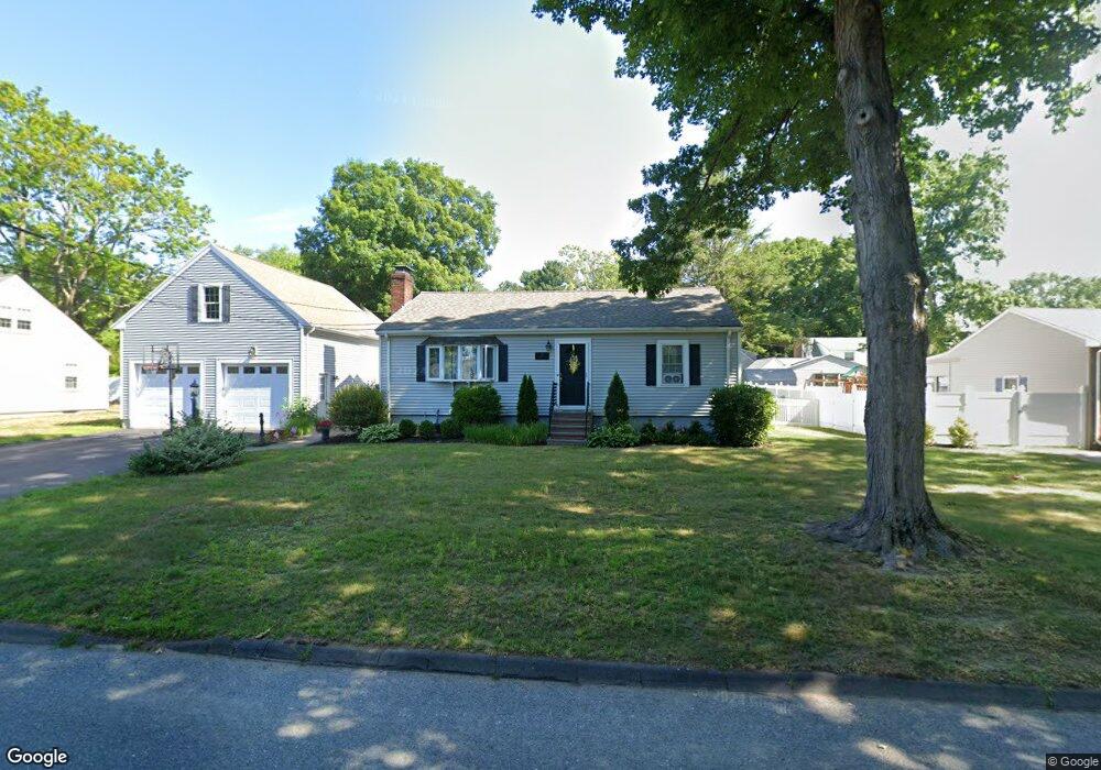
17 Edwards Rd Natick, MA 01760
Estimated Value: $705,000 - $800,000
2
Beds
2
Baths
1,064
Sq Ft
$699/Sq Ft
Est. Value
About This Home
This home is located at 17 Edwards Rd, Natick, MA 01760 and is currently estimated at $743,998, approximately $699 per square foot. 17 Edwards Rd is a home located in Middlesex County with nearby schools including Natick High School, J F Kennedy Middle School, and Brown Elementary School.
Ownership History
Date
Name
Owned For
Owner Type
Purchase Details
Closed on
Jan 3, 2012
Sold by
Gogliormella Michael A
Bought by
Gogliormella Michael A and Gogliormella Lucia M
Current Estimated Value
Home Financials for this Owner
Home Financials are based on the most recent Mortgage that was taken out on this home.
Original Mortgage
$269,700
Outstanding Balance
$31,032
Interest Rate
4%
Mortgage Type
New Conventional
Estimated Equity
$712,966
Purchase Details
Closed on
Aug 22, 2002
Sold by
Reynolds David W and Reynolds Neil G
Bought by
Gogliormella Michael
Home Financials for this Owner
Home Financials are based on the most recent Mortgage that was taken out on this home.
Original Mortgage
$257,400
Interest Rate
6.57%
Mortgage Type
Purchase Money Mortgage
Create a Home Valuation Report for This Property
The Home Valuation Report is an in-depth analysis detailing your home's value as well as a comparison with similar homes in the area
Home Values in the Area
Average Home Value in this Area
Purchase History
| Date | Buyer | Sale Price | Title Company |
|---|---|---|---|
| Gogliormella Michael A | -- | -- | |
| Gogliormella Michael | $286,000 | -- | |
| Gogliormella Michael | $286,000 | -- |
Source: Public Records
Mortgage History
| Date | Status | Borrower | Loan Amount |
|---|---|---|---|
| Open | Gogliormella Michael A | $269,700 | |
| Previous Owner | Gogliormella Michael | $257,400 |
Source: Public Records
Tax History
| Year | Tax Paid | Tax Assessment Tax Assessment Total Assessment is a certain percentage of the fair market value that is determined by local assessors to be the total taxable value of land and additions on the property. | Land | Improvement |
|---|---|---|---|---|
| 2025 | $7,860 | $657,200 | $425,000 | $232,200 |
| 2024 | $7,633 | $622,600 | $400,000 | $222,600 |
| 2023 | $7,544 | $596,800 | $385,000 | $211,800 |
| 2022 | $7,318 | $548,600 | $350,000 | $198,600 |
| 2021 | $7,038 | $517,100 | $330,000 | $187,100 |
| 2020 | $6,834 | $502,100 | $315,000 | $187,100 |
| 2019 | $4,011 | $502,100 | $315,000 | $187,100 |
| 2018 | $6,218 | $476,500 | $300,000 | $176,500 |
| 2017 | $5,778 | $428,300 | $255,000 | $173,300 |
| 2016 | $5,504 | $405,600 | $234,000 | $171,600 |
| 2015 | $5,411 | $391,500 | $234,000 | $157,500 |
Source: Public Records
Map
Nearby Homes
- 15 Edwards Rd
- 21 Kelsey Rd
- 26 Wellesley Ave Unit B
- 79 Speen St
- 36 Silver Hill Ln Unit 21
- 46 Silver Hill Ln Unit 1
- 54 Pilgrim Rd
- 3 Silver Hill Ln Unit 6
- 1 Post Oak Ln Unit 19
- 8 Village Way Unit 11
- 15 Village Way Unit 8
- 3 Oxbow Rd
- 57 Village Brook Ln Unit 5
- 28 Sylvester Rd
- 34 Walden Dr Unit 5
- 30 Walden Dr Unit 7
- 8 Walden Dr Unit 13
- 27 2nd St
- 89 W Central St
- 52 Village Brook Ln Unit 14
Your Personal Tour Guide
Ask me questions while you tour the home.