Estimated Value: $958,063 - $1,028,000
4
Beds
3
Baths
2,805
Sq Ft
$357/Sq Ft
Est. Value
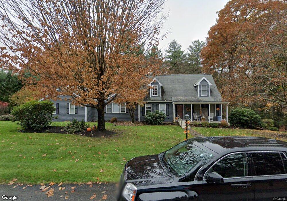
About This Home
This home is located at 17 Farm Rd, Stow, MA 01775 and is currently estimated at $1,002,516, approximately $357 per square foot. 17 Farm Rd is a home located in Middlesex County with nearby schools including Center School, Hale Middle School, and Nashoba Regional High School.
Ownership History
Date
Name
Owned For
Owner Type
Purchase Details
Closed on
Apr 9, 1992
Sold by
Red Acre Dev Corp
Bought by
Tuttle Roger W and Tuttle Mary A
Current Estimated Value
Home Financials for this Owner
Home Financials are based on the most recent Mortgage that was taken out on this home.
Original Mortgage
$140,000
Interest Rate
8.73%
Mortgage Type
Purchase Money Mortgage
Create a Home Valuation Report for This Property
The Home Valuation Report is an in-depth analysis detailing your home's value as well as a comparison with similar homes in the area
Home Values in the Area
Average Home Value in this Area
Purchase History
| Date | Buyer | Sale Price | Title Company |
|---|---|---|---|
| Tuttle Roger W | $175,100 | -- |
Source: Public Records
Mortgage History
| Date | Status | Borrower | Loan Amount |
|---|---|---|---|
| Open | Tuttle Roger W | $204,000 | |
| Closed | Tuttle Roger W | $145,000 | |
| Closed | Tuttle Roger W | $145,000 | |
| Closed | Tuttle Roger W | $140,000 |
Source: Public Records
Tax History
| Year | Tax Paid | Tax Assessment Tax Assessment Total Assessment is a certain percentage of the fair market value that is determined by local assessors to be the total taxable value of land and additions on the property. | Land | Improvement |
|---|---|---|---|---|
| 2025 | $14,798 | $849,500 | $351,000 | $498,500 |
| 2024 | $15,122 | $891,100 | $338,600 | $552,500 |
| 2023 | $14,426 | $795,700 | $323,200 | $472,500 |
| 2022 | $12,802 | $654,500 | $269,900 | $384,600 |
| 2021 | $12,302 | $615,700 | $269,900 | $345,800 |
| 2020 | $11,581 | $561,900 | $244,800 | $317,100 |
| 2019 | $11,122 | $552,500 | $244,800 | $307,700 |
| 2018 | $11,283 | $537,800 | $244,800 | $293,000 |
| 2017 | $10,888 | $528,800 | $230,400 | $298,400 |
| 2016 | $10,521 | $526,600 | $230,400 | $296,200 |
| 2015 | $10,362 | $518,600 | $209,600 | $309,000 |
Source: Public Records
Map
Nearby Homes
- 12 Patti Ln
- 6 Durant Ave
- 71 Liberty St
- 34 Meeting House Ln Unit 208
- 2 Marble Farm Rd
- 10 Mill St Unit Q
- 10 Mill St Unit B
- 63 Conant St
- 247 W Acton Rd
- 12 Brown St
- 12 Assabet St
- 17 Prospect St
- 37 Glendale St
- 19 Railroad St Unit D2
- 19 Railroad St Unit C2
- 131 Main St
- 129 Main St Unit 129
- 40 High St
- 41 Taylor Rd
- 25 Nylander Way