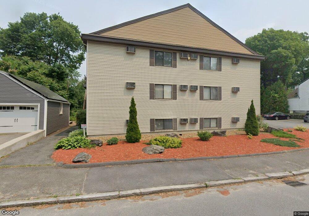
17 Farrar Ave Unit 7 Worcester, MA 01604
Grafton Hill NeighborhoodEstimated Value: $221,000 - $276,502
2
Beds
1
Bath
780
Sq Ft
$310/Sq Ft
Est. Value
About This Home
This home is located at 17 Farrar Ave Unit 7, Worcester, MA 01604 and is currently estimated at $242,126, approximately $310 per square foot. 17 Farrar Ave Unit 7 is a home located in Worcester County with nearby schools including Jacob Hiatt Magnet School, Chandler Magnet, and Rice Square Elementary School.
Ownership History
Date
Name
Owned For
Owner Type
Purchase Details
Closed on
Apr 13, 2010
Sold by
Sparanges Louis
Bought by
Roy David M
Current Estimated Value
Home Financials for this Owner
Home Financials are based on the most recent Mortgage that was taken out on this home.
Original Mortgage
$68,800
Outstanding Balance
$46,095
Interest Rate
5.12%
Mortgage Type
Purchase Money Mortgage
Estimated Equity
$196,031
Purchase Details
Closed on
Nov 24, 2009
Sold by
Est Ferraro John F and Docimo Elaine A
Bought by
Sparanges Louis
Purchase Details
Closed on
Mar 6, 1987
Sold by
F D Trust
Bought by
Damato Charles S
Home Financials for this Owner
Home Financials are based on the most recent Mortgage that was taken out on this home.
Original Mortgage
$68,700
Interest Rate
9.02%
Mortgage Type
Purchase Money Mortgage
Create a Home Valuation Report for This Property
The Home Valuation Report is an in-depth analysis detailing your home's value as well as a comparison with similar homes in the area
Home Values in the Area
Average Home Value in this Area
Purchase History
| Date | Buyer | Sale Price | Title Company |
|---|---|---|---|
| Roy David M | $86,000 | -- | |
| Sparanges Louis | $70,500 | -- | |
| Damato Charles S | $85,900 | -- |
Source: Public Records
Mortgage History
| Date | Status | Borrower | Loan Amount |
|---|---|---|---|
| Open | Roy David M | $68,800 | |
| Previous Owner | Damato Charles S | $10,000 | |
| Previous Owner | Damato Charles S | $68,700 |
Source: Public Records
Tax History Compared to Growth
Tax History
| Year | Tax Paid | Tax Assessment Tax Assessment Total Assessment is a certain percentage of the fair market value that is determined by local assessors to be the total taxable value of land and additions on the property. | Land | Improvement |
|---|---|---|---|---|
| 2025 | $2,885 | $218,700 | $0 | $218,700 |
| 2024 | $2,756 | $200,400 | $0 | $200,400 |
| 2023 | $2,008 | $140,000 | $0 | $140,000 |
| 2022 | $1,830 | $120,300 | $0 | $120,300 |
| 2021 | $1,195 | $73,400 | $0 | $73,400 |
| 2020 | $1,131 | $66,500 | $0 | $66,500 |
| 2019 | $1,919 | $106,600 | $0 | $106,600 |
| 2018 | $1,882 | $99,500 | $0 | $99,500 |
| 2017 | $1,874 | $97,500 | $0 | $97,500 |
| 2016 | $2,009 | $97,500 | $0 | $97,500 |
| 2015 | $1,957 | $97,500 | $0 | $97,500 |
| 2014 | $1,905 | $97,500 | $0 | $97,500 |
Source: Public Records
Map
Nearby Homes
- 78 Dana Ave
- 121 Pilgrim Ave
- 3 Bowker St
- 68 Dartmouth St
- 169 Fairmont Ave
- 10 Almont Ave
- 573 Grafton St
- 93 Plantation St
- 3 Ingleside Ave
- 17 Plantation St
- 70 Harrington Way
- 247 Pilgrim Ave
- 423 Grafton St Unit 7
- 340 Hamilton St
- 10 Lamar Ave
- 91 Standish St
- 22 Anderson Ave
- 19 Orient St
- 360 Hamilton St
- 15 Anderson Ave
- 17 Farrar Ave Unit 12
- 17 Farrar Ave Unit 11
- 17 Farrar Ave Unit 10
- 17 Farrar Ave Unit 9
- 17 Farrar Ave Unit 8
- 17 Farrar Ave Unit 6
- 17 Farrar Ave Unit 5
- 17 Farrar Ave Unit 4
- 17 Farrar Ave Unit 3
- 17 Farrar Ave Unit 2
- 17 Farrar Ave Unit 1
- 9 17 Farrar Ave Unit 17
- 74 Dana Ave
- 76 Dana Ave
- 19 Farrar Ave
- 80 Dana Ave
- 82 Dana Ave
- 182 Hamilton St
- 186 Hamilton St
- 84 Dana Ave