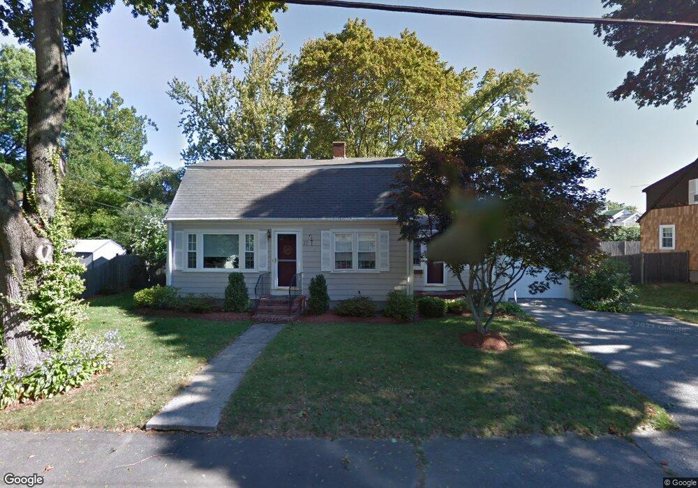
17 Forrester Rd Wakefield, MA 01880
Lakeside NeighborhoodEstimated Value: $763,000 - $876,000
2
Beds
2
Baths
1,536
Sq Ft
$540/Sq Ft
Est. Value
About This Home
This home is located at 17 Forrester Rd, Wakefield, MA 01880 and is currently estimated at $829,394, approximately $539 per square foot. 17 Forrester Rd is a home located in Middlesex County with nearby schools including Wakefield Memorial High School, St Joseph School, and Odyssey Day School.
Ownership History
Date
Name
Owned For
Owner Type
Purchase Details
Closed on
Oct 21, 2005
Sold by
Wood Dianne M
Bought by
Pizzano Lisa M
Current Estimated Value
Home Financials for this Owner
Home Financials are based on the most recent Mortgage that was taken out on this home.
Original Mortgage
$150,000
Outstanding Balance
$80,084
Interest Rate
5.72%
Mortgage Type
Purchase Money Mortgage
Estimated Equity
$749,310
Purchase Details
Closed on
Jul 7, 2003
Sold by
Shiner Frances
Bought by
Wood Dianne and Destefano Ronald
Home Financials for this Owner
Home Financials are based on the most recent Mortgage that was taken out on this home.
Original Mortgage
$304,000
Interest Rate
5.46%
Mortgage Type
Purchase Money Mortgage
Purchase Details
Closed on
Jun 18, 2003
Sold by
Forrester Road Rt
Bought by
Shiner Frances
Home Financials for this Owner
Home Financials are based on the most recent Mortgage that was taken out on this home.
Original Mortgage
$304,000
Interest Rate
5.46%
Mortgage Type
Purchase Money Mortgage
Create a Home Valuation Report for This Property
The Home Valuation Report is an in-depth analysis detailing your home's value as well as a comparison with similar homes in the area
Home Values in the Area
Average Home Value in this Area
Purchase History
| Date | Buyer | Sale Price | Title Company |
|---|---|---|---|
| Pizzano Lisa M | $450,000 | -- | |
| Wood Dianne | $380,000 | -- | |
| Shiner Frances | -- | -- |
Source: Public Records
Mortgage History
| Date | Status | Borrower | Loan Amount |
|---|---|---|---|
| Open | Pizzano Lisa M | $150,000 | |
| Previous Owner | Wood Dianne | $304,000 |
Source: Public Records
Tax History Compared to Growth
Tax History
| Year | Tax Paid | Tax Assessment Tax Assessment Total Assessment is a certain percentage of the fair market value that is determined by local assessors to be the total taxable value of land and additions on the property. | Land | Improvement |
|---|---|---|---|---|
| 2025 | $9,142 | $805,500 | $390,100 | $415,400 |
| 2024 | $8,430 | $749,300 | $362,900 | $386,400 |
| 2023 | $8,204 | $699,400 | $338,700 | $360,700 |
| 2022 | $7,693 | $624,400 | $302,400 | $322,000 |
| 2021 | $7,128 | $559,900 | $276,500 | $283,400 |
| 2020 | $6,703 | $524,900 | $259,200 | $265,700 |
| 2019 | $6,285 | $489,900 | $241,900 | $248,000 |
| 2018 | $6,057 | $467,700 | $231,100 | $236,600 |
| 2017 | $5,695 | $437,100 | $216,000 | $221,100 |
| 2016 | $5,830 | $432,200 | $213,300 | $218,900 |
| 2015 | $5,443 | $403,800 | $199,300 | $204,500 |
| 2014 | $5,034 | $393,900 | $194,400 | $199,500 |
Source: Public Records
Map
Nearby Homes
- 22 Wayland Rd
- 29 Cordis St
- 270 Lowell St
- 395 Vernon St
- 16 Pleasant St
- 50 Quannapowitt Pkwy
- 51 Crescent St
- 410 Salem St Unit 1203
- 34 Cedar St
- 35 Richardson St Unit 2
- 38 Bennett St Unit 3D
- 62 Foundry St Unit 310
- 62 Foundry St Unit 312
- 62 Foundry St Unit 412
- 62 Foundry St Unit 204
- 62 Foundry St Unit 309
- 62 Foundry St Unit 202
- 62 Foundry St Unit 208
- 62 Foundry St Unit 414
- 11 Elizabeth Way