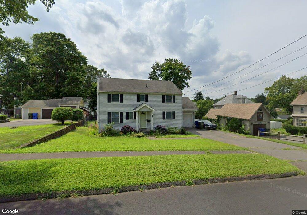
17 Frederick St Newington, CT 06111
Estimated Value: $372,462 - $416,000
3
Beds
2
Baths
1,632
Sq Ft
$242/Sq Ft
Est. Value
About This Home
This home is located at 17 Frederick St, Newington, CT 06111 and is currently estimated at $395,616, approximately $242 per square foot. 17 Frederick St is a home located in Hartford County with nearby schools including John Paterson School, John Wallace Middle School, and Newington High School.
Ownership History
Date
Name
Owned For
Owner Type
Purchase Details
Closed on
Jan 31, 2001
Sold by
Chabot Thomas and Chabot Lisa
Bought by
Barrett Tod and Barrett Marianna L
Current Estimated Value
Purchase Details
Closed on
Nov 15, 1999
Sold by
Carlson Lois
Bought by
Chabot Thomas and Chabot Lisa
Purchase Details
Closed on
Jan 14, 1992
Sold by
Moriarty Kevin and Moriarty Amy
Bought by
Deleo David
Create a Home Valuation Report for This Property
The Home Valuation Report is an in-depth analysis detailing your home's value as well as a comparison with similar homes in the area
Home Values in the Area
Average Home Value in this Area
Purchase History
| Date | Buyer | Sale Price | Title Company |
|---|---|---|---|
| Barrett Tod | $145,000 | -- | |
| Chabot Thomas | $75,000 | -- | |
| Deleo David | $116,000 | -- |
Source: Public Records
Mortgage History
| Date | Status | Borrower | Loan Amount |
|---|---|---|---|
| Open | Deleo David | $184,000 | |
| Closed | Deleo David | $11,500 | |
| Closed | Deleo David | $210,000 |
Source: Public Records
Tax History
| Year | Tax Paid | Tax Assessment Tax Assessment Total Assessment is a certain percentage of the fair market value that is determined by local assessors to be the total taxable value of land and additions on the property. | Land | Improvement |
|---|---|---|---|---|
| 2025 | $5,883 | $147,150 | $53,510 | $93,640 |
| 2024 | $5,837 | $147,150 | $53,510 | $93,640 |
| 2023 | $5,645 | $147,150 | $53,510 | $93,640 |
| 2022 | $5,664 | $147,150 | $53,510 | $93,640 |
| 2021 | $5,711 | $147,150 | $53,510 | $93,640 |
| 2020 | $5,646 | $143,730 | $51,450 | $92,280 |
| 2019 | $5,670 | $143,730 | $51,450 | $92,280 |
| 2018 | $5,534 | $143,730 | $51,450 | $92,280 |
| 2017 | $5,259 | $143,730 | $51,450 | $92,280 |
| 2016 | $5,138 | $143,730 | $51,450 | $92,280 |
| 2014 | $4,641 | $133,490 | $51,580 | $81,910 |
Source: Public Records
Map
Nearby Homes
- 446 Maple Hill Ave
- 24 Old Musket Dr
- 55 Coles Ave
- 46 Florence St
- 129 Glenview Dr
- 495 New Britain Ave
- 17 Whiteside St
- 1473 Willard Ave Unit B
- 20 Browning Ave
- 235 Lucille St
- 1 Old Farm Dr
- 144 Churchill Dr
- 7 Old Farm Dr
- 9 Old Farm Dr
- 15 Lester St
- 631 Churchill Dr
- 233 Church St
- 38 Northwood Rd
- 77 Thorniley St
- 116 Sunrise Ave
- 23 Frederick St
- 341 Robbins Ave
- 335 Robbins Ave
- 16 Stuart St
- 347 Robbins Ave
- 16 Frederick St
- 20 Frederick St
- 24 Stuart St
- 31 Frederick St
- 323 Robbins Ave
- 30 Frederick St
- 13 Stuart St
- 32 Stuart St
- 361 Robbins Ave
- 23 Theodore St
- 40 Frederick St
- 48 Frederick St
- 43 Frederick St
- 9 Theodore St
- 19 Stuart St
Your Personal Tour Guide
Ask me questions while you tour the home.